Search

Showing posts with label Disaster Sites. Show all posts

December 30, 2025

Year In Review: 2025 Updates to Past Posts

Los Angeles has been through a lot in the time that I've lived here. It took a big hit during the pandemic, and the homelessness crisis just keeps getting worse and worse. 

But nothing in my tenure here has compared to January 2025, when the entire city seemed to be surrounded by fire—and two communities were flattened in the blink of an eye. 

I can't even speak to what so many people went through, losing their homes and possessions and all sense of safety. I can only document a little bit of it, and help preserve the memory of some of our public places with the photos I've taken and the stories I've written. 

The more time that passes, the more it feels that I have a certain duty to share these stories and spread the word about places in danger of being lost, and places that have been spared and saved (including those from the Eaton and Palisades fires and the Sunset Fire at Runyon Canyon).

Because for as much as we mourn and grieve, we must also pay attention, intervene, and celebrate.

We couldn't manage to hold onto Pacific Dining Car. Or David Lynch. But the building that once housed Corky's returned to its former Googie glory. The Crystal Cave in Sequoia National Park finally reopened. And The Los Angeles Breakfast Club turned 100.

While those all got their own new blog posts, here are the updates I made to older posts in 2025:
 

January 17, 2025

Photo Essay: Saved from the Sunset Fire

On January 8, 2025, I was already glued to the local news, listening to updates about the Palisades Fire (about 8 miles west of me) and the Eaton Fire (about 20 miles east of me). 

And then around 6 p.m. came some terrifying news: After a full day of new fires popping up seemingly everywhere, there was yet another blaze, just 3.5 miles northeast of where I live.

I looked out the second-story window at the front of our building, and I could see the flames. The Hollywood Hills were on fire. 

And then I got a screaming alert on my phone that I was in an evacuation warning zone. 

This was new for me, after living in "the flats" for nearly 14 years. I always thought if we were in danger of anything, it was of a tall skinny palm tree toppling over onto my car parked on the street. 

But by then both the Palisades and Eaton fires had destroyed more of their respective city areas—nearly the entirety of Pacific Palisades and Altadena—than anyone ever thought could happen. 

As it turns out, the warning on my phone was a false alarm for me—but I was, in fact, less than a mile down the hill from the real evacuation warning zone. 

I took a shower (which I hadn't done in days) and washed my hair (which I hadn't done in over a week). I packed a suitcase to take along with my already-packed "go bag." 

And then I got back into bed and let my cat fall back to sleep on me. I watched the news. And I waited for the official word to "go."

There were so many fire crews in the area at that point, and there were so many first responders already on high alert, that the Sunset Fire—which erupted on the western ridge of Runyon Canyon—spread neither to the residential areas of Nichols Canyon or Laurel Canyon, nor the historic commercial district of Hollywood Boulevard.

But there were a few places that were in the crosshairs—and we might've lost, had the winds been stronger that night. 

 
Today I went to assess the damage and get some proof of life of what was saved. I could see the charred hillside from a little father south on Fuller Avenue (above).

January 12, 2025

Photo Essay: Things That Were Spared from the Fires (Palisades & Eaton Fires Edition—Continuously Updated)

[Last updated 1/20/25 5:32 PM PT—Added Christmas Tree Lane Model Railroad and added some info about Mountain View Cemetery.]
[Updated 1/18/25 9:36 AM PT—Added San Vicente Mountain Park.]
[Updated 1/15/25 7:11 PM PT—Added Saddle Peak Lodge, Will Geer Theatricum Botanicum, and Inn of the Seventh Ray.]
[Updated 1/13/25 9:48 PM PT—Added Balian House]

How am I faring in the tragic firestorms of Los Angeles? I'm safe for now, but I'm stressed. I'm grieving. I'm in mourning. All of LA is.

So I turn my attention to documenting. It feels like all I can do. 

I've already started a running tally of the places that were lost in the Palisades and the Eaton Fires, focusing on those I'd already photographed and knew pretty intimately. 

But I'd like to add some good news in the mix, so here's what I know about some of the places I care about and their survival status. 

Lake Shrine


January 10, 2025

Photo Essay: Things We Lost In the Fires (Palisades and Eaton Edition—Continuously Updated)

[Last updated 1/20/25 5:13 PM PT—Clarified status of Christmas Tree Lane and its model railroad in Altadena]
[Updated 1/13/25 10:04 PM PT—Added Mt. Lowe's Inspiration Point]

Los Angeles is currently on fire as it has never been on fire before. 

The Palisades Fire alone is almost twice the size of the island of Manhattan in terms of acreage. 

It seems like a new fire pops up every day. 

I've had two fires near me—a structure fire on the Sunset Strip in West Hollywood and a brushfire between Wattles Mansion and Runyon Canyon, the latter of which I could see from my building. That second one almost sent me evacuating, but I decided to pack up and wait it out until I was told to leave, rather than trying to get my cat in the carrier. 

I have been so very lucky so far. 

But all of Los Angeles is in mourning. And the grief has only just begun. 

Because I'm me, I've set my attention to documenting what's been saved and what's been lost. It feels productive. Maybe it's helpful.

I haven't been able to leave my apartment yet to go see anything. The air quality is not good for my weak lungs. I'd have too much separation anxiety being from my kittyboy during what feels like an apocalyptic time. (Besides, there are too many looky-loos with drones and cameras shooting photos and videos out there already, and they're getting in the way of emergency crews and the residents trying to go and check on their own homes.)

So, I'm keeping tabs on things remotely for now. From what I've seen on the internet and the local news, I'm not sure I'd want to see any of this in person. 

So here are some of the major updates as I know them—particularly about places I've documented before and was pretty familiar with, so I can confidently report what's going on with them.

The first conflagration to erupt, the Palisades Fire, first raged through the Pacific Palisades community of Los Angeles. It's wiped out entire residential neighborhoods, a commercial district, and historic structures in Palisades—and it's not done, as it rages towards the 405 to the east and the 101 to the north as I write this. (It's headed straight for San Vicente Mountain Park!)

 Photo: California State Parks

August 09, 2024

Photo Essay: Piru's Newhall Mansion is a 130-Year-Old Queen Anne Design in a 40-Year-Old Body

I first became intrigued with the Ventura County town of Piru because of its position in the path of the St. Francis Dam flood. (It's also home to a filming location from the music video to "Hot Legs" by Rod Stewart.) 

 
But then my interest was piqued even further when I found out there was a sprawling Queen Anne mansion in Piru—known simply as the "Piru Mansion," but also "Cook Mansion" and "Newhall Mansion."

January 01, 2024

Year In Review: 2023 Updates to Past Posts

At the end of each year now, it's no longer only about reflecting on the new experiences I've had over the last 12 months—but also recognizing how the world around me has changed.

And I can't help but document it.

That brings me back to some places—either physically or just mentally and emotionally—that I thought I'd be "done" with after one visit. 

Unfortunately, the scales were tipped way too far in one direction last year. We lost many more people and things than we were able to save.

And, in some cases, it didn't have to be that way. 

But life is loss—constant loss, in fact. And the sooner we come to terms with that, the sooner we can get to appreciating what we've got now. 

One of my most devastating experiences is whenever I find myself saying, "I never got to go."

But as time passes, the sentiment changes. Now, increasingly, it's the heartbreaking statement, "I never got to go back."

Here are some of the updates I made to past blog posts in 2023, reflecting changes that happened in that year or developments that had happened previously but I only got to documenting that year.

September 17, 2023

Taking In the View of 'Smoke Spotters' at Keller Peak Fire Lookout Tower, San Bernardino National Forest [Updated for 2024, Destroyed By Fire]

[Last updated 9/11/24 11:43 AM PT—On September 10, 2024, the Southern California Mountains Foundation announced on social media that the Keller Peak Fire Lookout had fallen in the wildfire known as the Line Fire and was out of service.]

Two years ago, I ascended to the Ancient and Honorable Order of Squirrels at the Strawberry Peak Fire Lookout Tower in the San Bernardino Mountains, near Lake Arrowhead.

It was such a fun experience, I wanted to return to shoot one of the videos I've been producing for our local PBS station, KCET, and its digital series "SoCal Wanderer."


But my contact at the Southern California Mountains Foundation, the non-profit organization that oversees the fire lookout tower program in the San Bernardino Mountains, suggested I visit a different lookout tower this time: Keller Peak, near the town of Running Springs.  

October 14, 2022

Photo Essay: Woolsey Fire Recovery Still Continues With the Reopening of Peter Strauss Ranch (Without Its Ranch House)

The last time I tried to check on Peter Strauss Ranch—one of my favorite places in LA—I couldn't get anywhere near it because the November 2018 Woolsey Fire had destroyed the Mulholland Highway bridge you'd normally have to walk across to get to it from the parking area.

 
That was January 2019. 


But the National Park Service had announced that the ranch—part of the Santa Monica Mountains National Recreation Area—had finally reopened in June 2022, so I went back a couple of weeks ago. (They still haven't replaced the park sign, which was burned to a crisp.)

May 24, 2022

Photo Essay: Glendale's Stone Barn, Once Burned and Flooded, Reopens As a Nature Center

Georges Le Mesnager was an immigrant French winemaker who arrived in Southern California in 1885-6 and purchased land in the Dunsmore Canyon area of La Crescenta—formerly known as Las Flores Canyon, now known as Deukmejian Wilderness Park.

At the time, the canyon was wild and steep—but nevertheless, Mesnager tried to develop the land, planting vines and growing wine grapes there. 

 
In 1905, his son Louis began building a stone barn primarily to be used as a stable and a storage facility—not only for vineyard equipment but also to store the grapes that would be shipped off to the family's winery at Main and Mesnager Streets in Downtown Los Angeles, a couple of hundred feet away from the west bank of the LA River. 
   
And now, over 100 years later, the stone barn is the site of grape-growing once again—and is home to the newly opened Stone Barn Nature Center. 

May 22, 2022

Photo Essay: The Resurrection of Verdugo Hills Cemetery, Upon Its Centennial Celebration

The Hills of Peace Cemetery (later renamed Verdugo Hills) was dedicated in 1922 to serve the areas of Sunland and Tujunga, California—in the Crescenta Valley region of Los Angeles. 

The most recent headstones you see are from, say, 1972. There's one crypt in the mausoleum dating back to 1977. 

That was before the torrential rains of February 1978 washed away many of the hillside graves.


And until recently, the only thing almost anyone ever remembered about it was its grisly history—not only natural disasters, but also vandalism and remains that were improperly disposed. It was so bad, some families actually moved their loved ones from their crypts.  

 
The cemetery finally closed to the public in 2002—after which family members of those interred could visit by appointment only (despite it being declared a Los Angeles Historic-Cultural Monument in 2009). The only other time it was open was for occasional historical tours. 


But thanks to the efforts of Friends of Verdugo Hills Cemetery (led by the "undertaker," Craig Durst)—which held monthly and then weekly volunteer cleanup days—the cemetery was prepped and beautified for its centennial celebration on April 23, 2022. 

November 29, 2021

Photo Essay: Good Fortune Helped This California 'Mission By the Sea' Survive Seismic Surges and Secularization

Incorporated in 1866, Ventura is a 152-year-old coastal city along California’s Mission Trail.

 
In fact, the Old Mission San Buenaventura—in the city's historic downtown, just a little more than a half-mile inland from the nearest beach, as the seagull flies—really put Ventura, California on the map. 

September 22, 2021

Photo Essay: The Former Ranch of Hollywood's Silent Film Era Western Hero, Harry Carey Sr.

On a tour of the St. Francis Dam disaster flood plain a couple of years ago with the Santa Clarita Valley Historical Society, we were supposed to visit the "Harry Carey Ranch"—but it was closed for a wedding.  

I'd never heard of it—and when we drove by, I saw nothing of it. Nothing besides the sign for the Tesoro del Valle residential community, which was built nearly two decades ago in Santa Clarita, California.


I finally got back there—to the Tesoro Adobe Historic Park—to see what was left of silent film star and Western movie hero Harry Carey, Sr.'s former ranch (reportedly "the first tourist attraction in Santa Clarita") and what had been washed away in the flood.  

September 07, 2021

Photo Essay: The Steepest Narrow-Gauge Railroad (With the Tightest Curves) Survives Among the Redwoods in the Santa Cruz Mountains

It had been almost a year since I'd ridden the Sugar Pine Yosemite Railroad in Sierra National Forest (and gotten smoked out of the area by local wildfires)—and it had come time for me to ride the rails once again. 
  

covered bridge (one of the shortest in the U.S,), built 1969

I'd planned a trip up to San Jose to tour Winchester Mystery House (blog post forthcoming) and had decided to drive the long way back home—mostly so I could ride the Roaring Camp Railroad on an antique train through the redwood forest of the Santa Cruz Mountains.

August 17, 2021

Photo Essay: S.S. Palo Alto, the Concrete Oil Tanker-Turned-Party Ship That's Being Overtaken by the Pacific Ocean

"The Cement Ship"—formerly known simply as "The Ship"—has become a symbol of the unincorporated town of Aptos, California (in Santa Cruz County) and its Seacliff State Beach in the 90+ years since it first arrived. 

It's actually a misnomer, because the ship isn't made of cement—but steel-reinforced concrete (a.k.a. ferroconcrete), which the WWI-era Emergency Fleet Corporation deemed necessary for a small handful of ships built for the war effort during a shortage of both steel and lumber circa 1917. 
      circa 1920, Oakland (Photo: Naval History and Heritage CommandCatalog No. NH 799, Public Domain)

Only problem was that the 420-foot oil tanker, built by the San Francisco Shipbuilding Company at the U.S. Naval Shipyard in Oakland, wasn't finished and ready to launch until 1919—and by then, the war was already over.

 
And now, 102 years later, that ship—the S.S. Palo Alto—is falling apart before our very eyes. 

June 27, 2021

As Cerro Gordo Ghost Town Rises From the Ashes of a 2020 Fire, It Turns Away Visitors

I almost didn't write about this adventure because it felt like a failure. But I guess it was actually a partial success. 

And since I'm not exactly sure when I'll be able to ever complete the mission, I've decided not to wait—and share what I've got now, even though I found it a bit disappointing. 

But let me back up for a moment. 

In a constant boom-bust cycle that lasted nearly 100 years, the mining town of Cerro Gordo—in the Inyo Mountains of the northern Mojave Desert, near the 395 to the west of Death Valley—produced silver, lead (galena), and zinc ore at one time or another between 1866 and 1957.

I can't remember when I first heard of it. But I know I first tried to go sometime after 2013, after I'd begun working as a field agent for Atlas Obscura and thought that it would make for a great—albeit far-flung—excursion for our group.


June 25, 2021

Photo Essay: A World-Class Trout Farm In the Sierra Nevada, Closed by Mudslide

When it opened in 1917, the Mt. Whitney Fish Hatchery near the town of Independence was one of the first of its kind to raise trout (even the rare golden trout, California's state freshwater fish) to stock in California's lakes and streams (including those in the High Sierra backcountry) for fishermen to catch. 

The Eastern Sierra had begun "opening up" to visitors, as road improvements along old prospector trails—like El Camino Sierra, or what was to become the Sierra Highway—made "the Alps of California" more accessible than ever by car, from Los Angeles all the way north to Tahoe. 

There was a great and growing demand to not only attract but also keep tourists in the area by facilitating their thirst for the outdoors—and their appetite for angling.  


March 13, 2021

Upon the One-Year Anniversary of the Pandemic Times

"How long do you think this is gonna go on?" my friend asked.

"At least a couple of months," I said, despite the authorities telling us it would only be three weeks. 

"Really? That long, you think?" she said. 

"Oh yeah."

 Warner Grand Theatre, San Pedro (taken 4/25/20)

February 15, 2021

Photo Essay: The Plowed Ruins of a Private Malibu Enclave at Nicholas Canyon Beach (Updated for 2022)

[Last updated 7/9/22 3:32 PM PT—Architect Harry Gesner's death noted]

We were in search of some architectural treasures in Malibu—and my friend had read that the best way to get to them would be from Nicholas Canyon Beach. 
    
We both shrugged, neither one of us familiar with the county-run beach—or the other treasures we were about to find. 

September 13, 2020

In the Line of Fire at Yosemite Mountain Sugar Pine Railroad, Sierra National Forest

I had a three-day weekend for Labor Day, and I was puzzled as to how to spend it. I've been kind of maxing out my opportunities to explore the LA area from a safe distance; and I've been dying for a farther-flung adventure.

Especially because I've seen and heard about some friends traveling. And I'm just fine if we're all in the same lockdown boat. But I'm not fine if I'm missing out on stuff that others are experiencing.

Fortunately, I tend to thrive under restriction. Give me very few choices, and I'll make the absolute most out of them.

So, after deciding to cross Forestiere Underground Gardens in Fresno, California off my list, I honed in on the other bucket list item that was 1) in the same general direction and 2) open despite the coronavirus pandemic.


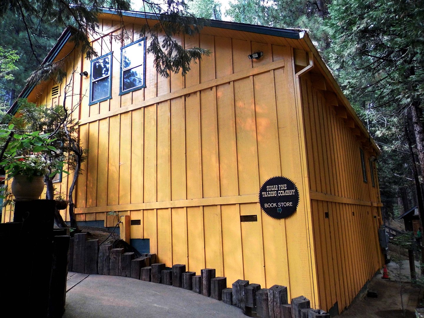
Less than an hour northeast of Fresno, I could ride the Sugar Pine Railroad! And, in fact, my timing was impeccable—because on the Saturday of Labor Day weekend, I could ride its narrow-gauge heritage rails twice, with the addition of the "Moonlight Special" evening train.


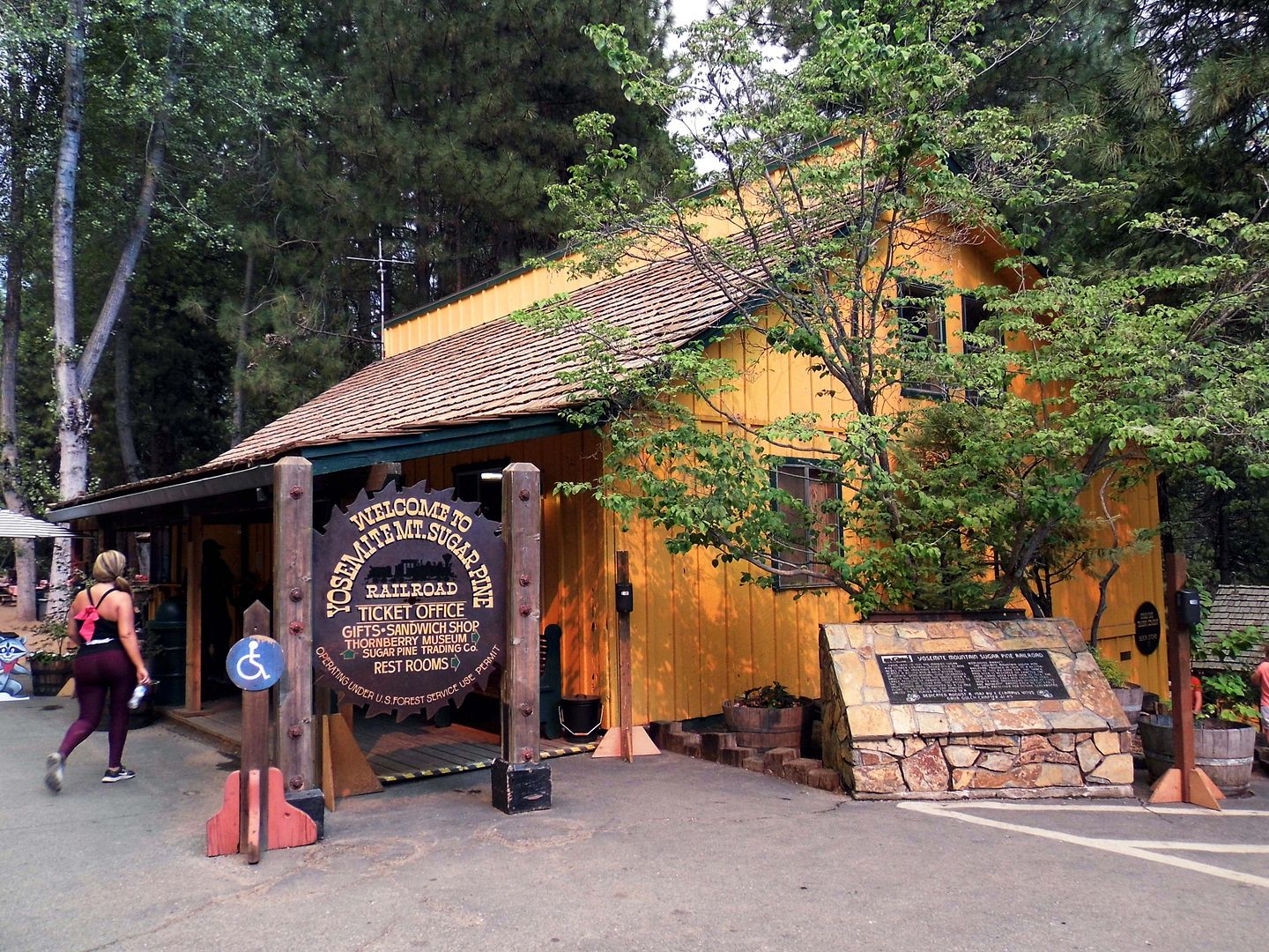
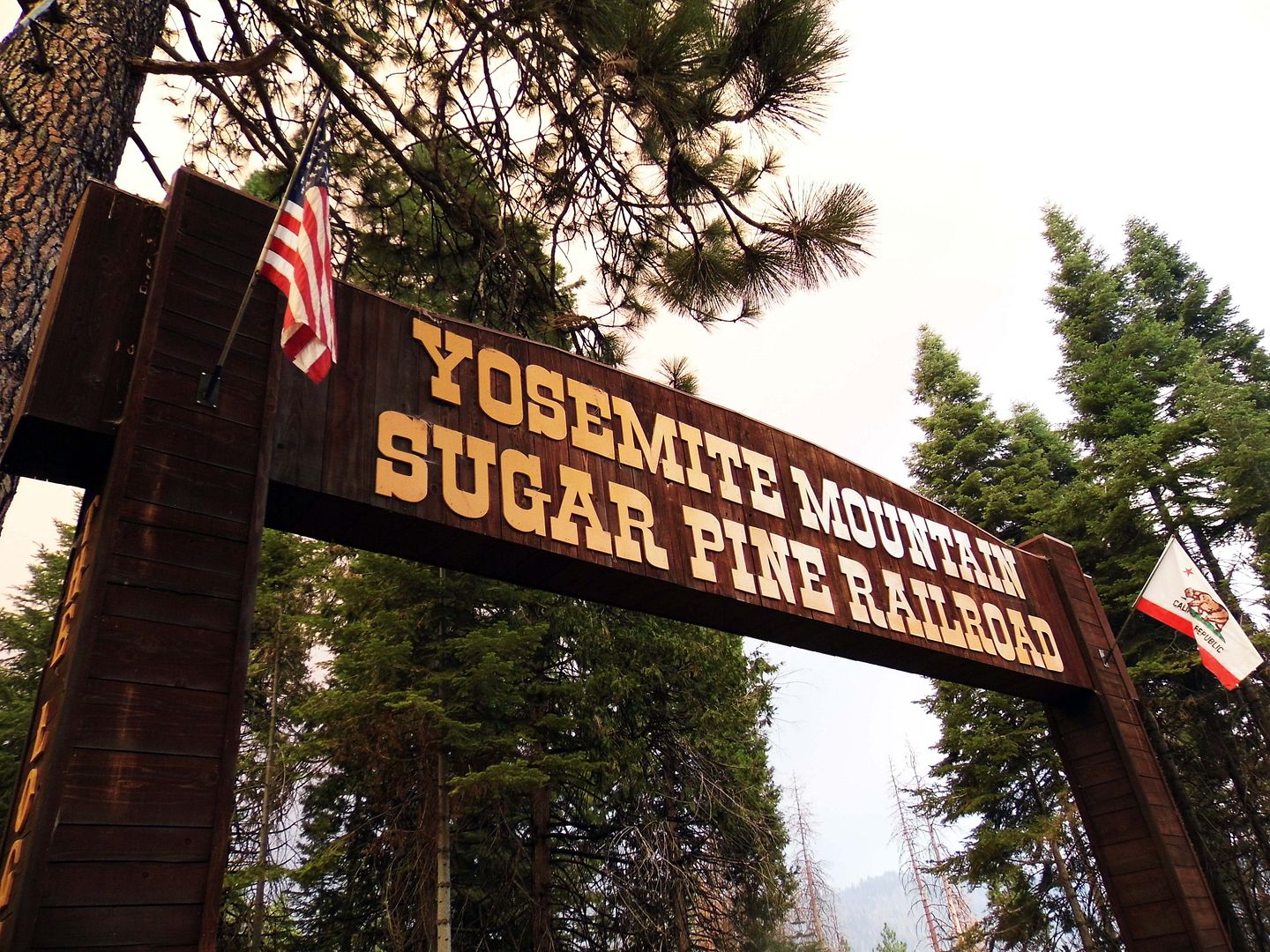
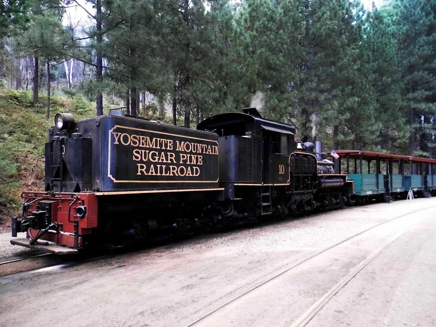
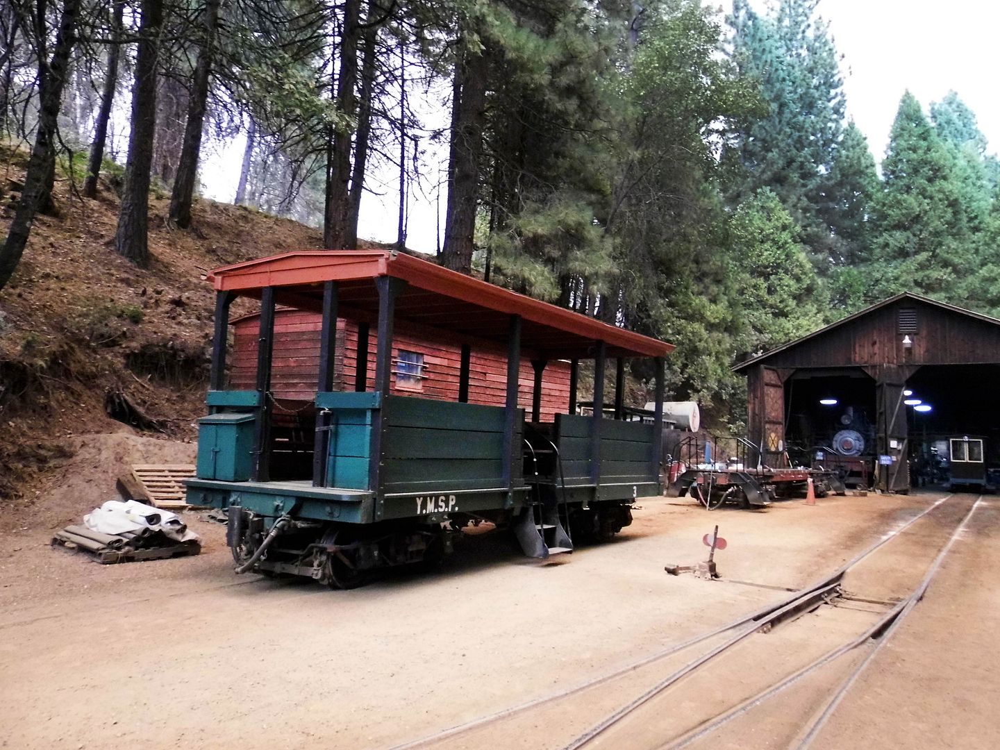
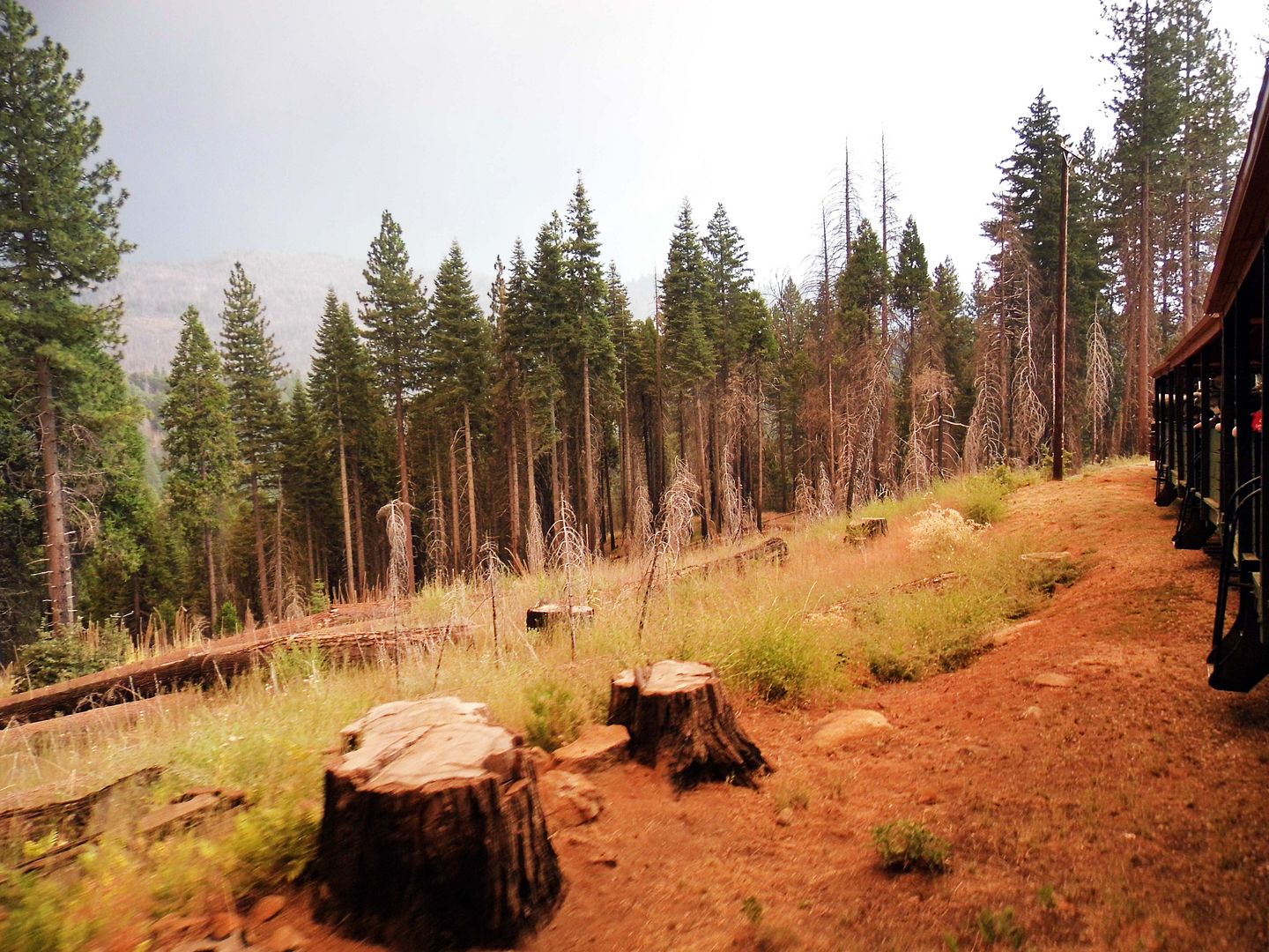
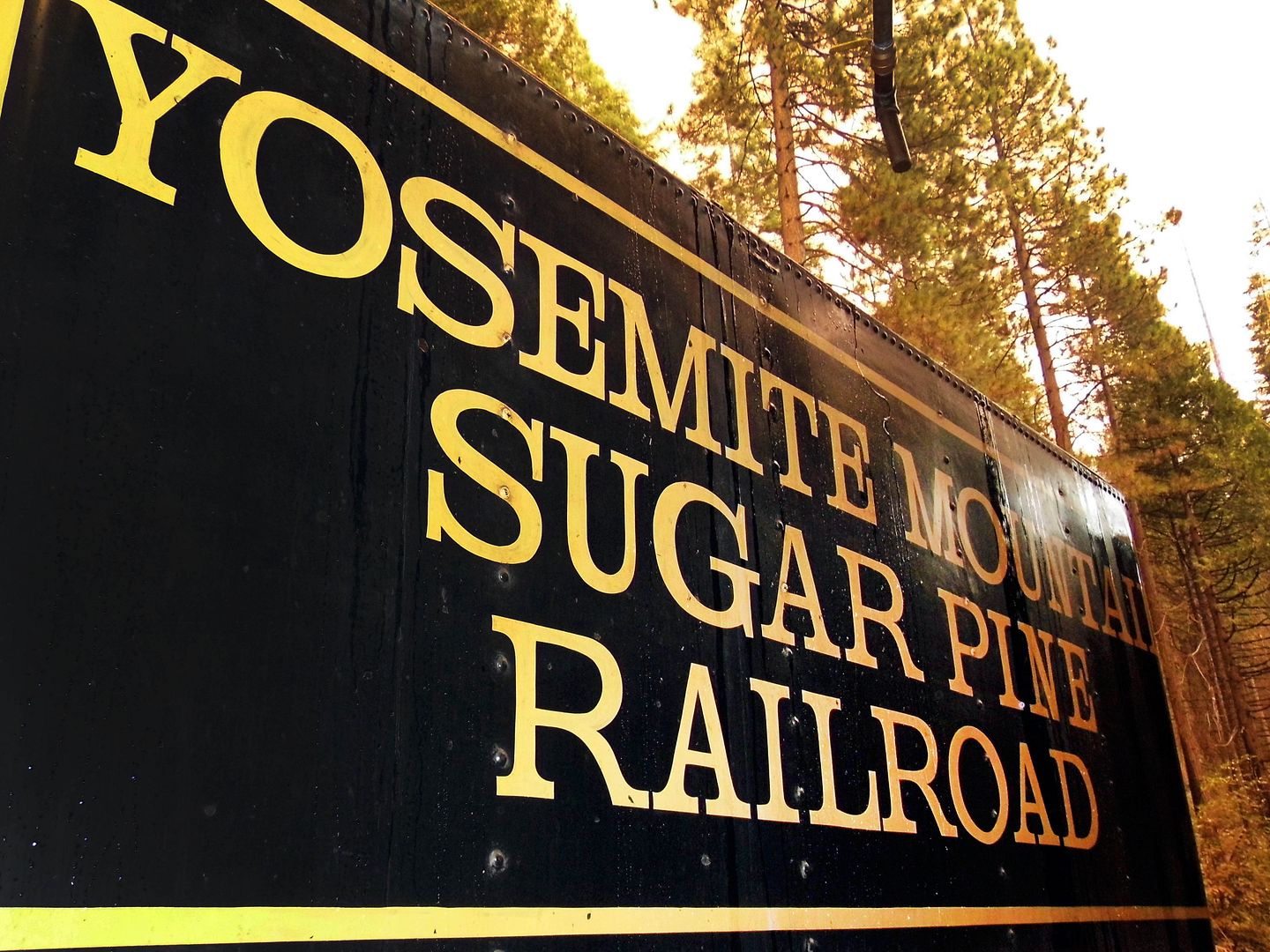
Located in Sierra National Forest near the town of Fish Camp, about 10 miles south of the Highway 41 entrance to Yosemite National Park, the Yosemite Mountain Sugar Pine Railroad has been running scenic passenger trains through federal land since 1965. It's still run by the same family that founded it.


It has restored and preserved the track and grade used from 1908 to 1924 in the logging operations of the former Madera Sugar Pine Lumber Company, which operated in the area from 1899 to 1931.


But now, instead of hauling logs...


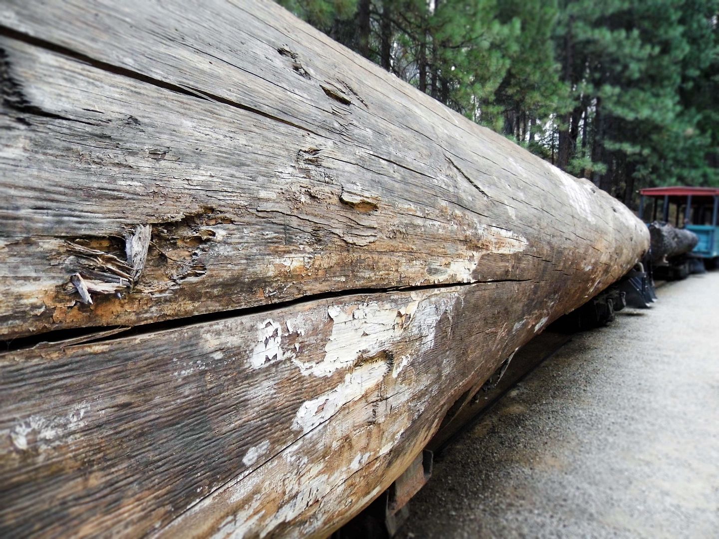
...the railway hauls tourists sitting on benches carved out of logs.


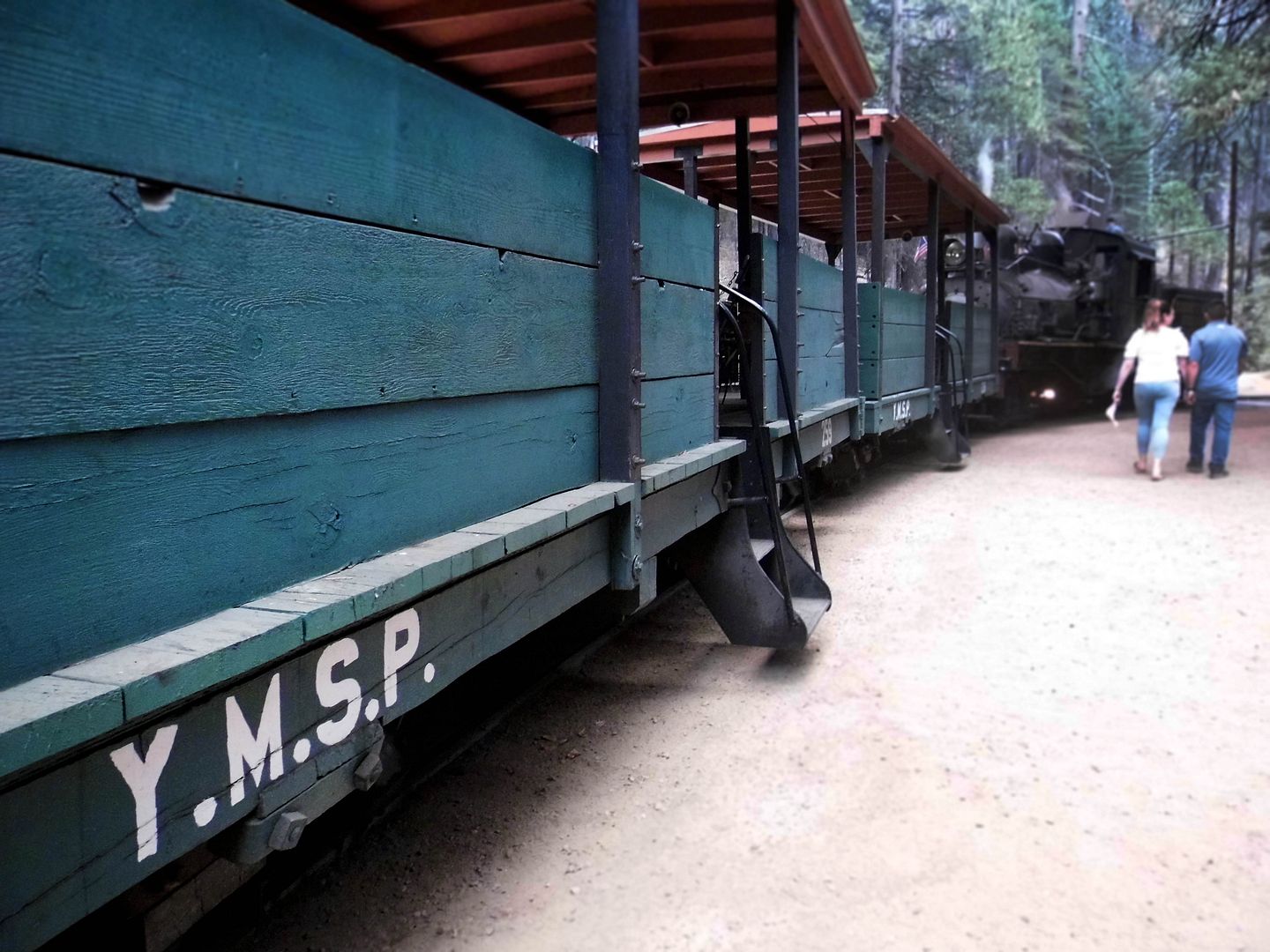
The main rolling stock for the current railroad—known as "The Logger"—also features covered but open-air carriages, offering both comfort and safety. That's where I boarded my first train ride of the day.


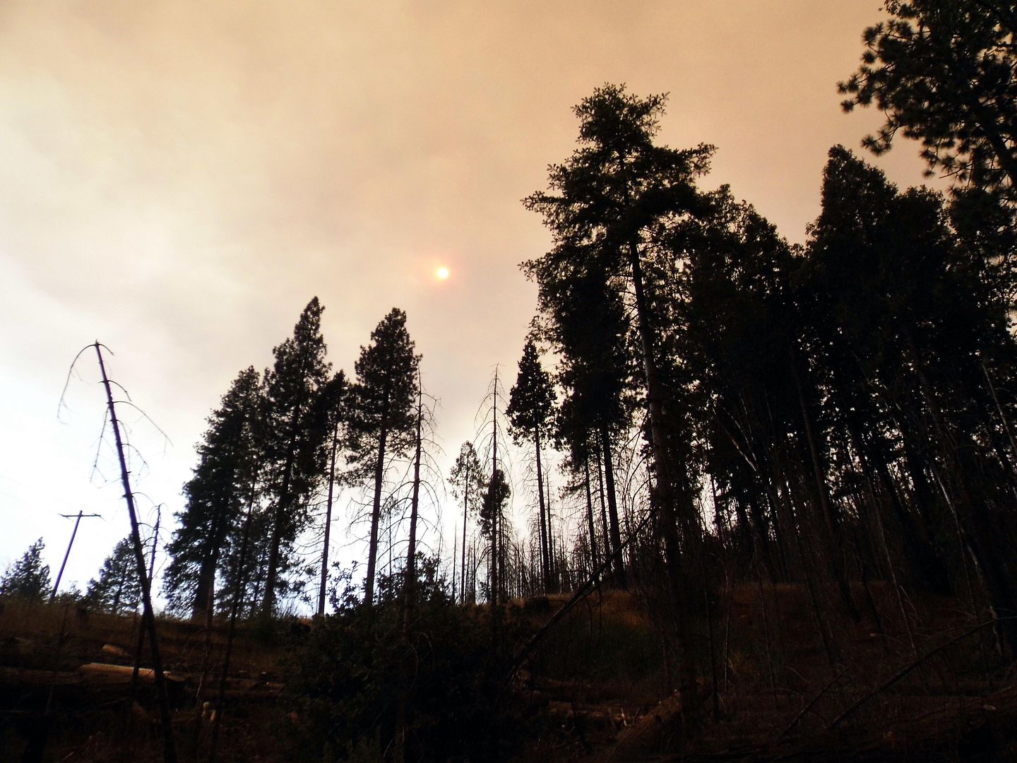
When I'd arrived in the area, I could see that there was smoke in the sky and an alien orange glow cast upon pretty much everything—but because I'd been driving since 9 a.m., I hadn't heard about the local wildfire that was causing it. I had no idea how close it was getting, either.


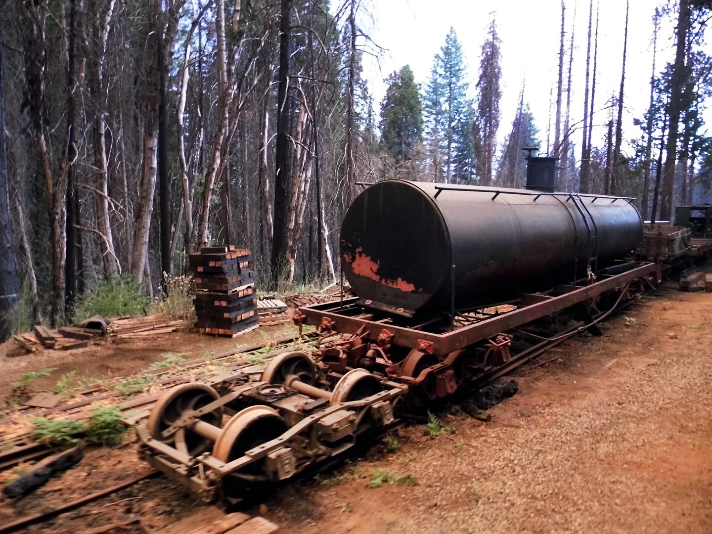
But as we rolled past some of the salvaged equipment and train cars relocated to California from the Durango & Silverton Narrow Gauge Railroad in Colorado...


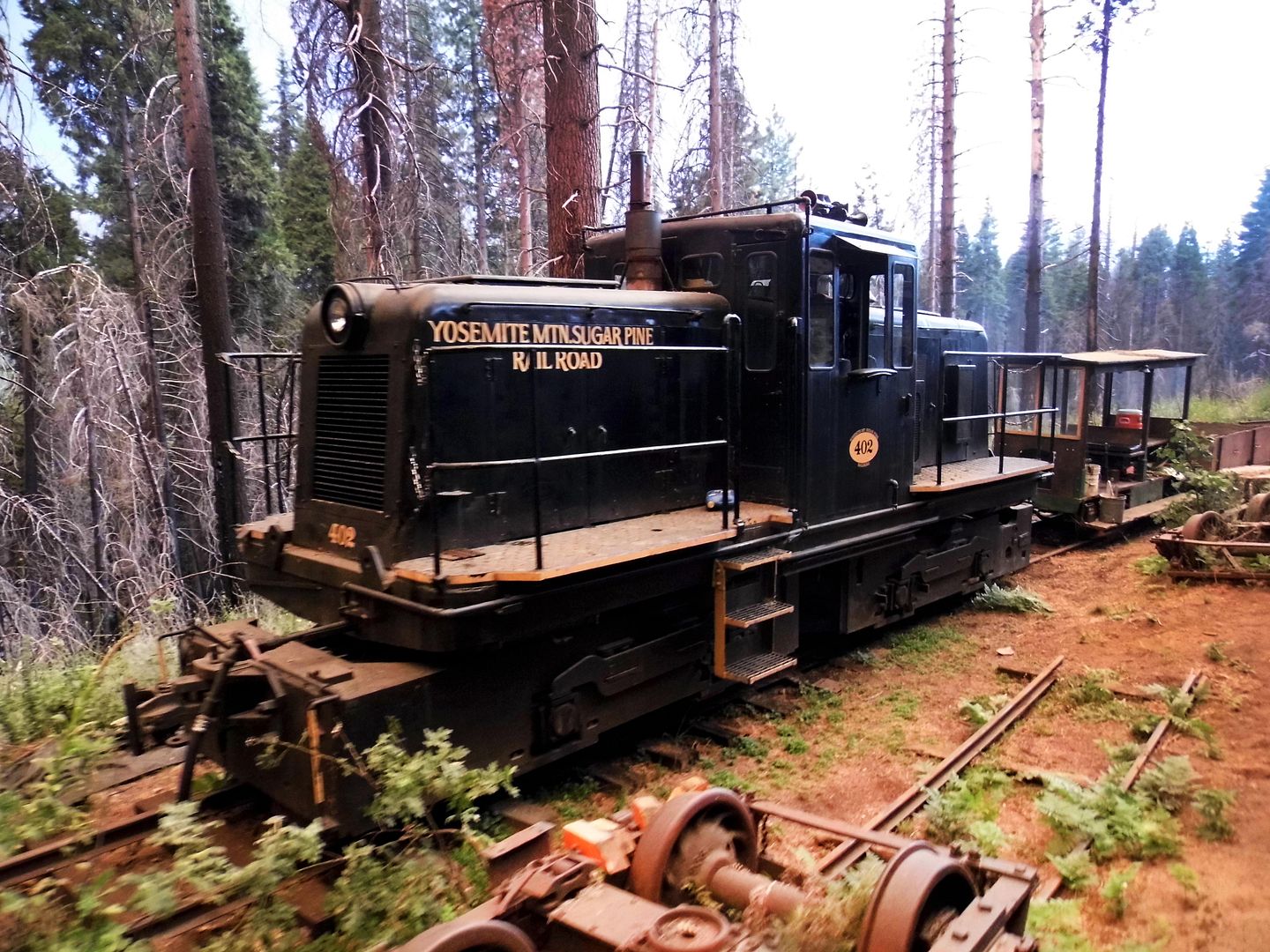
...like the No. 5, a two-axle diesel switch engine built in 1935...


...it wasn't far into our 4-mile journey that I realized something was very wrong, very close by.


I tried to focus on the magic of the oil-burning, steam-puffing locomotive as it chugged along the rails—but I did notice that I couldn't smell any sugar pines through my mask and bandana.


The only smell that got through my face covering was that of a campfire.


Plus, the sky was getting more foreboding as we got deeper into the national forest—though, at the halfway point of the loop, still only about 2 miles in.


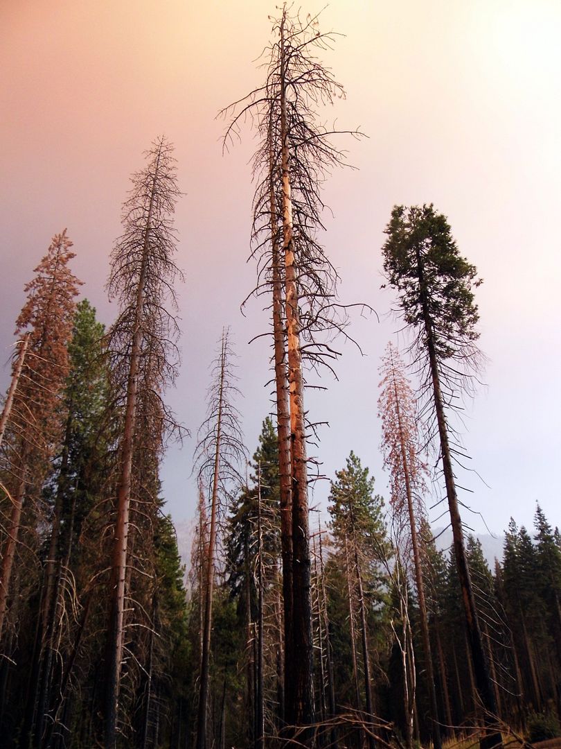
There was plenty of orange/amber sky to see out there, given the lack of "old growth" trees that would otherwise form a canopy above. That's because by the time the Madera Sugar Pine Lumber Company shut down operations, it had cleared about 30,000 acres of trees. And because the company never replanted any, what's growing along the rail route now is completely natural, "new" growth.


It's kind of amazing that wildfires haven't impeded this self-reforestation process—although the 2017 Railroad Fire, which started across the highway from the YMSPRR station, did char some of its historic equipment.


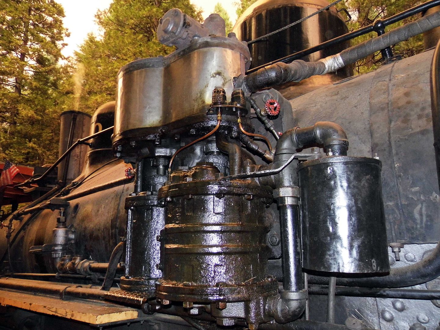
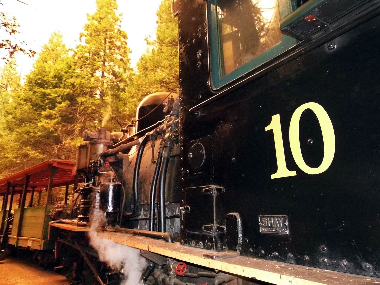
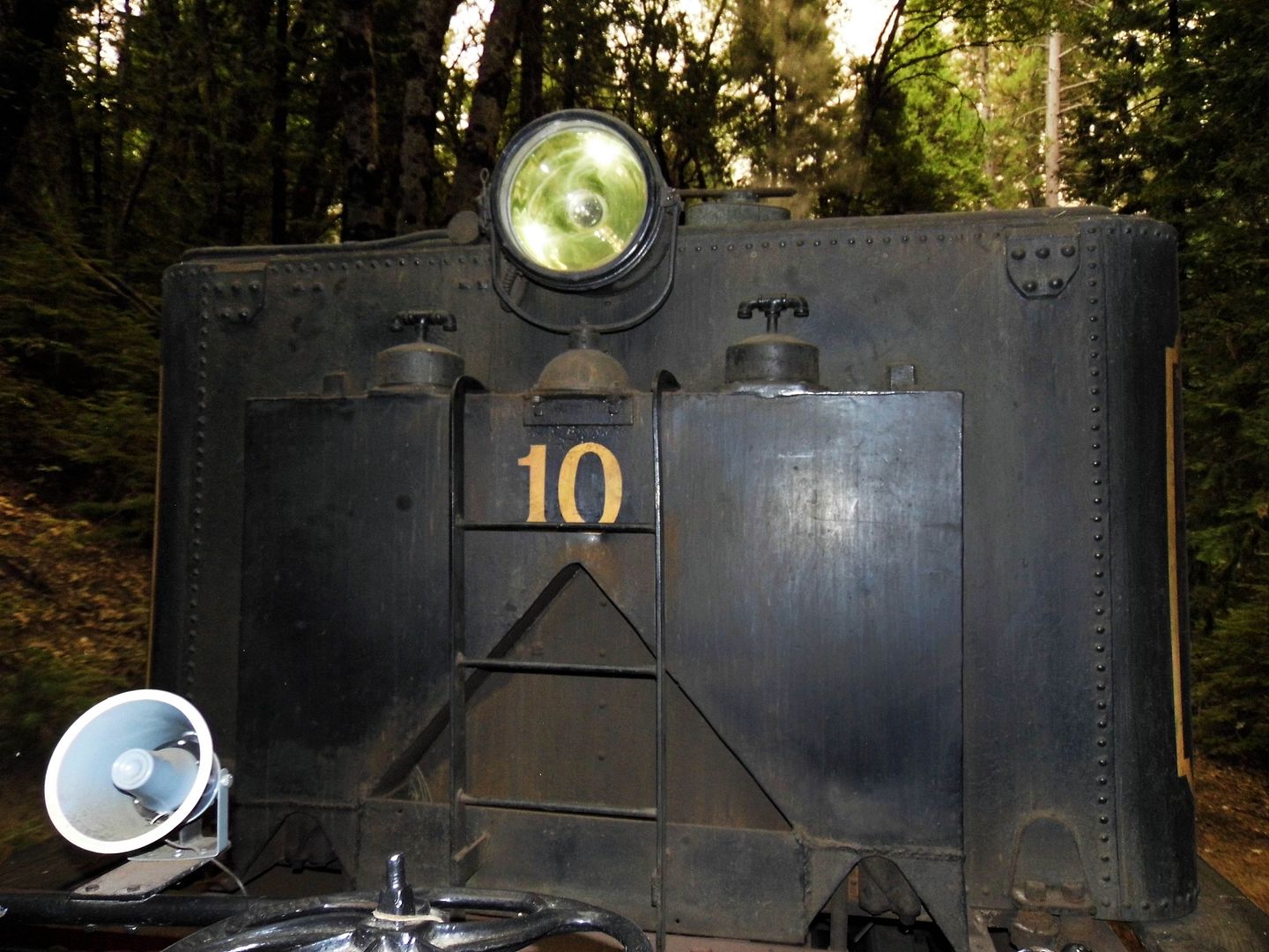
Fast-forward a couple of hours to my second scenic ride of the day—the "Moonlight Special"—and that's when I chose to sit in a log right behind the No. 10 "Shay," completed in 1928. Lima Locomotive Works of Lima, Ohio constructed it for the Pickering Lumber Company, which used it for the West Side Lumber Company's operations in Tuolumne, California.


It didn't much matter to me if the locomotive drowned out the sound of our guide's voice coming through the speaker. I'd already heard the narration once that day. I just took all the sights in once again, for as long and as much as the remaining light would allow.


By the time we made our final 2-mile passage through Sierra National Forest at the end of the night, it was so pitch black out that I could see nothing ahead but trails of white steam and the flames from the firebox.

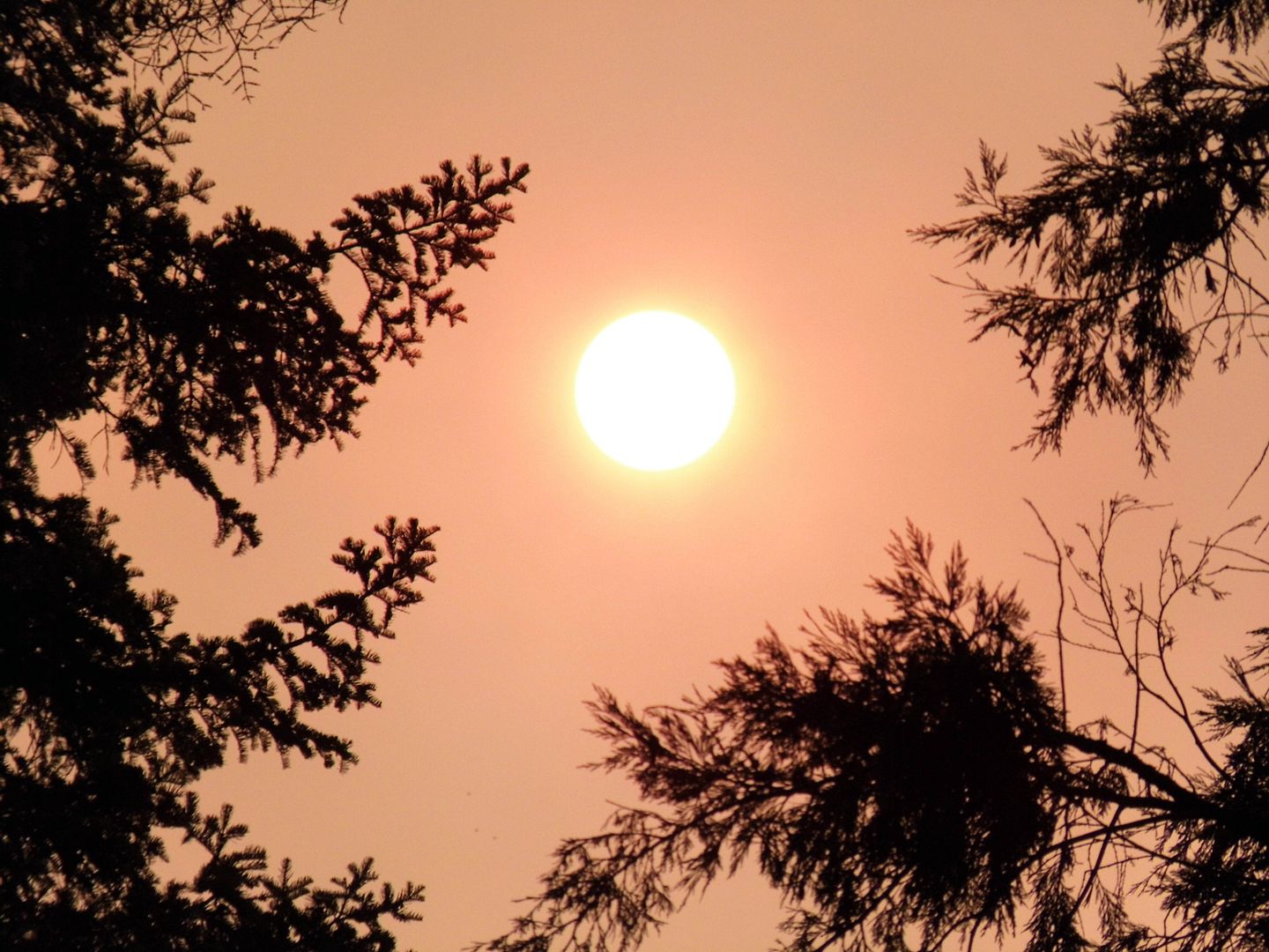
There was no moon to admire, no stars or constellations or planets or Milky Way. Smoke from the nearby Creek Fire—which was getting closer and closer as we progressed through the forest by rail—had formed a thick canopy above, blocking our view of any night sky and insulating us with the 100+ degree heat from earlier in the day.

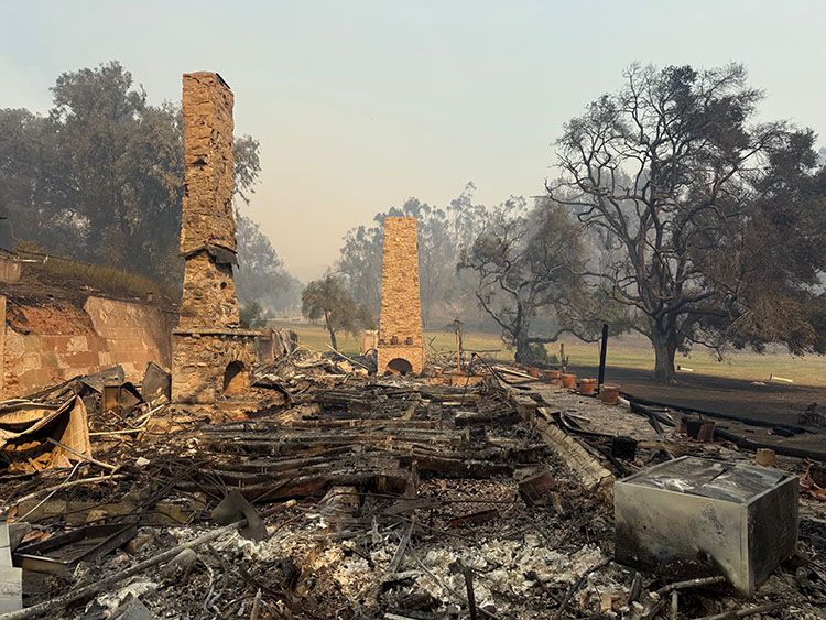
On my drive back down the 41 to the gateway town of Oakhurst, where I'd planned to spend the night, I couldn't keep the red glow of the Creek Fire from invading my peripheral vision. Though I could see no actual flames, there was an unmistakable inferno blazing just down the way—how far or how fast, I wasn't sure.

Back at my hotel, and back with a cell phone signal, I discovered that what had begun as a small wildfire the night before had exploded into over 30,000 acres that afternoon. And nearby evacuations were underway.

I fortunately wasn't staying in backcountry, so I'd presumably have plenty of notice if I had to high-tail it out of there. I was prepared for a knock on the door or a phone call in the middle of the night to tell me to get out—though fortunately, those orders didn't come during my stay.

I woke up at 8:30 a.m. without an alarm, disoriented as to the time and place I was in—because it was a dark orange-gray outside, with every car using its headlights and every street light still on. I couldn't find the sun in the sky. And after getting myself ready to leave in 30 minutes flat, I found my car covered in fallen ash—ash that was continuing to fall, but now on top of my head.

The next day—that Sunday, the day before Labor Day—the Yosemite Mountain Sugar Pine Railroad closed for the safety of its staff and visitors, with the Creek Fire still expanding and advancing.

And as of today, the following Sunday, it hasn't yet reopened. The Creek Fire has grown to more than 200,000 acres and is still burning, although evacuation orders have been lifted for Oakhurst and relaxed to a warning for Fish Camp.

So, it looks like the YMSPRR will dodge another bullet this time around when it comes to fire season. But I sure am glad I got there just under the wire for this trip. And I hope they continue to ride the rails in Sierra National Forest for decades to come.

Related Posts:
Missing Out and Making Lists In the Time of Coronavirus (Steam Railfest Edition)

August 20, 2020

Starting Over Again at Ventura Botanical Gardens, Ravaged by Wildfire

It was one of those places I kind of knew about and had vaguely added to my list—but being located in the city of Ventura, I'm usually whizzing past it along the 101 on my way somewhere else (or on my way home from somewhere else).

And then the Ventura Botanical Gardens—located in Grant Park, on land donated by the Grant family over 100 years ago—closed for nearly a year after getting scorched in the devastating Thomas Fire at the end of 2017.

Nearly every plant perished. But the recovery efforts managed to much of the vegetation. And now, it's difficult to tell that it ever burned at all (with one exception, which I'll get to at the end of this post). 


Located on city-owned land behind Ventura City Hall, the Ventura Botanical Gardens embraces the local Mediterranean climate by grouping its plantings by theme—California Natives, South African Cape, and Chilean gardens.


The lower portion—accessible from the parking lot—represents plant species from Chile, including representatives of 180 species of cacti as well as endemic and rare plants of that region.


The Chilean matorral plant community is actually similar to Southern California chaparral, so it's not much of a stretch. The major difference is that Chilean flora have practically zero resistance to brushfires.


But considering how decimated the landscape was after the fire, it's incredibly lush now.


I embarked on the Demonstration Trail, starting at the bottom of the hill at the newly-built visitors center and passing through the new nursery area...


...climbing up stone stairs, past stretches of doquilla (a.k.a. Pata de Guanaco, Cistanthe grandiflora) that breached the trail boundaries...


...and soaked up the sun as they ornamented the path upwards.


Although 6,000 or so plants have been replanted (with some additional ones actually surviving the fire)...


...the complete development of almost 107 acres won't be completed until 2050.


As much as there is to see in the lower gardens—like the perennial Chilean "Aunt May" (Sisyrinchium striatum)—there's even more to be added in the upper gardens.


The inflorescences along the rock-lined walls began to fade as I gained elevation—but then again, it was summer. I barely expected to see any blooms with the temperatures so hot, even with the Pacific Ocean in view.


The gardens are a relatively new addition to the city of Ventura—first envisioned in 2005, with a lease for the land signed in 2011 and much of the trail work done in 2012.


In fact, many of the plants that ended up getting charred (some, to death) in the Thomas Fire had only been planted maybe two or three years before—and in some cases, maybe less.


But fortunately, the non-profit that operates the gardens built it back better than before.


And when it's done, it'll encompass all five of the major Mediterranean climate zones of the world—enjoyed with multiple viewpoints and 360-degree vistas (with the Channel Islands in view on a clear day). 


It's so steep that the Master Plan accounts for a funicular or gondola to help transport visitors from the bottom to the top (or from one vista point to another). No sign of anything like that yet.


And maybe that's for the best—Grant Park has already transformed so much since its past uses in agricultural in the 18th century and as a grazing pasture in the 19th century.


There's one tiny parcel of land within Grant Park—and pretty much surrounded by Ventura Botanical Gardens—that's separately owned but inextricably linked to the city of Ventura.


It's the spot on a hill called "La Loma de la Cruz" where legend has Franciscan friar JunĂ­pero Serra erecting his "Mission Cross" in 1782—the year he founded Mission San Buenaventura, his final California mission before his death in 1784.


This 1-acre plot, known as Father Serra Park, has been owned by the Serra Cross Conservancy since 2003—the only way such a religious symbol could stay there while maintaining the separation of church and state.


This isn't the original cross, of course—its predecessors having been taking down by fire and wind. This one dates back to 1941—and it's still holding on for dear life, despite having been licked by the flames of the Thomas Fire.


Serra Park is a popular destination for weddings—or really anyone who just wants to get a good look at the panorama and maybe say a few words to their higher power.

Maybe one day Serra Cross will burn down and no one will care enough to put it back up. Maybe the same holds true for the botanic garden—one day, when its usefulness goes out of vogue.

But for now, these are precious resources that are literally in the line of fire every single wildfire season. Better to go now than to wait for more tragedy to strike.

Related Posts:

Photo Essay: A Rock House of Plays, Poetry, and Ceramics (and The Cross That Overlooks It)