
[Last updated 9/11/24 11:43 AM PT—On September 10, 2024, the Southern California Mountains Foundation announced on social media that the Keller Peak Fire Lookout had fallen in the wildfire known as the Line Fire and was out of service.]
Two years ago, I ascended to the Ancient and Honorable Order of Squirrels at the Strawberry Peak Fire Lookout Tower in the San Bernardino Mountains, near Lake Arrowhead.
It was such a fun experience, I wanted to return to shoot one of the videos I've been producing for our local PBS station, KCET, and its digital series "SoCal Wanderer."
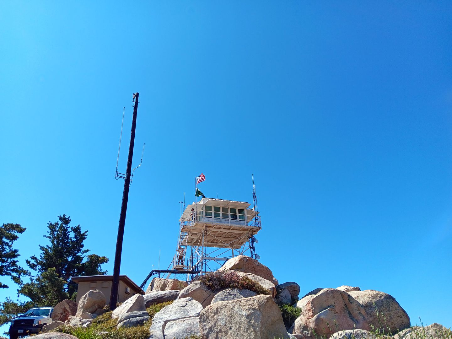
But my contact at the Southern California Mountains Foundation, the non-profit organization that oversees the fire lookout tower program in the San Bernardino Mountains, suggested I visit a different lookout tower this time: Keller Peak, near the town of Running Springs.
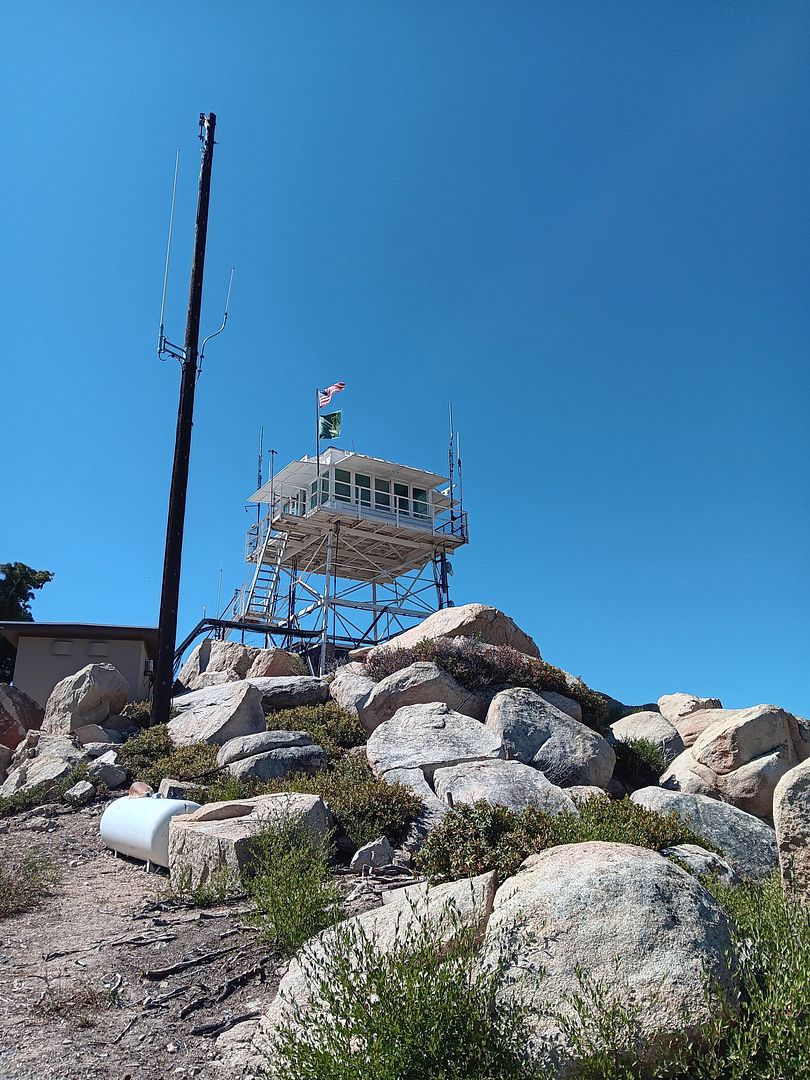
When I asked why, he mentioned that it was the oldest of the fire lookouts—built in 1926 and still in operation by volunteers. (Besides, the road is paved the entire way, he said.)
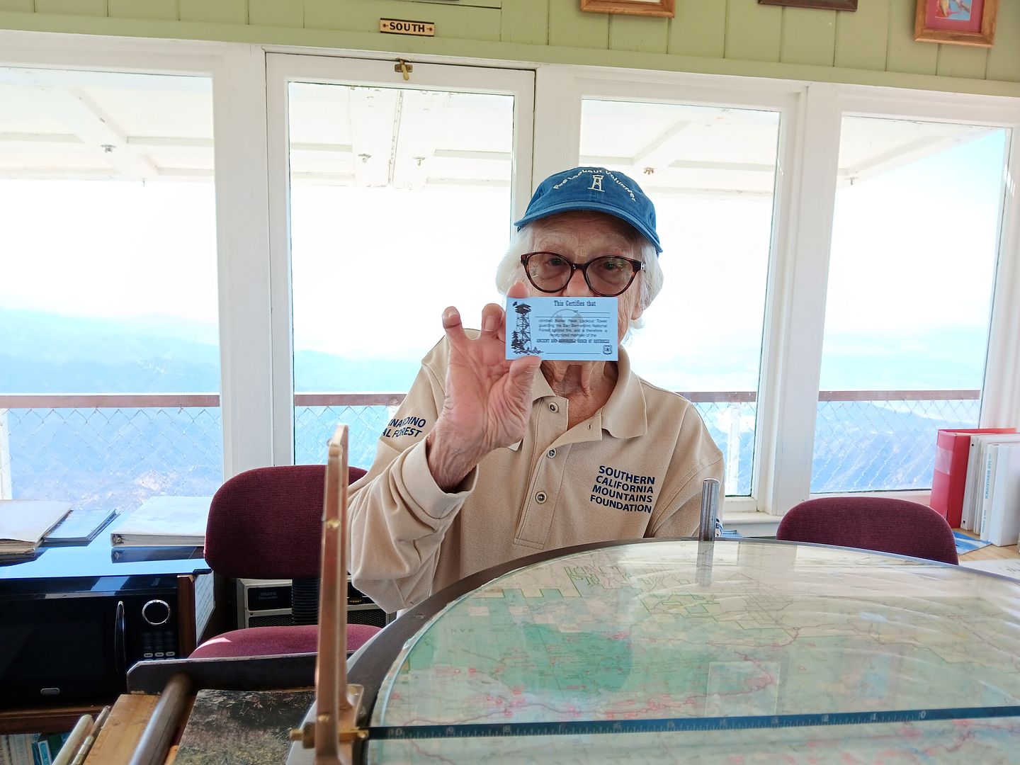
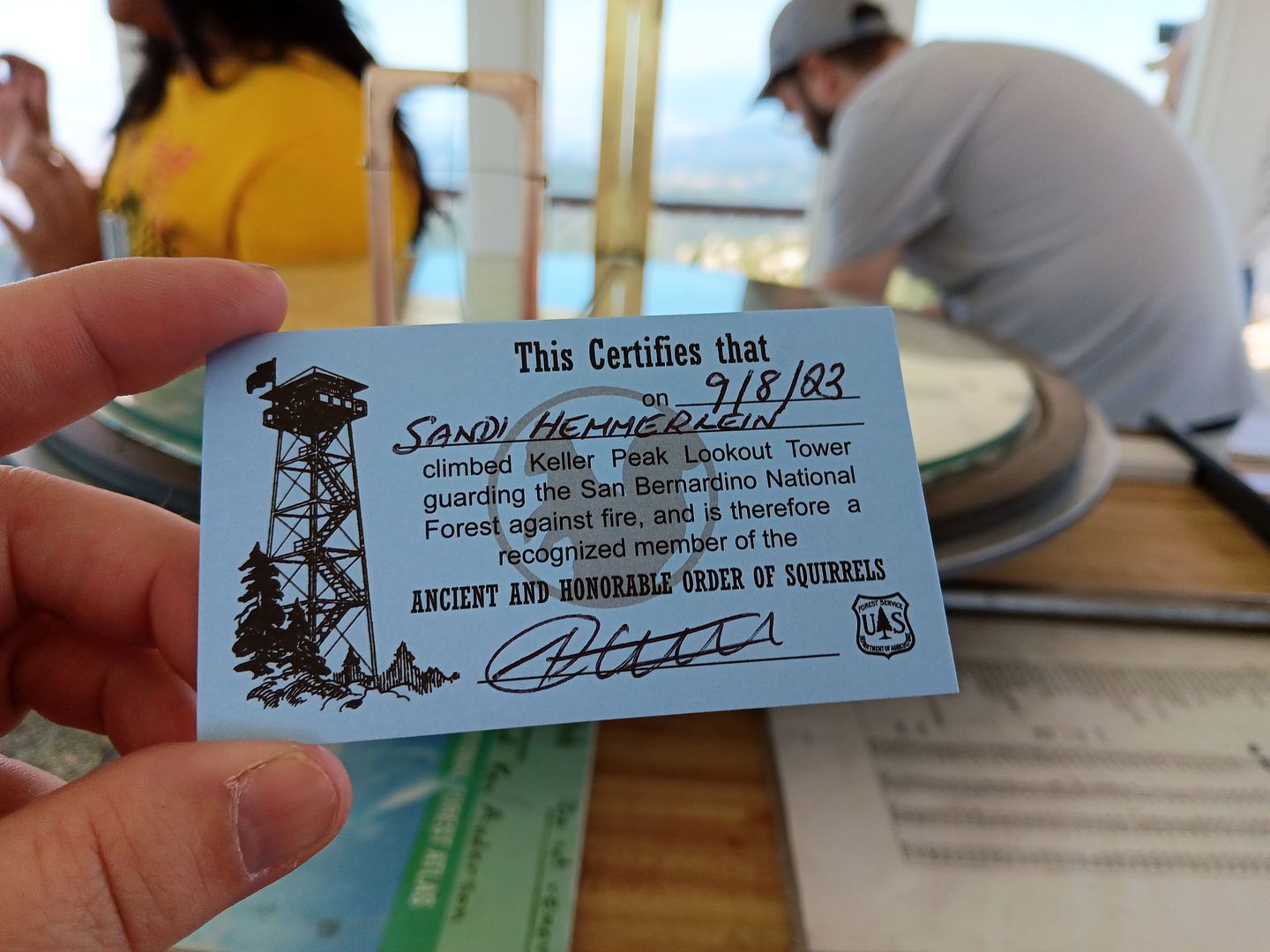
But there was another reason he encouraged me to climb these steps, as opposed to climb the ones I'd already climbed at Strawberry Peak: I'd already gotten my squirrel card there, and I needed to get my squirrel card from Keller Peak now.
Consider me convinced.
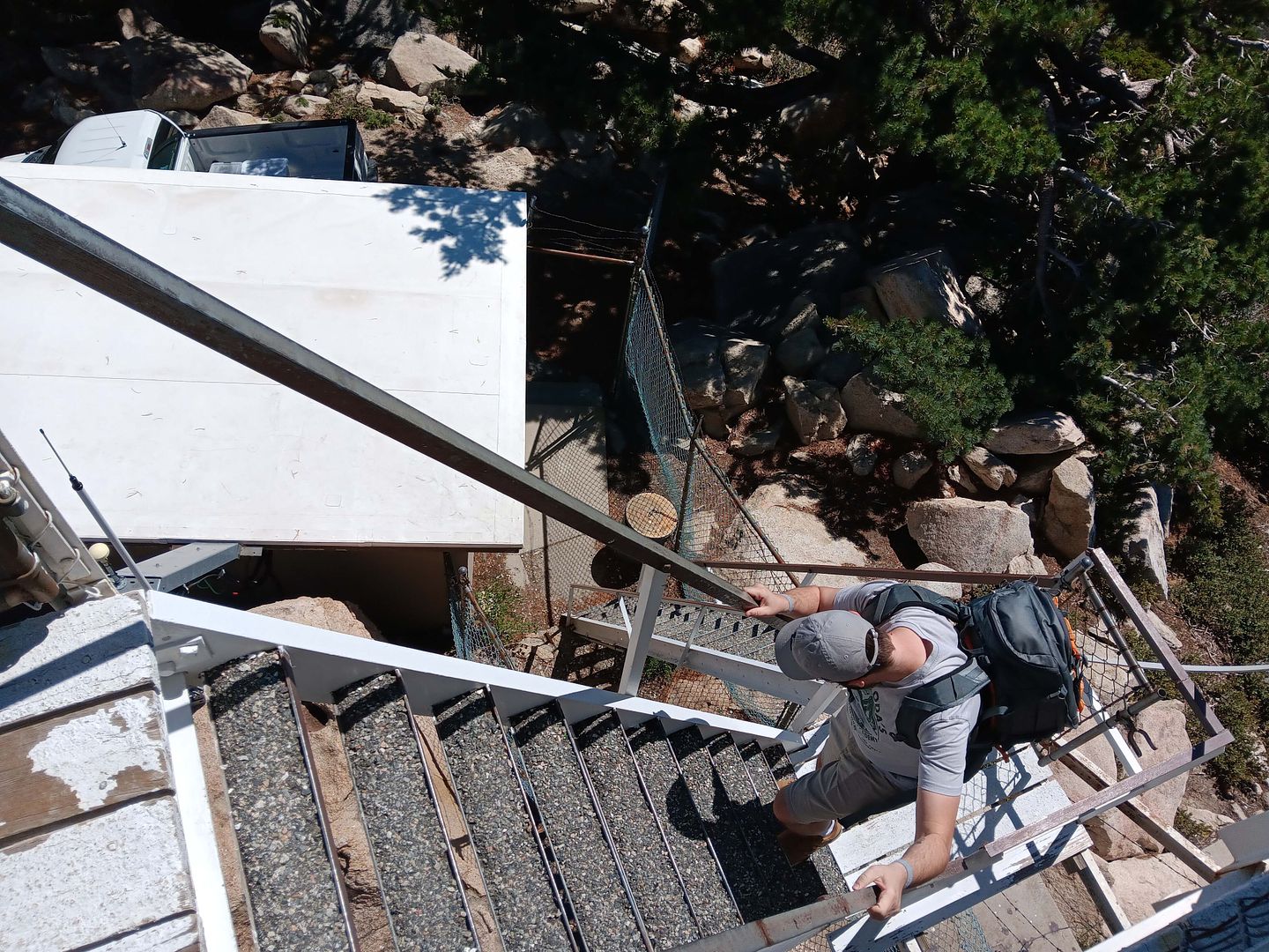
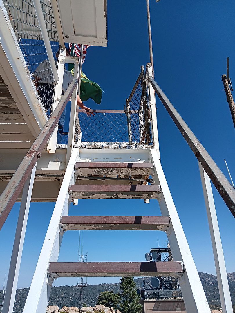
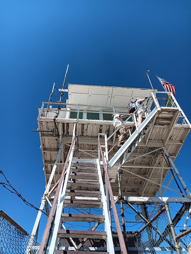
So I happily climbed the 28 stairs up to the cab—a steep journey of narrow steps, more akin to a ladder than a staircase.
The top of the tower stands at about 7900 feet of elevation, so I really started to feel the altitude.
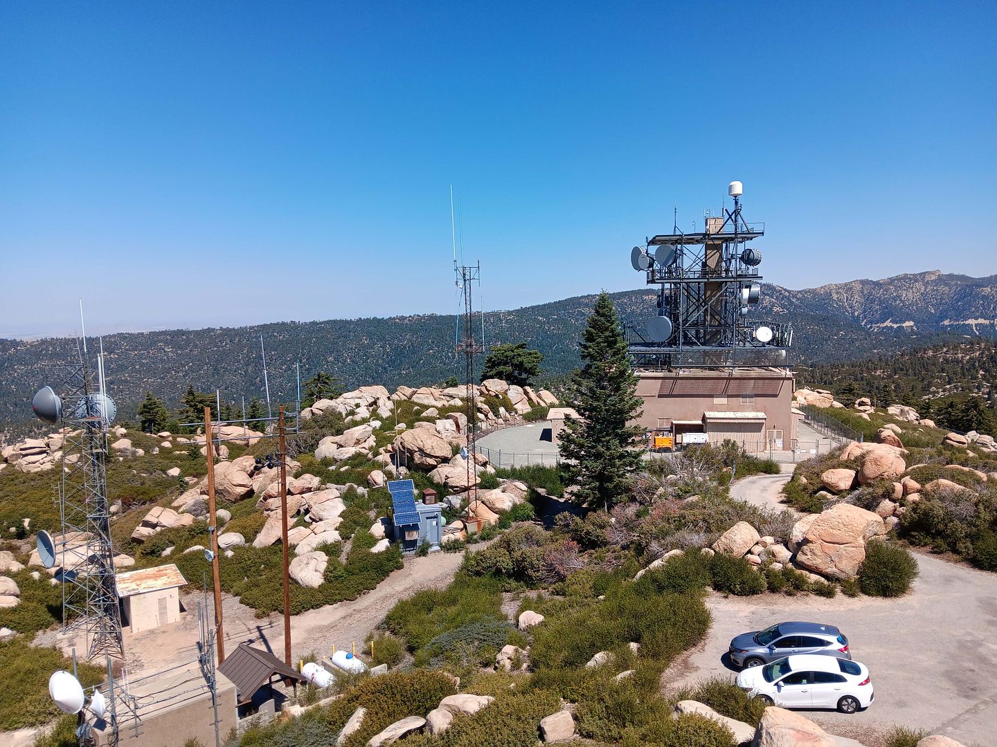
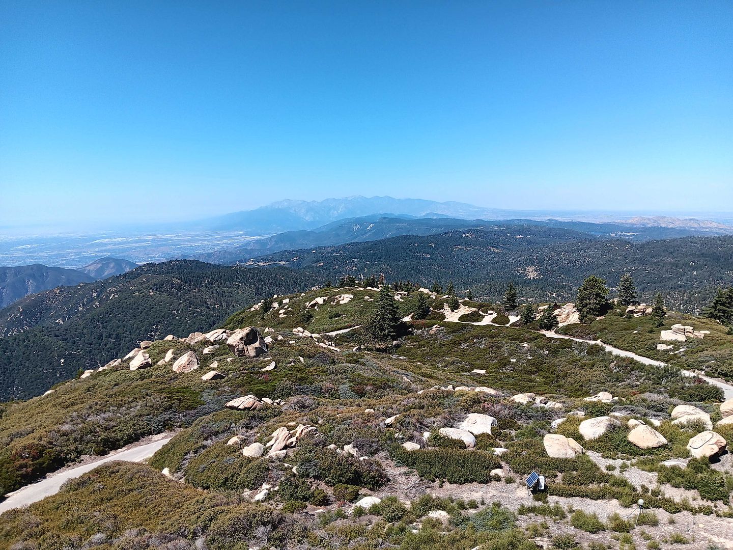
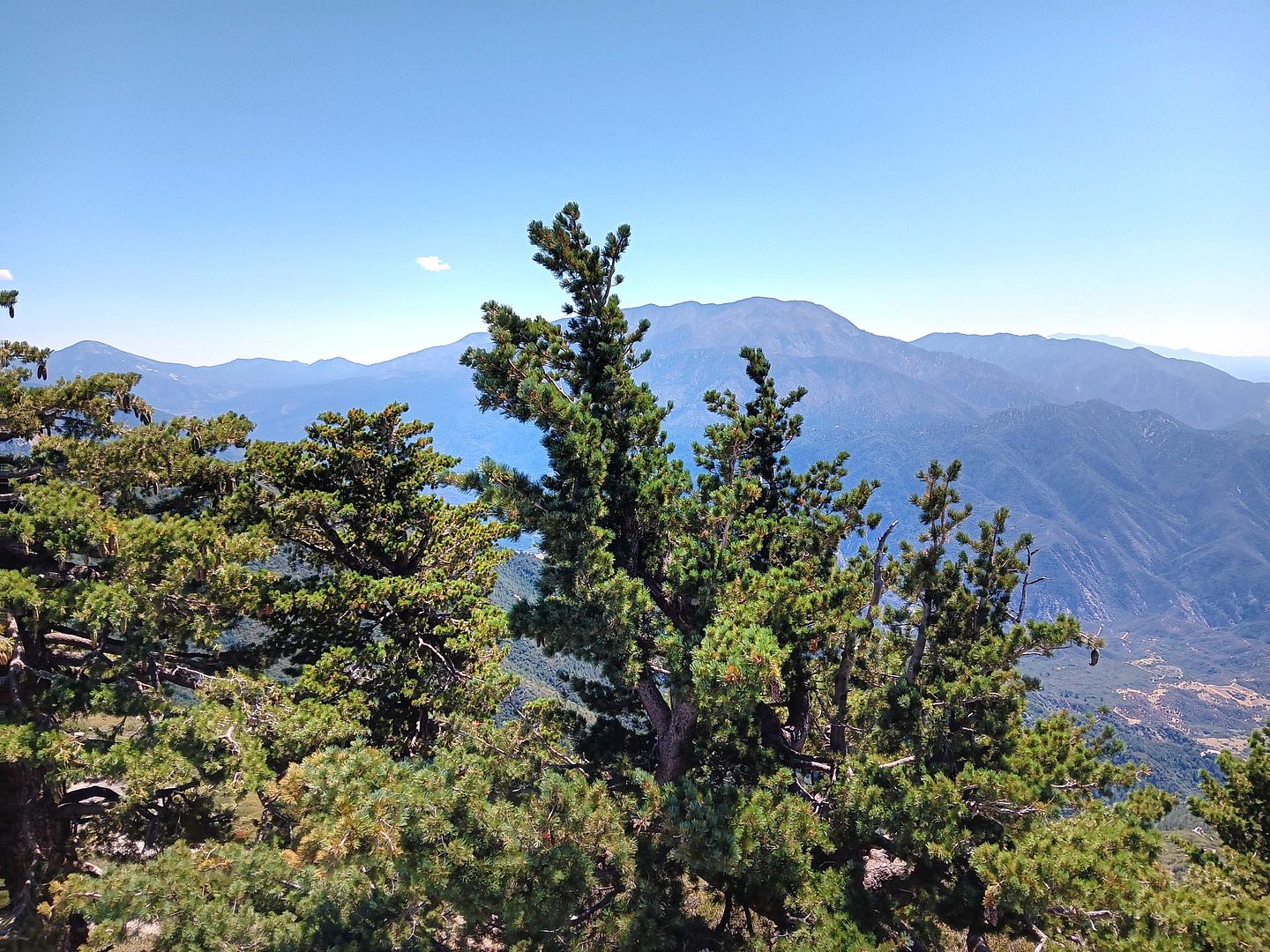
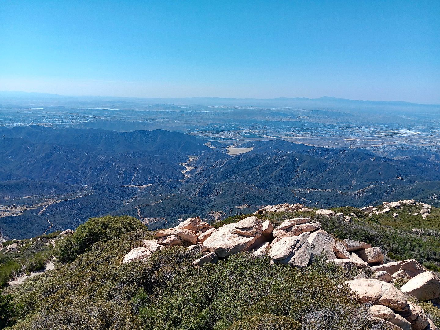
Or maybe it was the scenery that took my breath away—far less obstructed than at Strawberry Peak, with far fewer communications towers getting in the way.
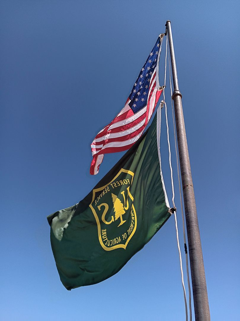
Or maybe it was the wind that day. You can tell which direction it's coming from by which way the flags are flapping.
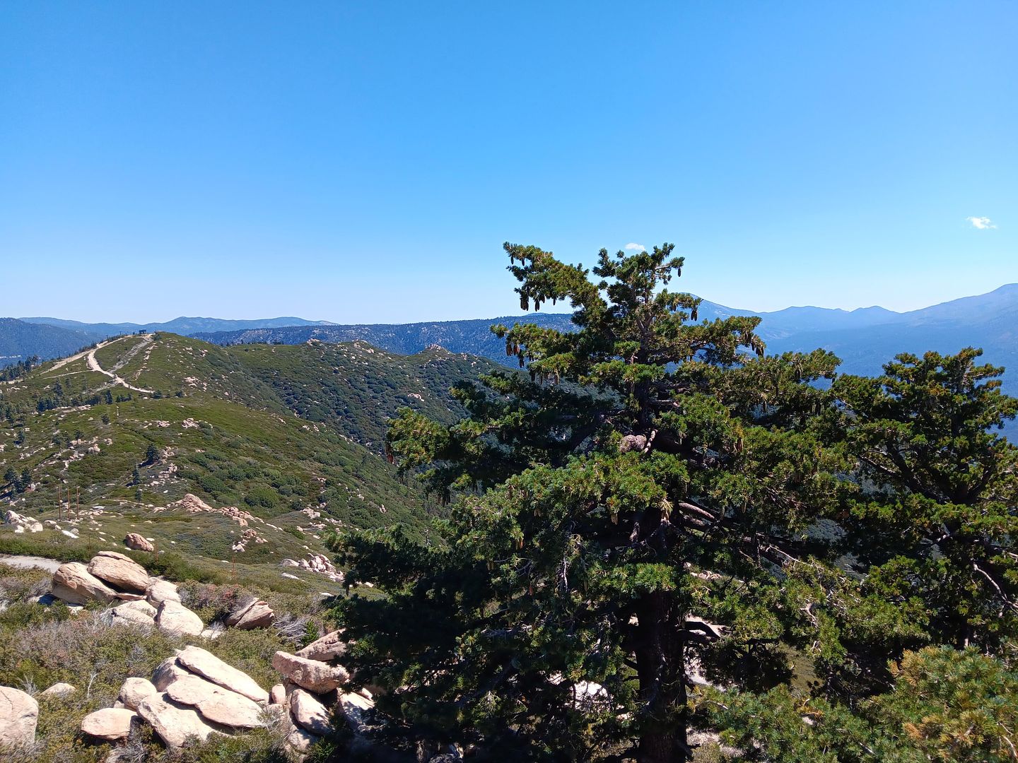
It's absolutely stunning up there—both on the narrow, winding road leading up to the peak and from the peak itself.
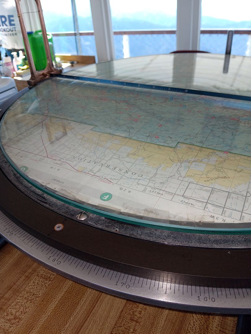
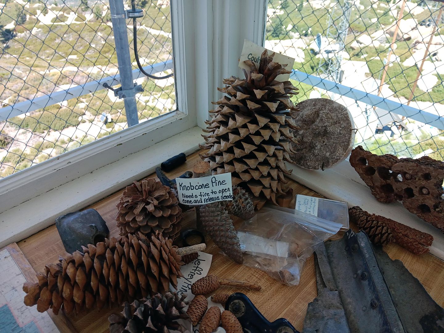
As at Strawberry Peak, the volunteer lookouts use an incredibly analog system for recording where they spot smoke and/or flames—the Osborne Fire Finder, which determines the azimuth and distance to geolocate the suspected fire.
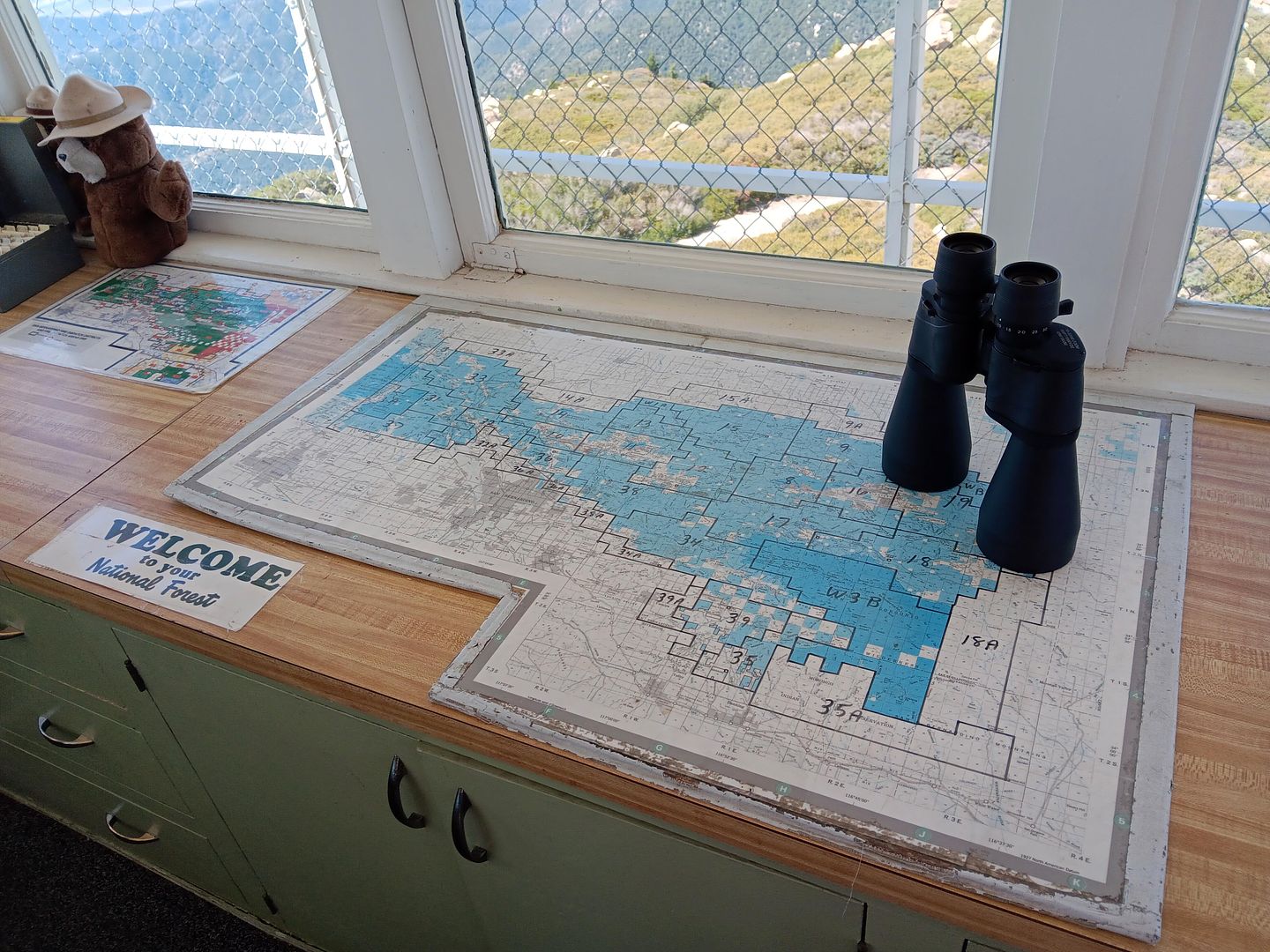
But first, it starts with scanning the forest every 20 minutes with a pair of binoculars. If they see something, they log it, draw an "X" on the Osborne Fire Finder with a red wax pencil, and call it in.
In addition to the Forest Service taking note, one of the other fire lookouts will keep an eye on the location as well, especially if they're closer.
But there are only two other fire lookout towers in this forest—Strawberry Peak and Butler Peak in Fawnskin, the latter being the highest one but also temporarily closed because of wildfire recovery efforts in the area.
The entire fire lookout program in California has shrunken over time—with the number of towers reduced from a height of 600-some-odd to now just over 200. And a fraction of those are actually staffed.
It's a special type of person who would want to work in a 14-by-14-foot room, or even sleep overnight there, with wildly changing weather conditions that can include getting "sucked in" with the fog or buried in snow and ice. Add to that the lack of utilities—with only electricity, no gas, no running water.
Fire lookout volunteer Edie Cole told our crew that she loved coming up in the mountains, taking care of the mountains, and encouraging others to enjoy (and protect) the forest.
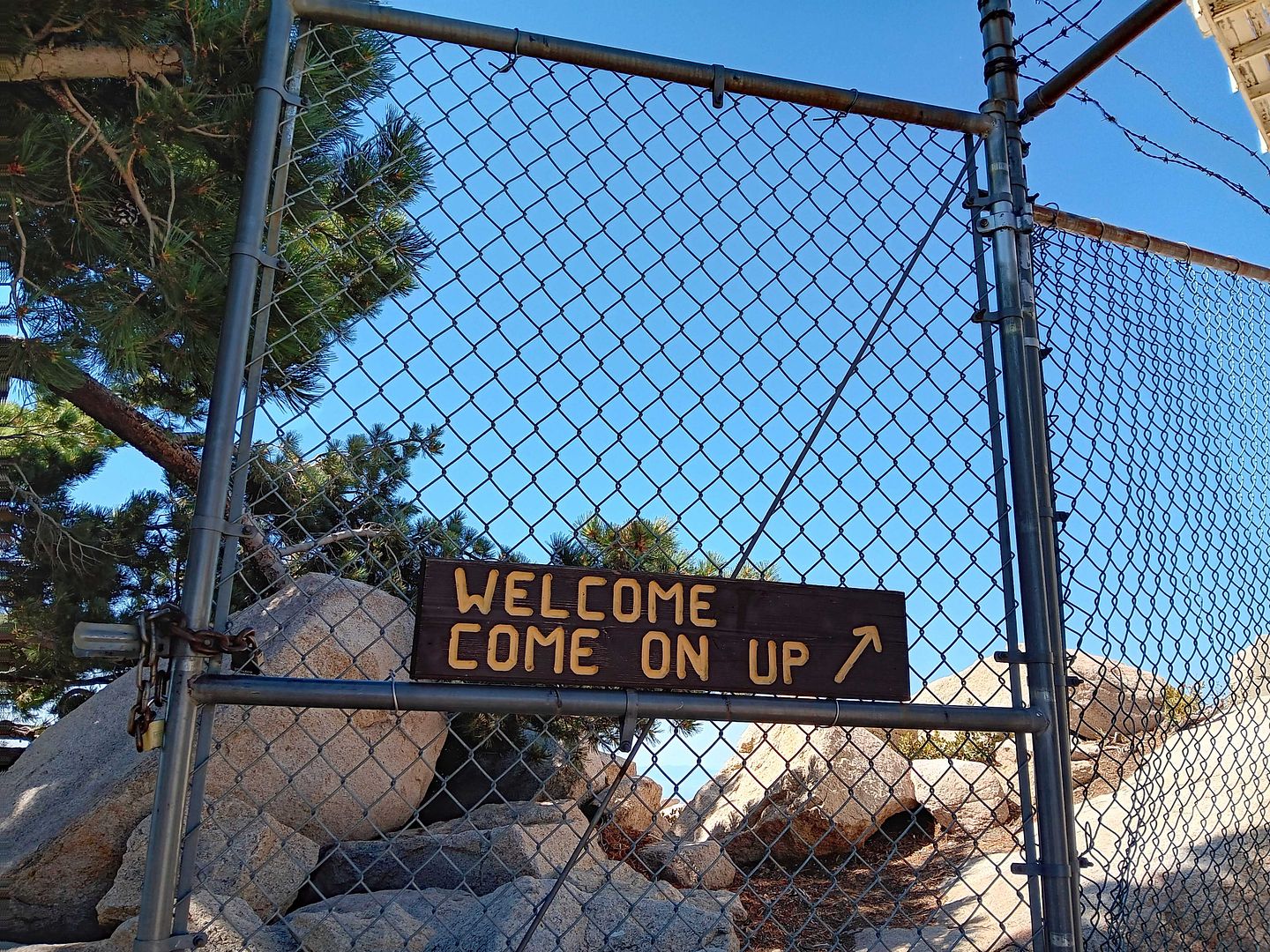
There's a well-known hiking trail that leads to Keller Peak, but the drive is really nice too—about 5 miles off of Rim of the World Highway. The real test, however, is that climb to the top of the tower—and, for me, worse yet, the climb back down (which is best to do backwards, although the height still really hit me).
You can watch the video we shot in the embedded player above.
Related Posts:
That is an awesome place to visit when up in that area. Have not been up there for four years. Thank you for the article and the reminder of the cool places located all around us. Keep up the good work.
ReplyDelete