Search

July 29, 2019

Photo Essay: The Volcanic Legacy of the West (Or, The Drowned Volcano That Brought Me From California to Oregon)

Probably everybody knows about the influx of prospectors who traveled west to California during the Gold Rush.

Farther north, the east-west route known as the Oregon Trail was immortalized an educational computer game.

But the lesser-known north-south passage back and forth between California and Oregon remains an important emigrant route of the West.


I'd never been to Oregon myself—so, on 4th of July weekend this year, it was time to make my own trek. And I was lured to Oregon from California—just like many travelers once were—by the famous views and earth-shattering scenery.


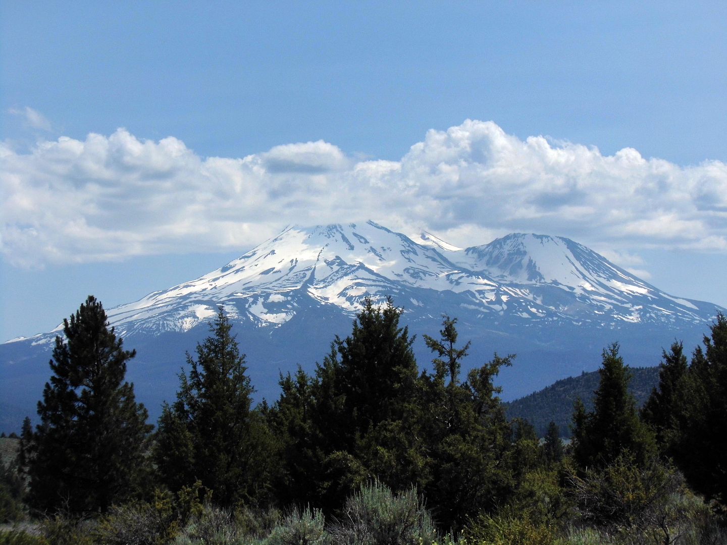
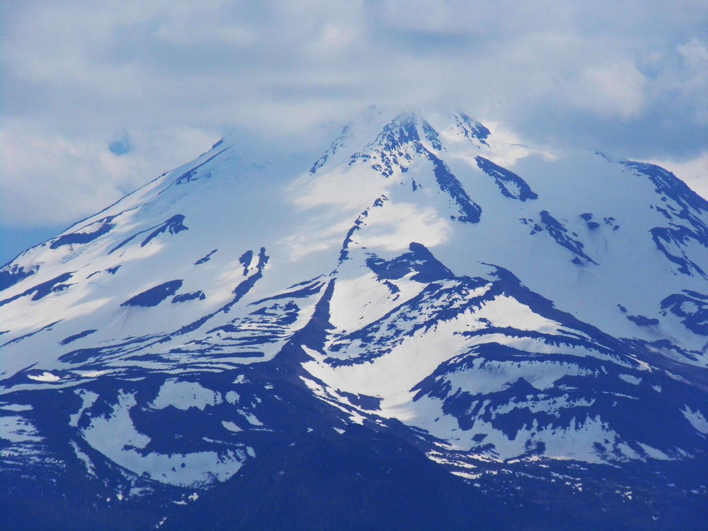
Unlike John Muir, I didn't climb the 14,000-foot Mount Shasta—the largest volcano in Cascade Mountain Range and part of the Ring of Fire between British Columbia and Lassen Peak—on my way to Oregon. Its most recent eruption was in 1786—and as it's still considered active, it was probably best that I keep my distance (besides my altitude sickness and current lack of physical fitness).


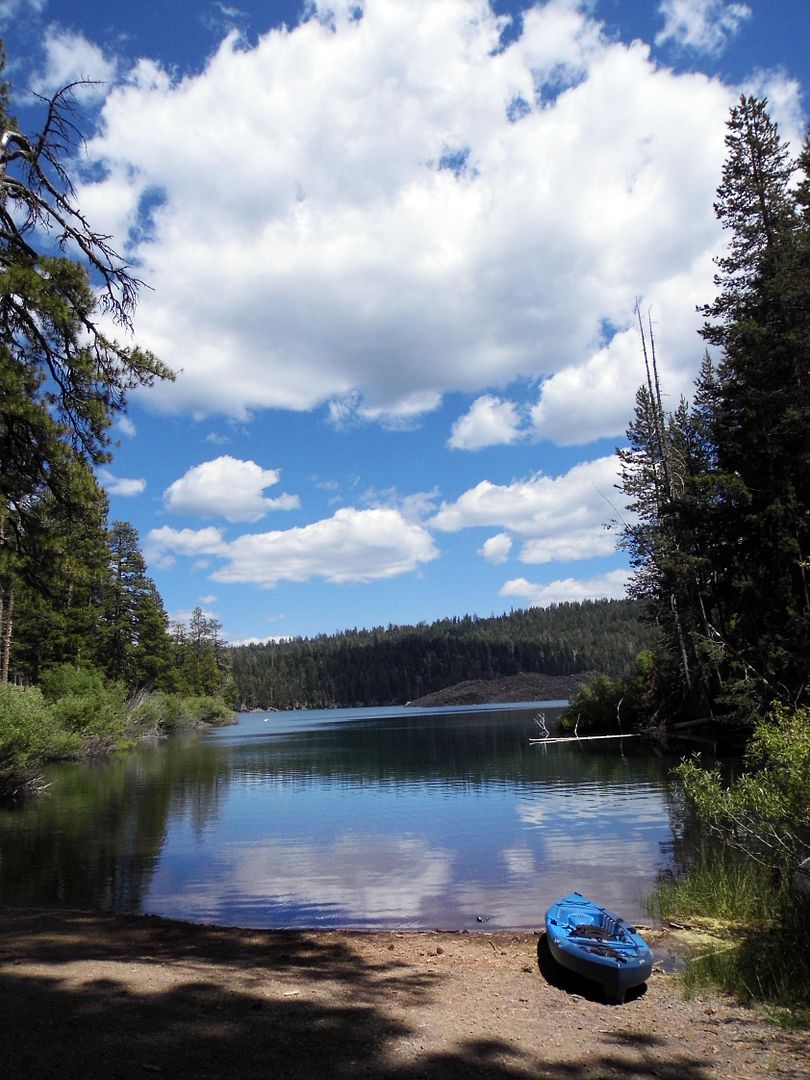
But I felt like I was under its shadow the whole time I traveled along the former Oregon and California stageroads and Volcanic Legacy Scenic Byway—the latter road taking us from Susanville into Lassen Volcanic National Park, where we stopped at Butte Lake.


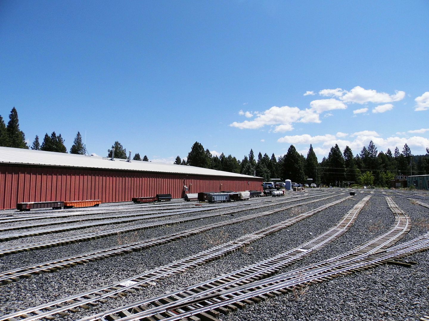
The hike to the Lassen cinder cone is along the Nobles' Emigrant Trail (circa 1850s-60s), a former wagon road (Fort Kearney, South Pass and Honey Lake Wagon Road) named after pioneer William Nobles. It linked Nevada—where we started our journey—to the Northern Sacramento Valley, where we found ourselves driving through Lassen along Highway 36.


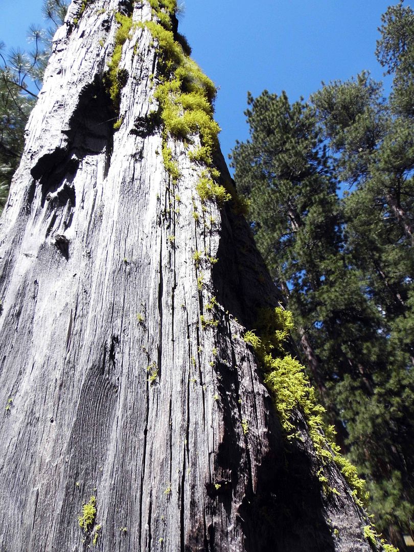
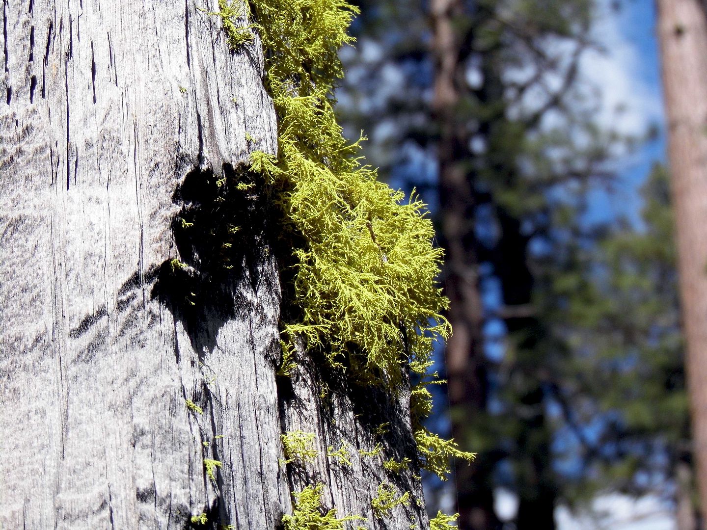
But we were along the Cinder Cone Nature Trail—and on foot, climbing up a loose trail that was as sandy as any beach (but much blacker).


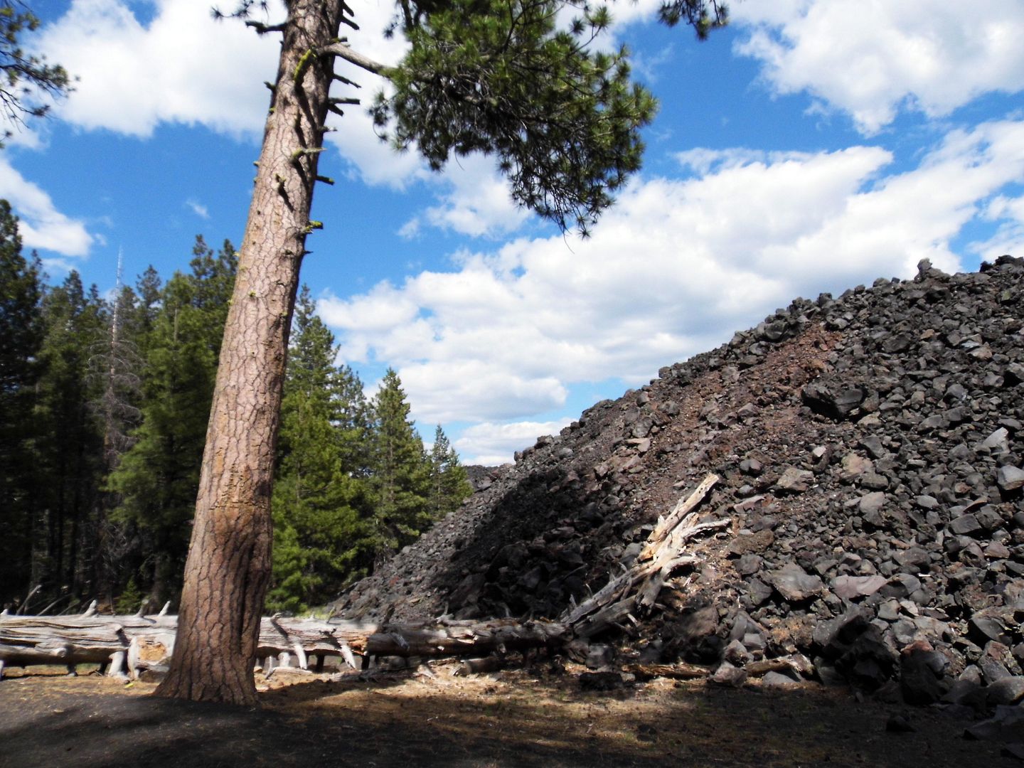
Though shadowed woodlands scarred by burns stood majestic to our right, on our left we found the "Fantastic Lava Beds," a flow of basalt lava that has hardened into glassy quartz crystals across a massive field.


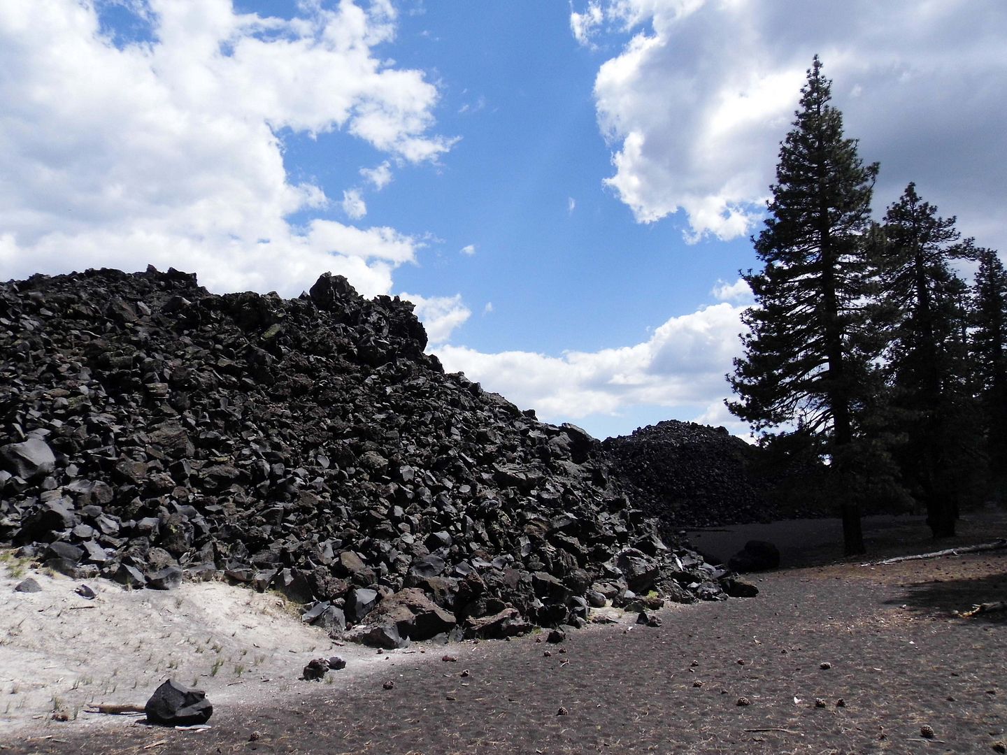
Probably a result of eruptive activity that occurred in the mid-1800s, it dammed up creeks and formed Butte Lake as well as Snag lake.


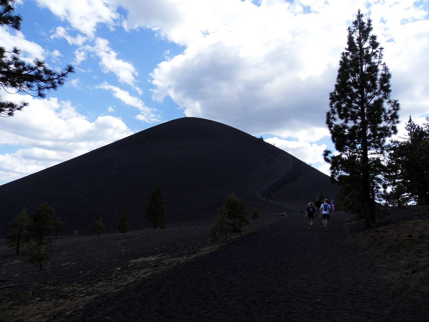
Beyond that, there's the Painted Dunes—a reddish, yet multicolored, volcanic ash formation—and the Cinder Cone itself. You can climb up to the top of the cone and into its crater if you've got the time and the stamina. We had more sightseeing to do on our way to Oregon.


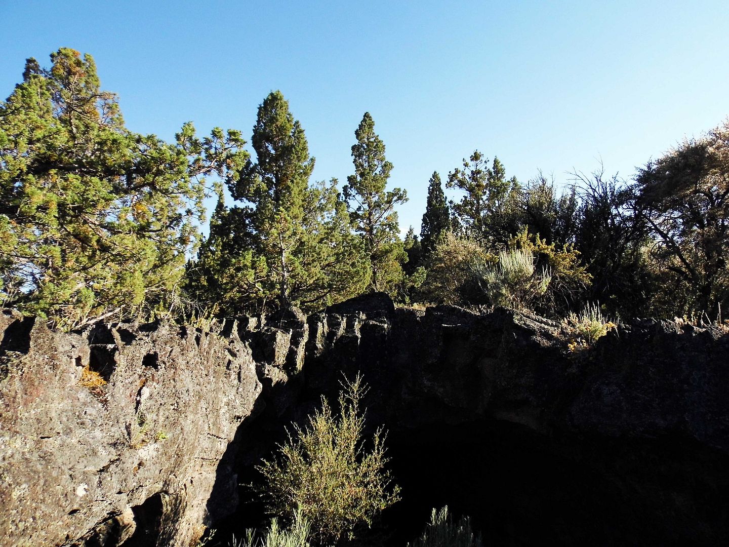
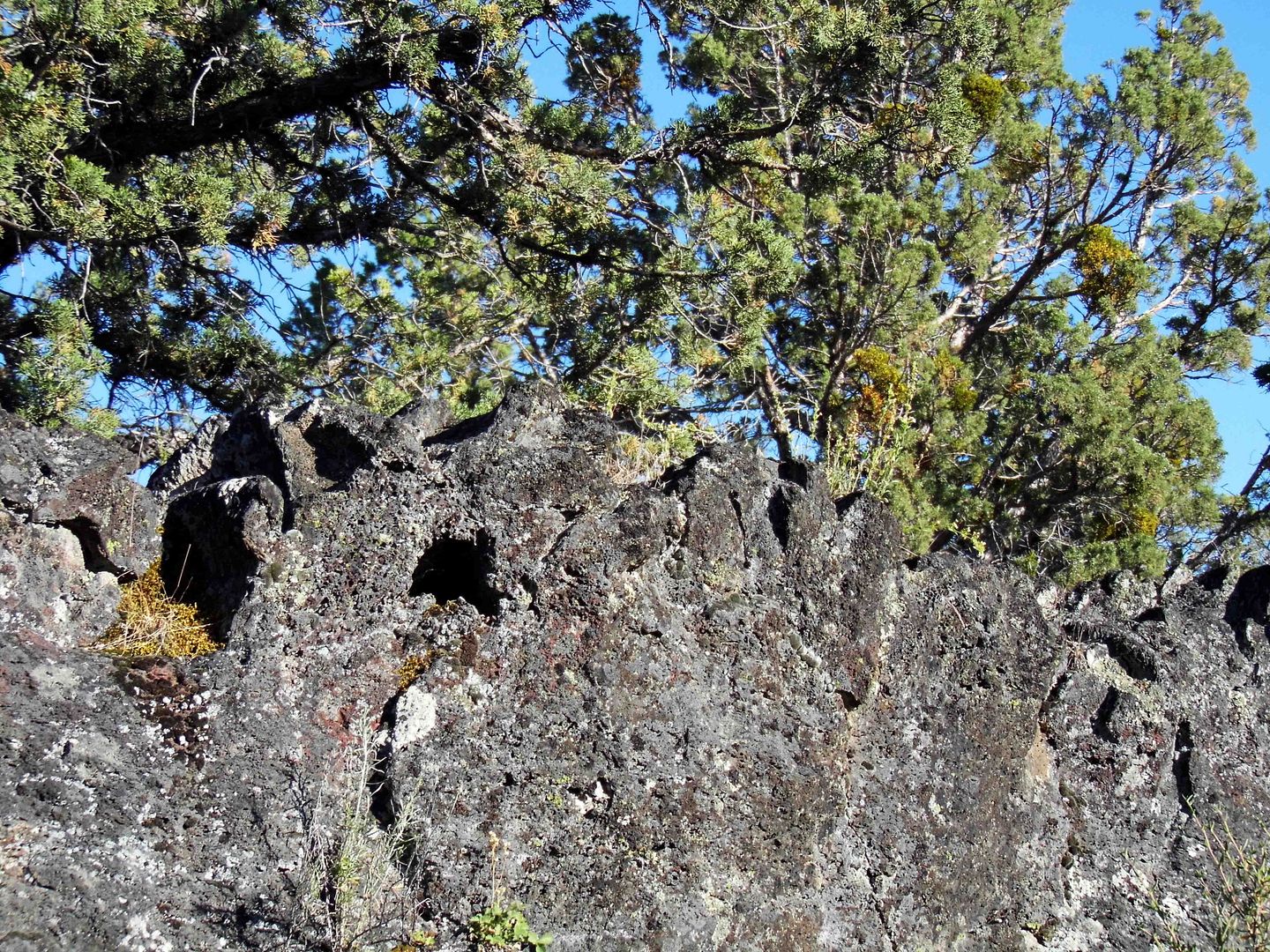
The 500-mile Volcanic Legacy Scenic Byway is a destination unto itself—with lots more to offer than what we could explore in just two days. But we made quick stops along the way, like to Lava Beds National Monument, on the north side of Medicine Lake shield volcano in the Cascades.


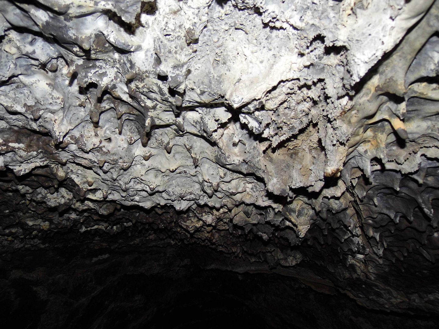
Probably formed in the late Pleistocene period, the lava tube caves have been bestoyed with relatively modern names like "Indian Well" (above), "Mushpot," and "Valentine" (below).


The vascular system of the caves were thoroughly explored by Judson Dean "J.D." Howard, now considered the "Father" of Lava Beds National Monument, established 1925.


It's a marvel that he didn't get lost inside those tributaries—and that he actually made it out of them alive—in the early 1900s before widespread artificial lighting.


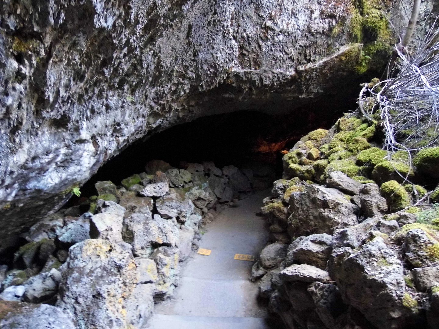
Formed by a basalt lava flow from Mammoth Crater, most of them are pitch black inside—a tourist gimmick now known as "The Twilight Zone."


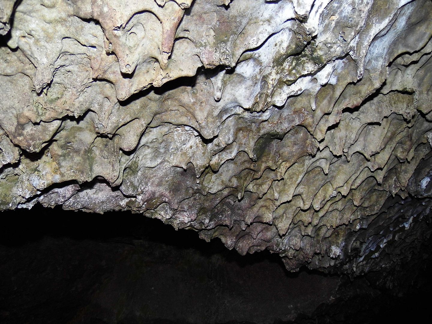
What was left behind is now a kind of cast of the emptied lava flow—and the utter darkness provides shelter for bats, spiders, packrats and other troglophiles, and millipedes and other troglobites.


Many of the caves are tall enough to stand up in. Others require booty-scoots and belly crawls, hard hats and knee pads.


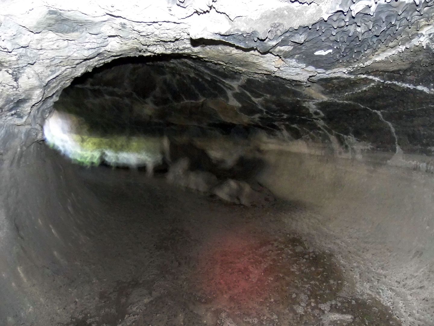
A permit (available at the visitors center) is required to enter the caves on your own—or you can take a ranger-led guided tour.


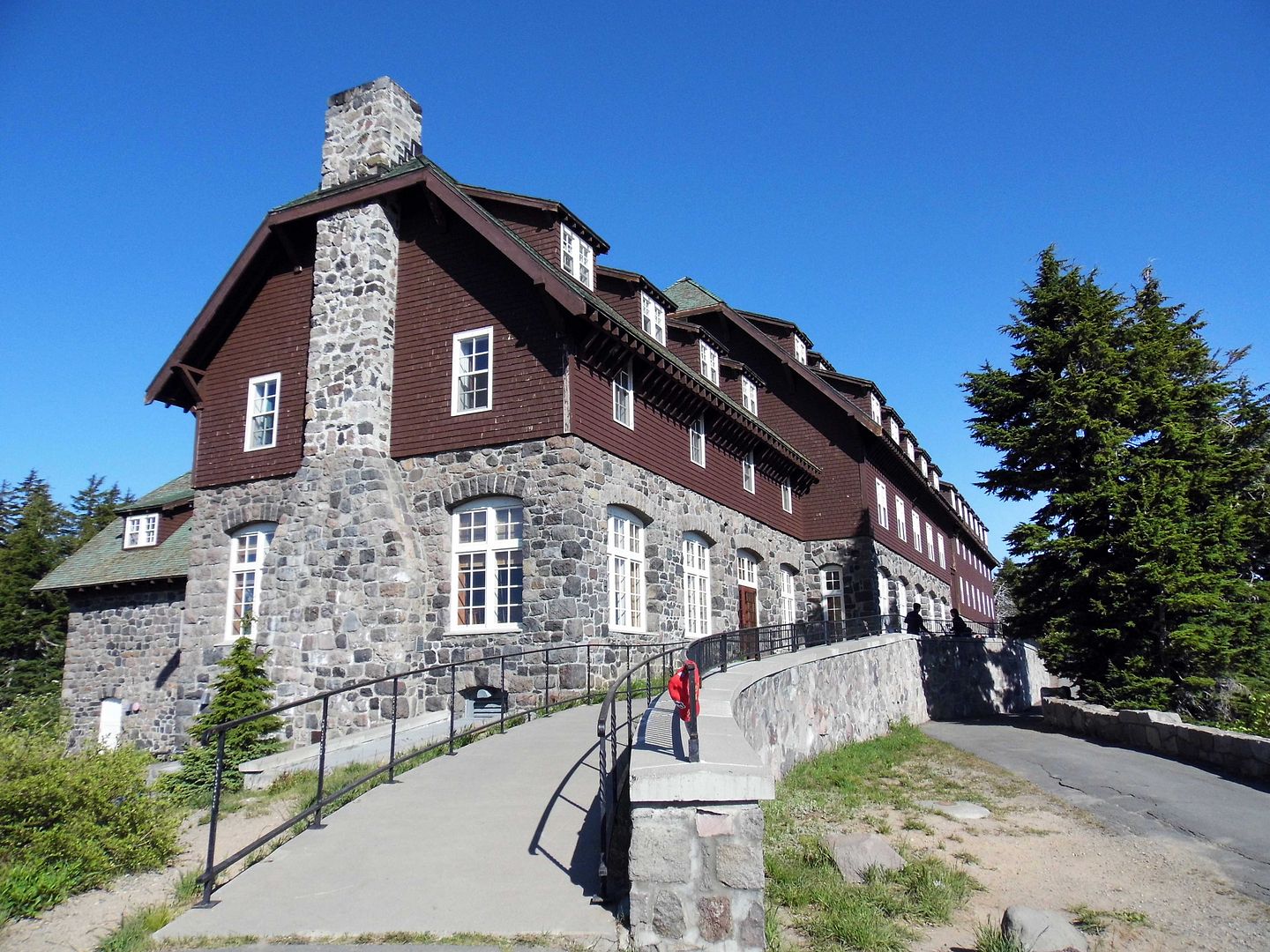
We reached the pinnacle of our journey along the Volcanic Legacy Scenic Byway—through its multiple volcanic centers with ongoing volcanic activity—after spending the night in Klamath Falls, Oregon, and heading west into Rim Village Historic District, the 32-acre tourist center of Crater Lake National Park.


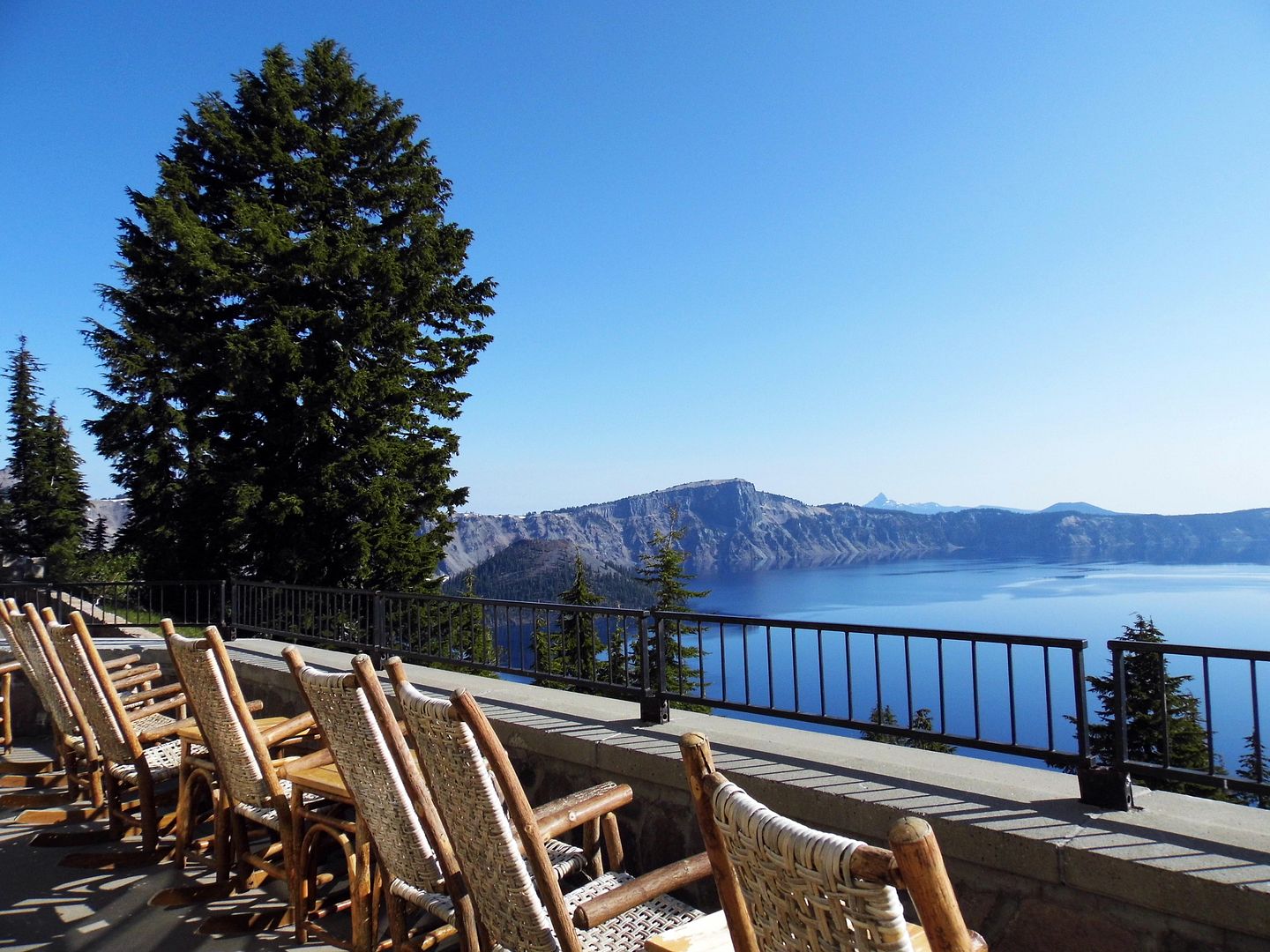
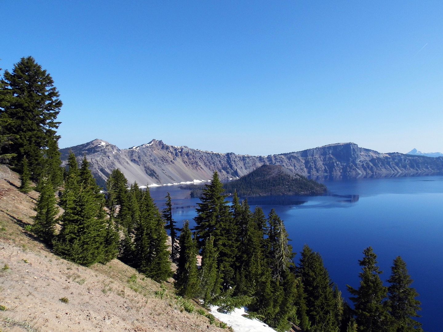
The historic and rustic Crater Lake Lodge (c. 1915) is located on the southwest rim overlooking Crater Lake, a deep basin (or caldera) that formed 7700 years ago from the eruption and subsequent collapse of the former Mount Mazama, once 12,000 feet high. It's the perfect spot to sit and marvel at the deep blue "lake," which is fed only by rainwater and snowmelt, no streams or creeks.


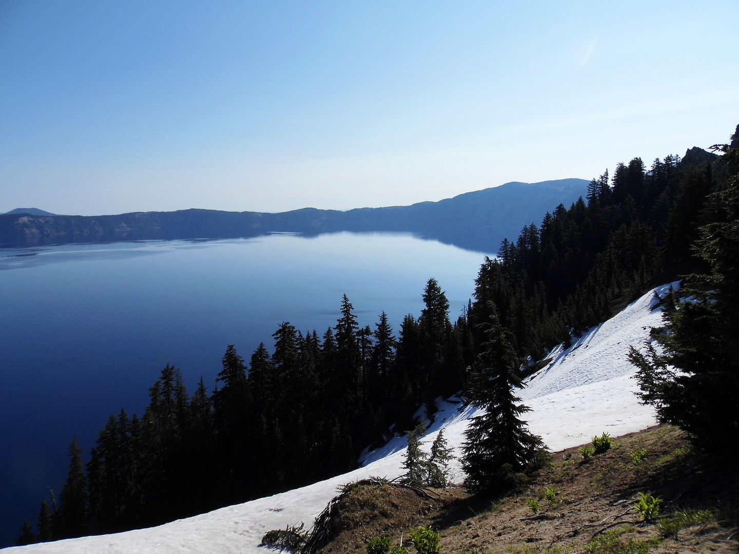
It was July, but at somewhere between 6000 and 8000 feet of elevation, there was still snow on the ground—from the 44 feet of snow that falls, on average, annually (though the record is 73 feet, which fell in the winter of 1932-3). As it's snowy eight months out of the year, I guess we shouldn't have been surprised.


The lake first formed from the water of melting snow 7000 years ago. It wasn't until the 1930s that rotary snowplows allowed visitation to Rim Village in winter (though the NPS-owned Crater Lake Lodge is currently only open mid-May to mid-October). Around the same time, the Civilian Conservation Corps built the rest of the village's rustic structures, as well as walkways and landscaping.


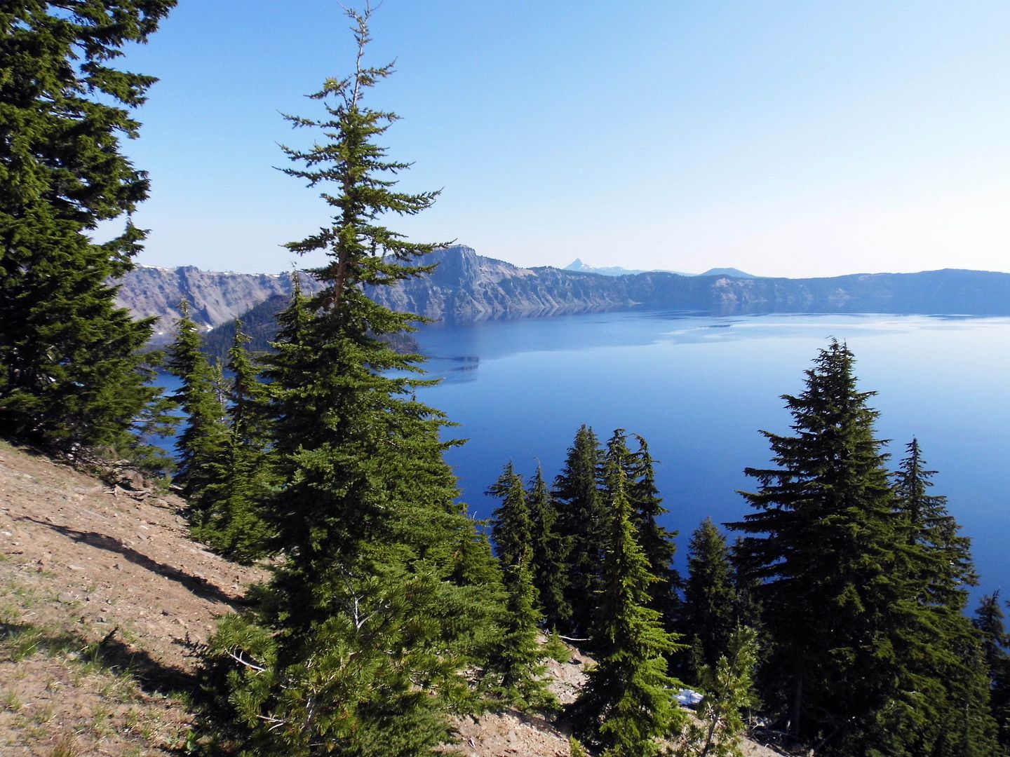
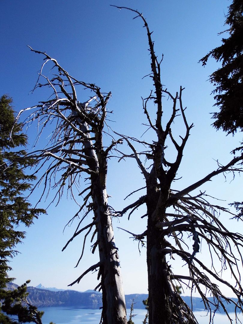
The green of the mountain hemlock trees make the lake look even bluer—though I suspect that the water isn't actually blue, but that its surface merely reflects the color of the sky.


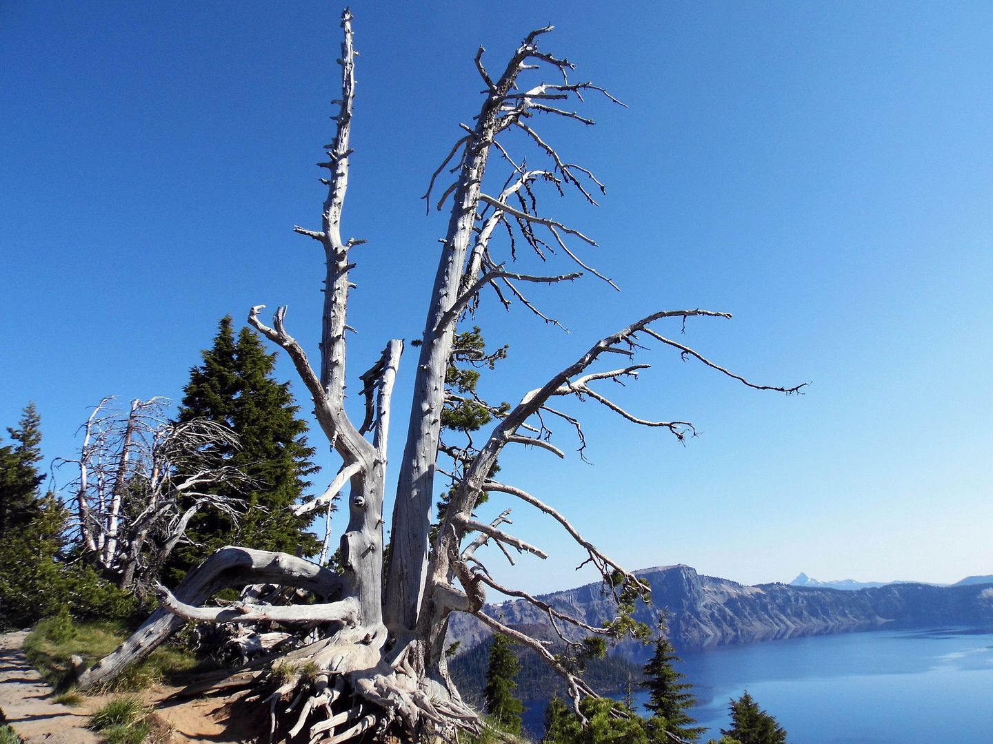
Even in the snags along the Rim Promenade, you'll find Clark's nutcrackers thriving and Steller's jays screaming their heads off.


The golden-mantled ground squirrels—whose striped bodies lead many to mistake them for chipmunks—take their sweet time coming out in the morning. But when they do, it's in droves.


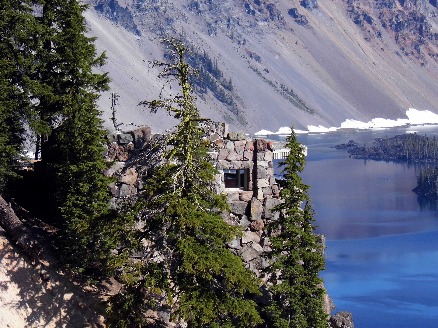
To get an even closer look at the lake, a flight of historic stairs leads to the Sinnott Overlook (c. 1931, a memorial to former Oregon congressman Nicholas J. Sinnott). Its open parapet directly faces Wizard Island, a 764-foot high cinder cone with a crater that's 300 feet wide and 90 feet deep.


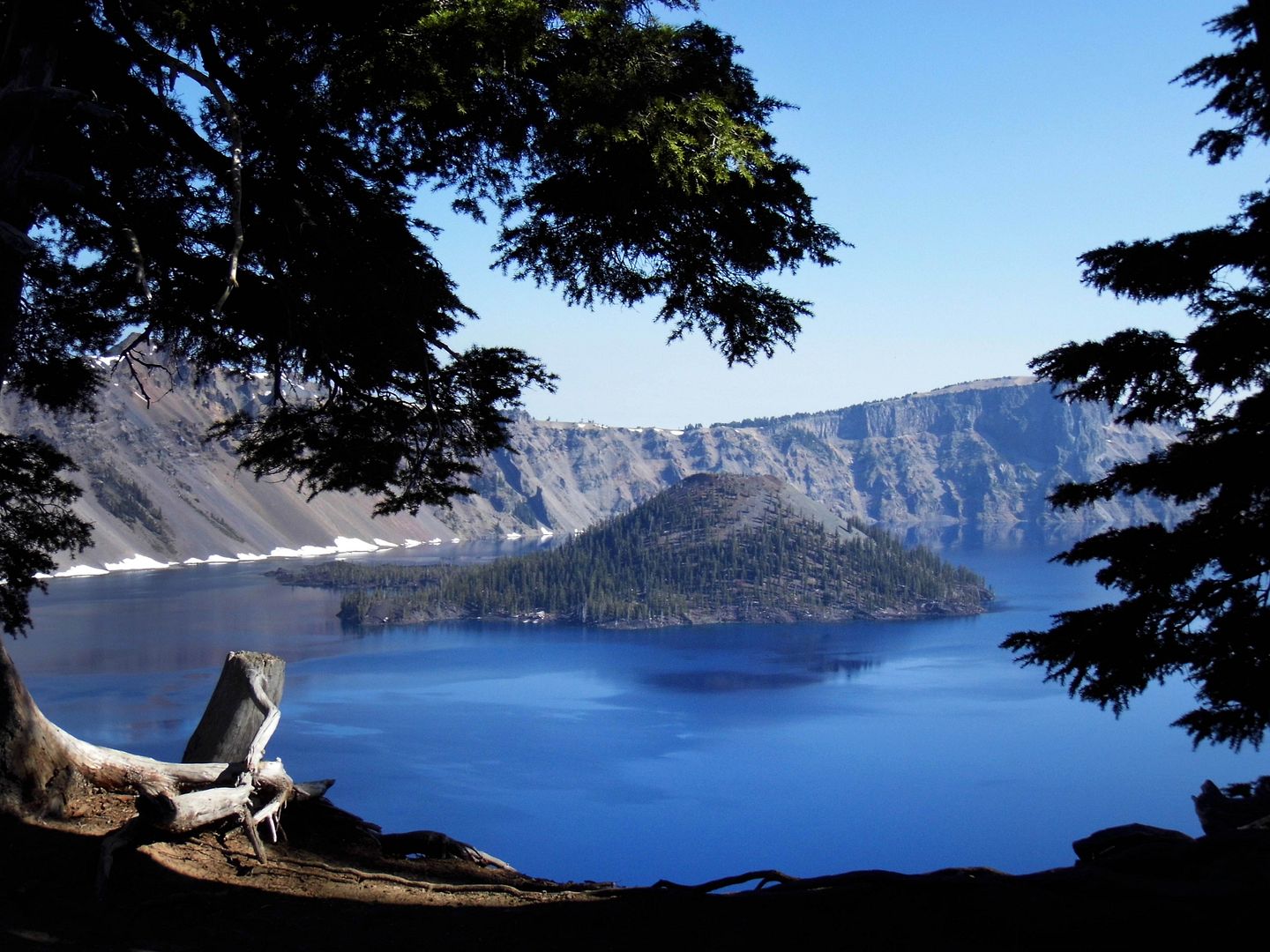
During the summer, you can actually take a boat tour of Crater Lake and even to Wizard Island. However, the lake's other cone, Merriam Cone, is underwater—whether the depth is at its maximum of 1949 feet or its surface level drops a few feet from evaporation or seepage.

Either way, Crater Lake is the deepest lake in the U.S. and the second-deepest in North America (behind Canada’s Great Slave Lake).

Something in me wants to cross its 5 miles in diameter, walk all 20 miles of its shoreline circumference (or at least drive the 33 miles of paved road around the perimeter).

I wonder what would happen if I jumped in and took a swim among the bull trout and salmon. (Fortunately, that's allowed.)

After all, another volcanic eruption could occur. The USGS considers the young volcano's threat potential to be "very high."

Only this time, it would be underwater.

Related Posts:
Alone in A Crowd, Naturally.
Photo Essay: Amboy, A Quintessential Ghost Town Along Route 66
A Last Resort
Is This the Geology and Geometry Of... The Devil?
Photo Essay: The Shrinking Southern Tip of the Salton Sea
Leave No Trace
Photo Essay: The Scenic Route, Nevada Edition

July 27, 2019

The State Capitol That Almost Never Was, And the Architect Who Went Crazy Trying to Build It

In 1866, the principal of the San Francisco firm Clark and Kenitzer, Architects—Reuben Clark—died while committed at California State Insane Asylum at Stockton, CA.


Construction photo: McCurry Foto Co. via California State Library

The state hospital had diagnosed the Maine-born architect and Sacramento transplant with insanity, due to “continued and close attention to the building of the State Capitol in Sacramento.”


While working under San Francisco-based architect M. Frederic ("M.F.") Butler, Clark’s drawings of the neoclassical monument (based on the U.S. Capitol building in Washington, D.C.) were soaked in the floods of 1861-2. On top of that, the Civil War was already well underway, causing a shortage of building materials that Clark could no longer bring from the East Coast to California.


Perhaps the proverbial nail in the coffin occurred in the wake of Abraham Lincoln's assassination in 1865, when Clark was found guilty of "disloyalty to the Union" for hiring “known secessionists” and supposedly saying that he didn’t care which side won the Civil War.


By the time Clark was exonerated for his treasonous statements, it was too late—he was already dead. And his former assistant, Gordon P. Cummings, had taken over as the supervising architect, completing the project over two non-consecutive stints (1865-1870 and 1872-1874).


Between the two of them, the end result is a somewhat incongruous mishmash of Greco-Roman influences—with Cummings shifting from Roman to Greek, Doric capitals giving way to Corinthian columns.


And while Clark had begun to use granite, Cummings switched to cheaper materials simulated to look like granite. Even the granite itself doesn't match—at least on the lower floor, where the governor's own railroad investments influenced which quarries it would be sourced from.


As the California state capitol building was under construction from 1860 to 1874—the last eight years proceeding without its original supervising architect—Clark rarely gets credit for its design.


At a cost of $2.5 million—compared to Clark's original budget of $100,000—the final result wasn't exactly what the architect lost his sanity trying to accomplish.


One posthumous victory for Clark came on October 29, 1871, when a gold-plated copper ball was affixed as he crowning ornament of the cupola at the apex of the Capitol. Nearly three feet in diameter and reminiscent of a gold nugget, he'd included the ball in his original plans—and his replacement, Cummings, tried to replace it with a bronze statue, a more traditional choice.


The ball won out—which seems appropriate, since the capitol's dome and rotunda are the crown jewels of Clark's design. Emblematic of the use of religious architecture for state capitols in the 18th century, the rotunda rises 120 feet high; and its dome features frescoing that reflects the Renaissance Revival style popular during the 19th century. But the frieze at the base of the dome is truly Californian—with depictions of grizzly bears, our state symbol and state animal.


Clark himself was a Freemason and managed to incorporate a Masonic floor pattern in the circular room below the dome, surrounding the neoclassical statuary group, Columbus’ Last Appeal to Queen Isabella (carved of Carrara marble by sculptor Larkin Goldsmith Mead and gifted by Darius Ogden Mills in 1883). The Capitol's dedication ceremony was even Masonic.


The current building has served as California's state capitol building since 1874—but it almost didn't happen at all. The state government could be found "roving" from city to city within California over the course of a good two decades. First, the State Capitol was in San Jose from 1849-51. It moved to Sacramento for five months in 1852. Otherwise, from 1852-3, it was located in Vallejo.


The Benicia Capitol Building (circa 1853-4) is the only edifice still standing outside of Sacramento. In 1958, it was rededicated as state historic park—and for the occasion, the state capital was moved there for just one day (except for that other day in the year 2000, for the 150th anniversary of California's statehood).


replica ceramic tiles originally installed in 1896 from the Mosaic Tile Company of Zanesville, OH 

Sacramento was named permanent seat of the California government in 1854—but even that wasn't permanent. The December 1861 flooding sent the state government packing for San Francisco in 1862, while the current Capitol Building was under construction. 


The current capitol was almost demolished in 1975—but instead, a pricey renovation returned it to its grandeur circa 1906, the year of the San Francisco earthquake and fires. That meant rebuilding grand staircases that had been removed; reinstalling its California poppy mosaic tile floor; and recreating the 1906 governor's offices (which had been used until 1951) and 1906 treasurer's office (which once held $8 million in gold and silver coins, before they were transferred to a bank the following year).


The Senate Chambers on the south side and the State Assembly on the north side of the building currently look as they did in the late 1800s, with color schemes that can be traced back to the British Parliament (red=House of Lords and green=House of Commons). Coffered ceilings loom over desks carved out of walnut and restored to their original splendor.


Outside of each gallery is the California state seal, fabricated out of stained glass and lit by electricity, not sunlight. Installed in 1907, they depict the Roman goddess Minerva under an arc of 31 stars (the of states in the Union upon California's annexation) and surrounded by such California state symbols as the grizzly bear, a grapevine, a (gold?) miner, and the Sierra Nevada mountain range. Of course, there's also our state motto, "Eureka" ("I have found it").


The tradition of commissioning portraits of California's governors wasn't formalized by the State Legislature until 1931, but you can still find portraits of 38 governors displayed throughout the West Wing—including Ronald Reagan and yes, Arnold Schwarzenegger.

After all, it's got to portray some recent history.

I wonder how many other people have been driven insane by their association with the California state government?

Related Posts:
Photo Essay: Glimpses of Sacramento, California
Photo Essay: The First Cathedral of the Colonies
Photo Essay: How A Metaphysical Religious Sect Brought a Glimpse of DC to LA
Photo Essay: City Hall at Sunset (Updated for 2017)

July 23, 2019

Photo Essay: Getting Back on Track at Train Mountain Railroad

When we arrived at Train Mountain Railroad in Chiloquin, Oregon—just outside of Klamath Falls, where we'd spent the night—we heard that a train had just left the station but another one was due back soon.


Union Pacific bunk cars with caboose 25228 

We were free to walk around the grounds amidst the decommissioned—and some derelict—rolling stock until a running train was ready to board.


Atchison Topeka and Santa Fe caboose 999150 (built 1930, rebuilt 1967)

Fortunately, there was plenty to look at, including the world's largest collection of cabooses (37 in total)...


...and remnants of the Weyerhaeuser logging railroads of Klamath Falls, including a big yellow snow dozier circa 1941.


But still, it took longer than we expected—and as it turned out, it was for two reasons.


circa 1939 (each compartment holds 1000 gallons of wine)

One, Train Mountain Railroad is Guinness Book of World Records-certified as the world's longest miniature hobby railway, clocking in at 36 miles. (It qualified in 2002 with 22.5 miles and in 2008 with 32.5 miles.) 


The shortest train ride you can take lasts 45 minutes. The longest runs two hours.


The second reason it took so long is that a train got derailed somewhere along the course, causing a three-train backup.


There was nothing to do but wait until it got back on track.


After all, anything can derail you in this life.


As a conductor, your load could be too heavy.


You could attempt to go faster than the speed limit (in this case, 7 mph).


Your equipment could fail. Or you could fail to operate it properly.


As a passenger, you could lean too far to one side or another...


...trying to get the perfect picture of the scenery as it passes by.


Absolutely anything could interfere with your ride—trespassers, aliens, trespassing aliens, wildlife, debris, and so on.


Everything that crosses your path can be a hazard. And everything you cross can imperil you.


Whether you're traveling under bridges...


...or over them...


...something will fail at some point.


It might be the track, the signals, or any other infrastructure...


...or it might be you.


If it's the railroad itself, Train Mountain has a huge repair shop shed where hobbyists can come and work on their engines. Volunteers are also working to slowly replace all the old, worn out track throughout the Klamath and Western line.


If your train derails at Train Mountain, the railroaders will find a way to get you back safely.

But if you get derailed and find yourself running off track somewhere else, you've got to be your own engineer.

Ring the bell, blow the whistle, flip the switch, or just get off the train.

Do whatever you've got to do to get back on track. No matter how long it takes.

Related Posts:
Photo Essay: Riding the Rails On a Model Scale in Orange County
A Travel Town Birthday in Griffith Park