Search

Showing posts with label Rivers. Show all posts

September 02, 2023

Taken By the River

The last time I kayaked the Elysian Valley section of the Los Angeles River, I celebrated a certain victory—not falling in, despite some rocky patches and rough waters.

But at the time, I noted that the river might change its mind and have other plans for me the next time. 

And that ended up ringing true, when I returned a couple of weeks ago to shoot a video for KCET's SoCal Wanderer YouTube series
    

June 03, 2023

Photo Essay: Another LA River Bridge Tries to Unify Two Sides of the Same City

In early 2020, I was working on an article for KCET's SoCal Wanderer that brought me to Rio de Los Angeles State Park—one of three California state parks along the Los Angeles River, this one located in the Los Angeles neighborhood of Cypress Park. 

It’s a project first initiated nearly 30 years ago—and, having opened in 2007, it's now become part of the Los Angeles River Revitalization plan to restore 11 miles of the LA River between Griffith Park and Downtown Los Angeles.

But three years ago, there was no easy way to get from the park, formerly part of the Taylor Yard railyard, to the other side of the river (an area known as Elysian Valley/Frogtown).


That changed last year, when the Taylor Yard car-free bridge opened up in the Glendale Narrows section of the Los Angeles River. 

May 15, 2023

Yet Another Island Gets Added to New York's Five Boroughs

NYC is full of weird experiences—from swimming in a shipping container to picnicking on a former landfill to squishing your toes in the sand of a pretend beach on the East River. 

So, having been away for a while, I was tickled to spend part of my return visit checking out one of the weirder new additions to Manhattan,

It's Little Island, a manmade park that opened at the former Piers 54 and 55 off of Hudson River Park in May 2021.

 
Pier 54 was once the Cunard-White Star pier, where the RMS Carpathia dropped off Titanic survivors in 1912 and where the British RMS Lusitania departed in 1915 before being torpedoed on its way to London. In 1918, in the final year of WWI, the German U-boat U-55 also sunk the Carpathia

April 16, 2022

Photo Essay: San Diego's Steel Bridge Was Closed to Traffic 35 Years Ago, Still Open For Exploration

In East San Diego County, where the community of Spring Valley meets Rancho San Diego just southeast of Jamacha Junction, Campo Road runs along an old stagecoach road that was the primary east-west route between San Diego and Yuma, Arizona


April 25, 2021

Photo Essay: Golfing In Miniature Along the Arroyo Seco

Los Angeles Magazine calls the Arroyo Seco miniature golf course "a living artifact that vibrates with the memories of a thousand bygone childhoods."

 
I couldn't have put it better myself. 

September 21, 2020

Photo Essay: A Preserve of Wetlands and Willows In the South Bay's 'Garden Spot' City

The Gardena Willows Wetland Preserve in the South Bay city of Gardena, California is only open on the second Sunday and fourth Saturday of the month—and after months of pandemic closure, it's now reopened by advance reservation only.
   
It's easy to miss, with the Meadowlark Manor senior housing tucked into its corner, and its entrance tucked onto the corner of the city's Johnson Park. 


Upon entering the preserve, you take the North Loop trail going clockwise, starting to your left...


...past laurel sumac and an observation deck enshrouded in overgrowth...
 

...and you quickly forget you're anywhere near the 91/110 freeway interchange (or the LA metro area for that matter). 

 
Gardena may have gotten its name for being a "garden spot" (a factoid somewhat under dispute), but most of the city looks nothing like the land that the Tongva people lived off of—and that drew Spanish and Mexican rancho owners like the the Dominguez and Rosecrans families in the 19th century. 


But what's now hidden—though visible within "The Willows"—is marshland that's part of the 110-square-mile Dominguez Watershed. It was once fed by a "river" that got concretized into a flood control canal now known as the Dominguez Channel. 


Fortunately, this last remaining bit of the Laguna Dominguez Slough (or "swamp") is teeming with life—and not just monarch butterflies. 
 
 
On a hot and steamy August morning, there was plenty of greenery to behold—plus not-yet-dormant buckwheat and still-thriving wildflowers. 

 
It's amazing that a region that struggles with drought would spend so much time cutting off its water sources. 


The Willows nearly got filled in during the mid-1970s, when the City of Gardena floated such ideas as building a convention center there. 

 
Today, its 9.4 acres of wetland includes a riparian forest of water-loving trees (including multiple species of willows), shrubs, and other vegetation that form tree tunnels and a shady canopy for local critters and visitors alike. 

 
And besides the flower blossoms, oak acorns, willow seeds, and unfallen leaves, there are also unexpected outcroppings of fruit...

 
...like the native and ripened lemonade berry, whose flavor lives up to its name. 


During normal times, you'd be able to learn about all these botanical wonders and more at Mother Nature's Backyard, a nature center located on part of The Willows' 4 acres of upland terrain. 
 
 
But with it closed for COVID-19, you've got to just keep going to complete the loop...

 
...crossing the Zigzag bridge (which hopefully keeps evil spirits away like it's supposed to)...

 
...and finishing up the South Loop Trail at the Stream Bridge. 


On my way into the Willows preserve, I was rushing too much to notice the wall of hybrid grapevines, known as "Roger’s Red" grape (Vitis californica "Roger's Red"), along the entrance path. But fortunately, my exit was much more leisurely—so I got a good look at the wild purple grapes and the green leaves that hadn't yet turned their fall red color. I hear that the red foliage is spectacular once it turns. 

Google Satellite View

As I was leaving, I couldn't quite believe where I'd just been—though while inside the preserve, I did catch glimpses of the traffic running up and down Vermont Avenue. But watching that urban scene through the fence was like peeking into some other world that I'd managed to escape—and somehow no longer seemed real. 

We've paved over so much. It's easy to forget what's underneath—like the the underlying riverbeds channelized by concrete. 

Even our green spaces are industrialized—built environments consisting of parking lots, playground equipment, artificial turf, manmade ponds, and other facilities. 

I'll take a little corner of wild land over a planned park any day. 

Related Posts:

May 10, 2020

Resurrected, But Not Immortal

Lined up along the east side of Radford Avenue—just outside the CBS Studio Center gate—there's a series of sculptures by Studio City’s own assemblage artist Karl Johnson (1945-2015).


Installed in 2012 as part of a collaboration with the Studio City Beautification Association, they’re part of the Radford Art Walk. Although it extends for just 0.25 miles, each of the 15 sculptures is so intriguing that they command plenty of time to explore them.


I discovered it completely by accident, while poking around the LA River...


...first spotting the "Welcoming Lamp," which lit my way to the rest of it.


I then stumbled upon the retaining wall made of local rocks and, thrillingly...


...a surplus of old Mole-Richardson Co. studio lights from the CBS Studio Center's soundstages.


Beyond the somewhat overgrown California natives and other Mediterranean plantings, there are the mixed-media sculptures hiding in plain sight...


...like the "Door to Enlightenment," representing ignorance as a prison...


...or the scales in "Out of Balance"...


...which show how emotion usually outweighs reason and rationality.


Johnson fabricated all these "resurrected" art pieces out of recycled and salvaged stone, welded steel, mosaic, wood, and more reclaimed materials.


They're are open for viewing 24/7, rain or shine, free of charge.


But does anyone know about them? Or remember they're here?


Situated near where Radford Avenue ends at the Tujunga Wash (a tributary of the LA River), not many cars drive by. And only a few locals pass on foot, maybe with their dogs.


Just as the "Ticking Clock" sculpture reminds us of the relentless tug of war with time...


...and how we must face our own mortality as we literally disintegrate before our very eyes, increasingly burdened by our past...


...so too does the Radford Art Walk suffer from the passage of days, weeks, months, years.


Drawing: Studio City Beautification (via RadfordArtWalk.org)

Weeds grow and are not mown. The berm becomes unclimbable. The wooden stair slats sink or maybe submerge into the earth. And seating either goes missing or was never installed in the first place.

It's been less than 10 years since the Radford Art Walk was celebrated for beautifying Studio City. And yet its legacy feels a bit... anticlimactic.

After all, Karl Johnson's own Studio City house and front yard—the crown jewel of the artist's oeuvre—were unceremoniously dismantled upon his passing in 2015. (Unfortunately, I didn't know to go see it before it was summarily erased.)

Without him around to maintain these public works—or to advocate on their behalf—I worry what'll happen to them when they get in the way of some new urban plan (like, say, with the River).

I'm glad I found them when I did. But they make me sad.

I guess that's OK.

Related Posts:
Walking in the Footsteps of Mary Tyler Moore, Newhart, and Gilligan at CBS Radford

March 20, 2020

Photo Essay: The St. Francis Dam Flood Plain, Upon the Anniversary of the Disaster

On the night of March 13, 1928, there were 145 men—maybe as many as 185—sleeping at a work camp called Kemp, set up by the Southern California Edison Company on the slope of the dry bed of the Santa Clara River near an area known as the  "Blue Cut" Promontory. (Not to be confused with the Blue Cut of the Cajon Pass.)

During the day, they were setting up new power lines; at night, they slept in tents.

But that one night, the enormous flood was coming from the St. Francis Dam break, raging on its way toward the Pacific Ocean. And by the time anybody knew enough about the danger to warn them, it was too late.

Most of them died, and nearly all of them were stripped of their clothing from the force of the debris flow.

The few survivors there were came to Rancho Camulos for help (and dry clothing).


Ranch owner August Rubel—a New York-born son of Swiss immigrants—and his wife Mary were awakened by a ranch foreman, who alerted them to a lot of water running through the normally dry river. The truth is that along its path, the water flooded over the river banks and—although no one lost their life at the ranch itself—created extensive damage to their agricultural operations (which included citrus orchards and cattle ranching).


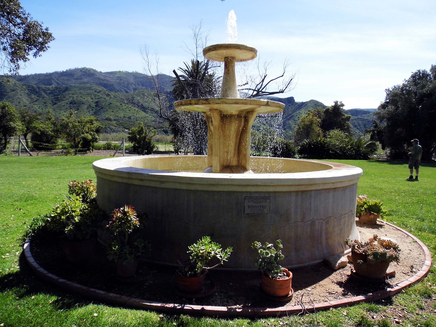
The flood waters washed up past the old fountain that had been built in 1852 by Ygnacio Del Valle, the son of the original recipient of this westernmost part of the 48,000-acre Rancho San Francisco Mexican land grant in 1839—Antonio Del Valle. Both members of an important Californio family during the Mexican period and early California statehood, Ygnacio had inherited it from his father in 1841.


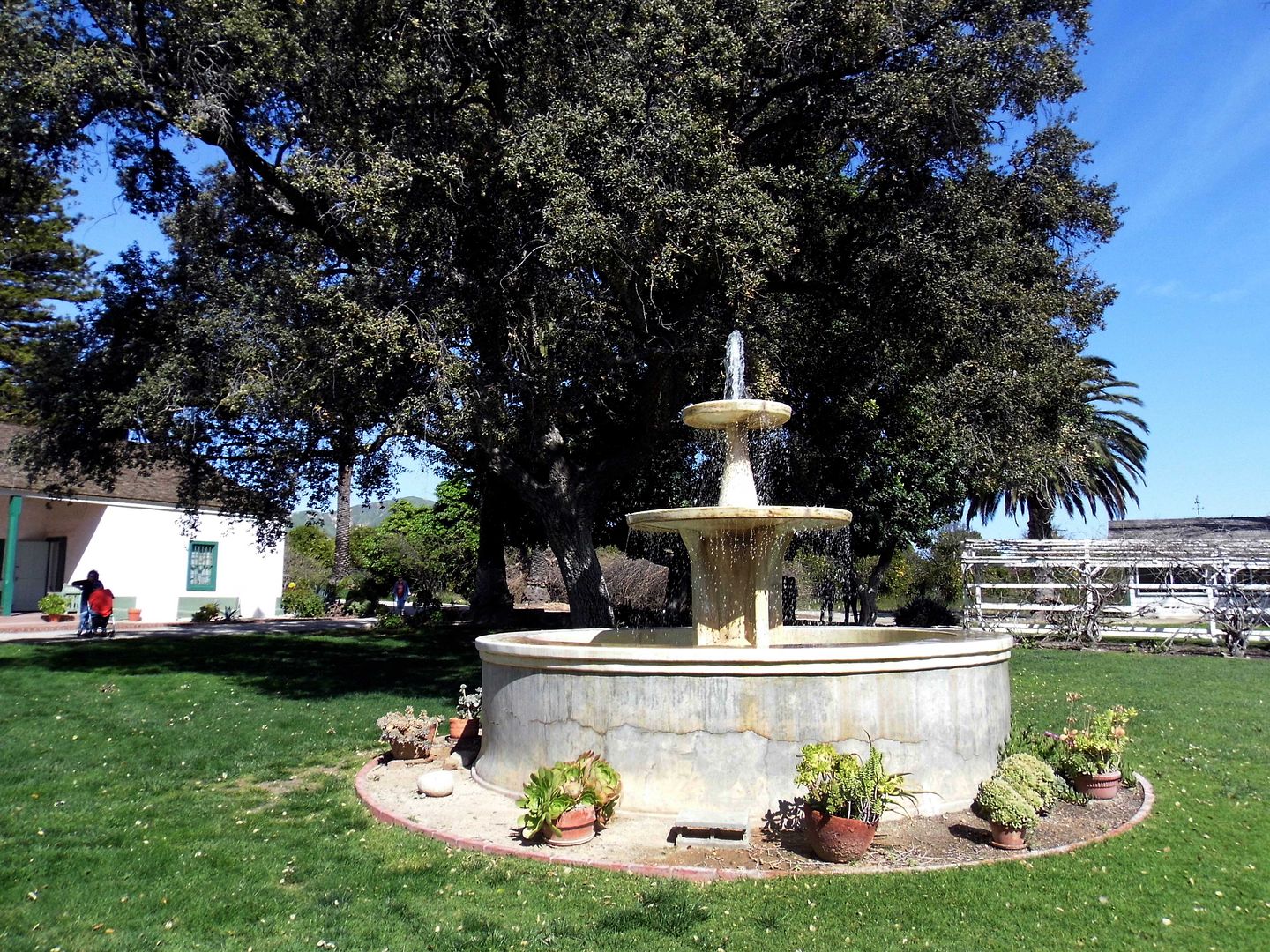
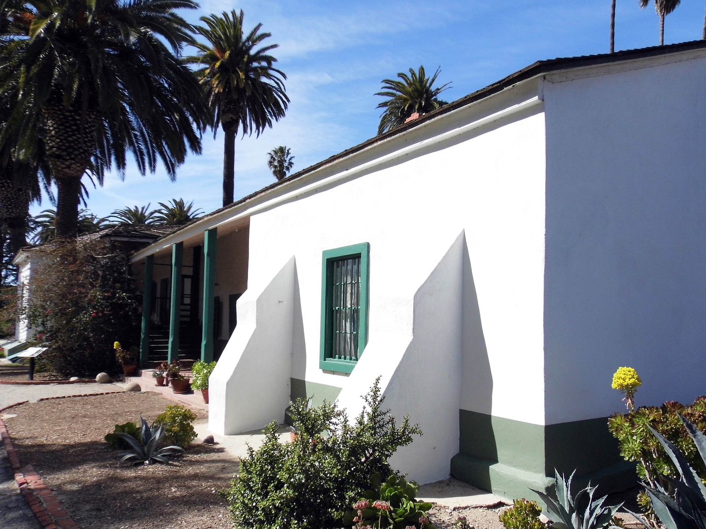
In fact, the water came nearly right up to the ranch house, sparing the dwellings by just inches. And while the fountain took a pretty big hit, the Rubels—who'd purchased the property in 1924—rebuilt it in 1934. (It was later restored in 2009.)


By then, Rancho Camulos had already been a historic property for decades—especially since novelist Helen Hunt Jackson, who visited the last of the "real" Spanish ranchos in 1882, based part of her wildly successful book Ramona there. D.W. Griffith also shot part of his 1910 movie version starring Mary Pickford at the ranch.


In the wake of the St. Francis Dam disaster, there was a lot of misinformation and no easy way of correcting it. The living were scrambling to identify the dead and locate the missing. And in that chaos, the false rumor spread that Rancho Camulos had been destroyed by the flood waters.


In fact, that wasn't true at all—but fans of Ramona far and wide were up in arms and besides themselves. Rubel had to make an announcement assuring the public that "The Home of Ramona" still stood.


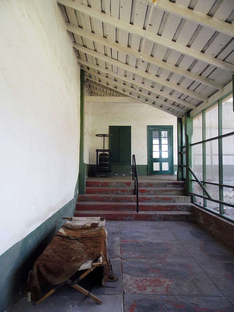
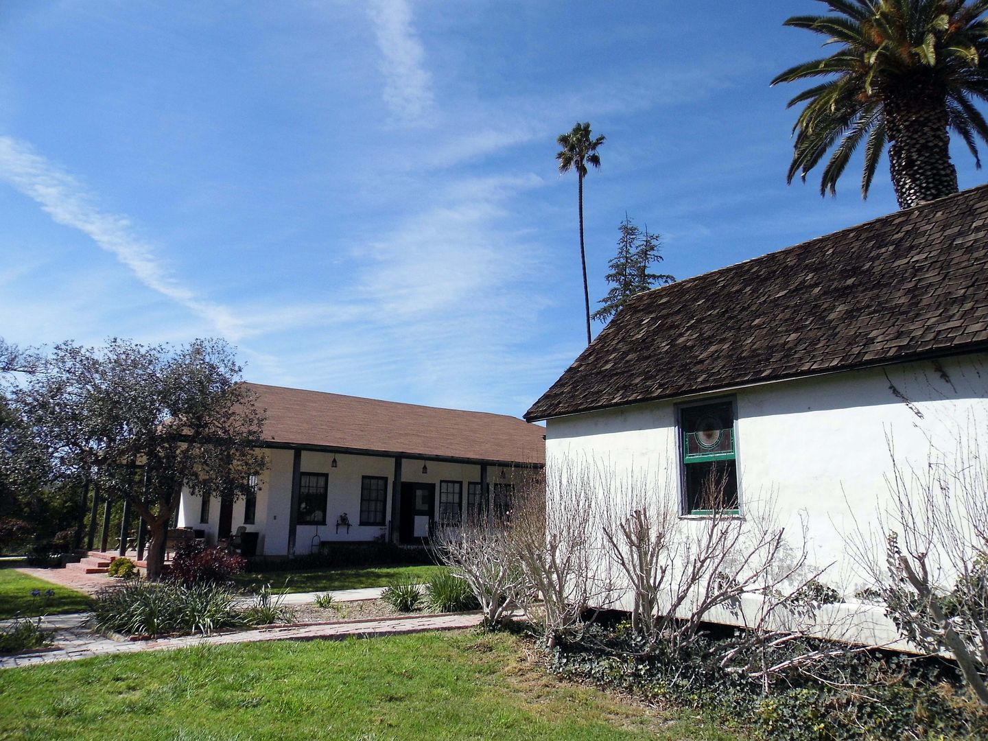
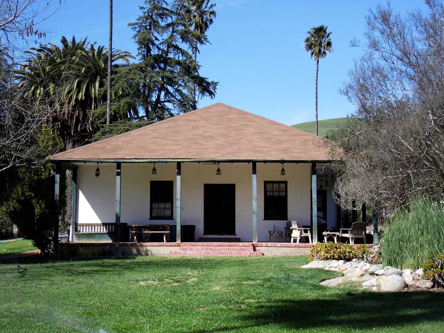
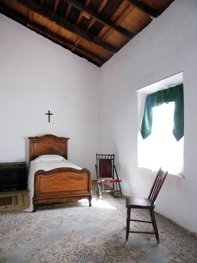
And, in fact, it still stands today—after a massive preservation effort to save it in the aftermath of the 1994 Northridge earthquake.


In 1853, Ygnacio Del Valle had built a small 4-room adobe for his majordomo and, 8 years later, expanded it to accommodate his wife Ysabel and kids moving from their townhouse at the Los Angeles Pueblo.


By 1880, what began as an adobe with 2-foot-thick walls—constructed by Mexican laborers and members of the Fernandeño Tataviam Band of Mission Indians—grew to a 20-room, hacienda-style estate that sprawled across more than 10,000 square feet. And that example of Spanish-Mexican vernacular architecture is what, in part, inspired the tale of Ramona, first published in 1884.


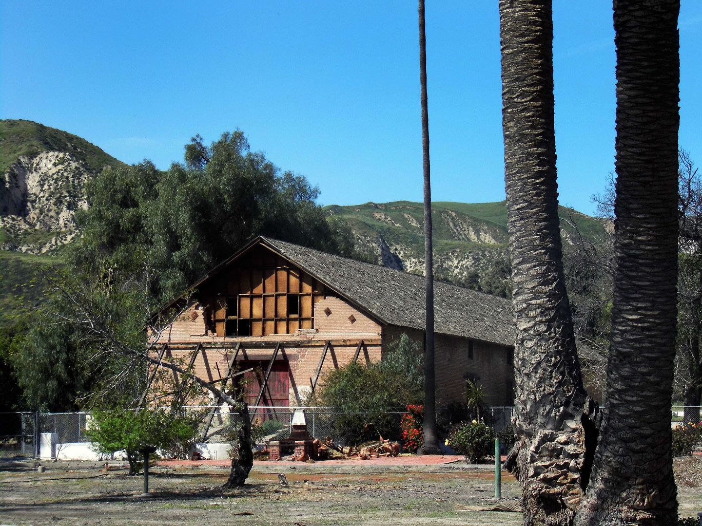
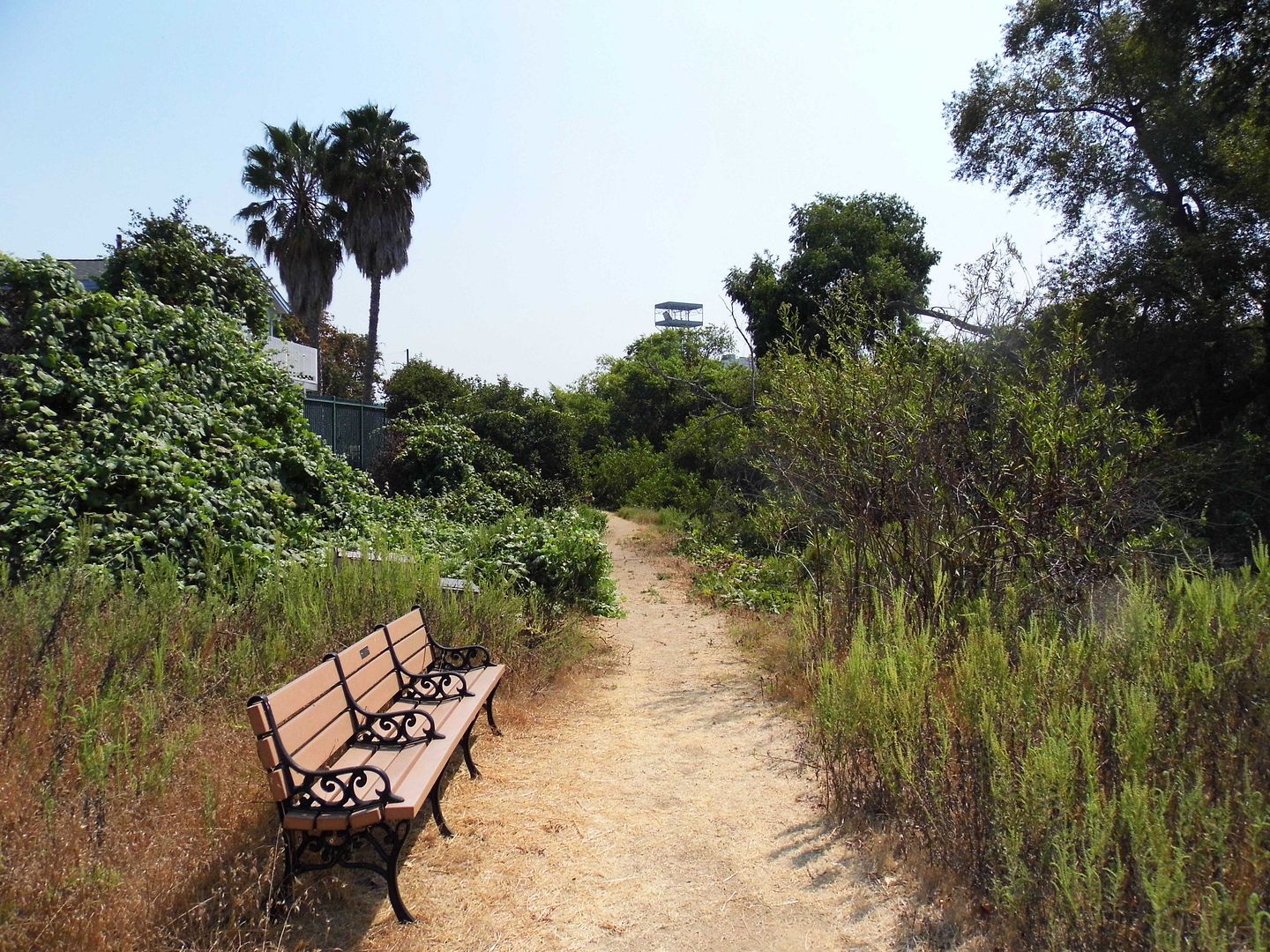
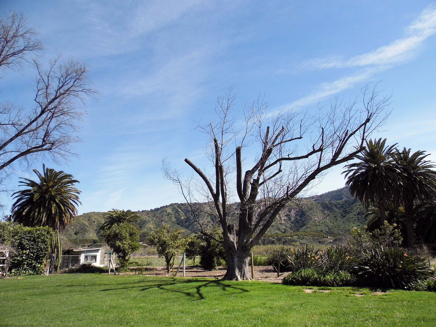
Today's "Ramona seekers" can admire the old, crumbling brick winery (circa 1867) from afar...


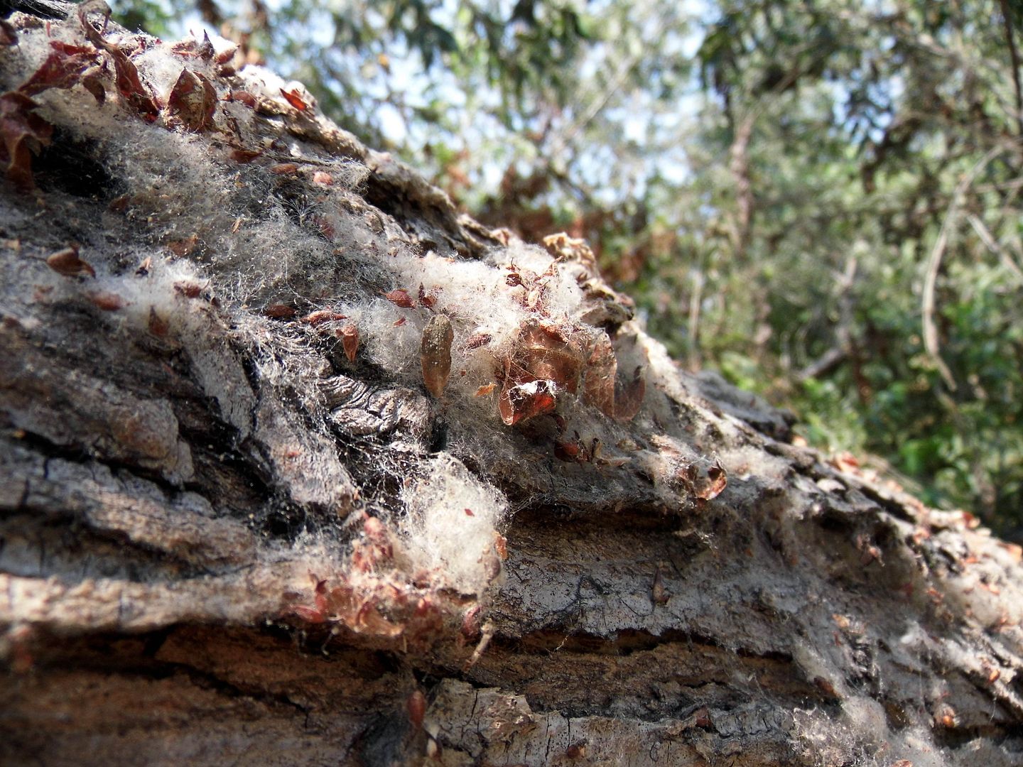
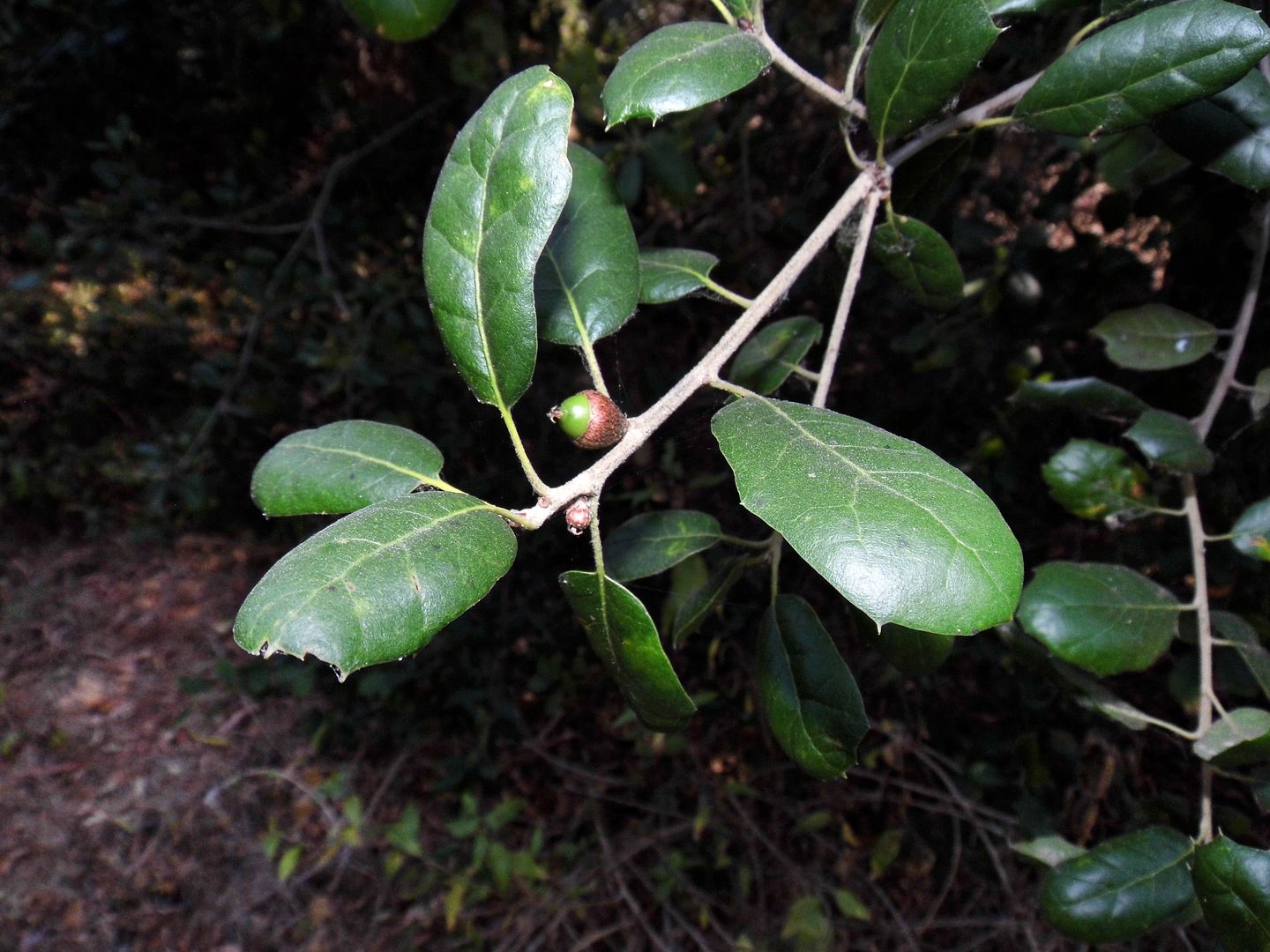
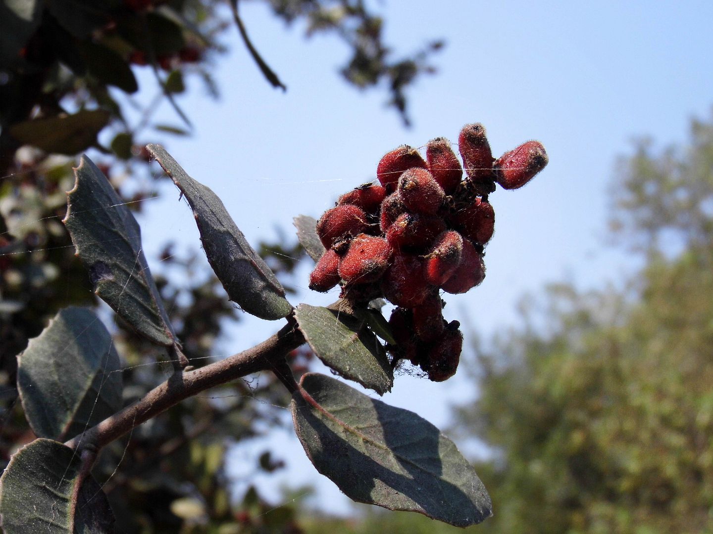
...and inhale the sweet and floral perfume of the orange blossoms, which are in full bloom this time of year.


About three miles away from the Santa Clara River (still dry) and across what's now Highway 126 is the town of 
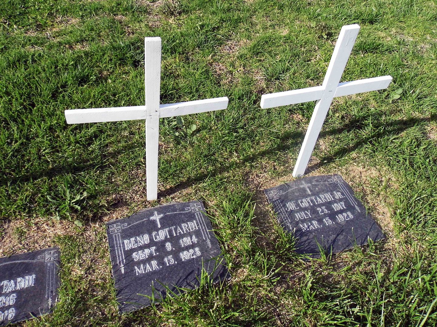
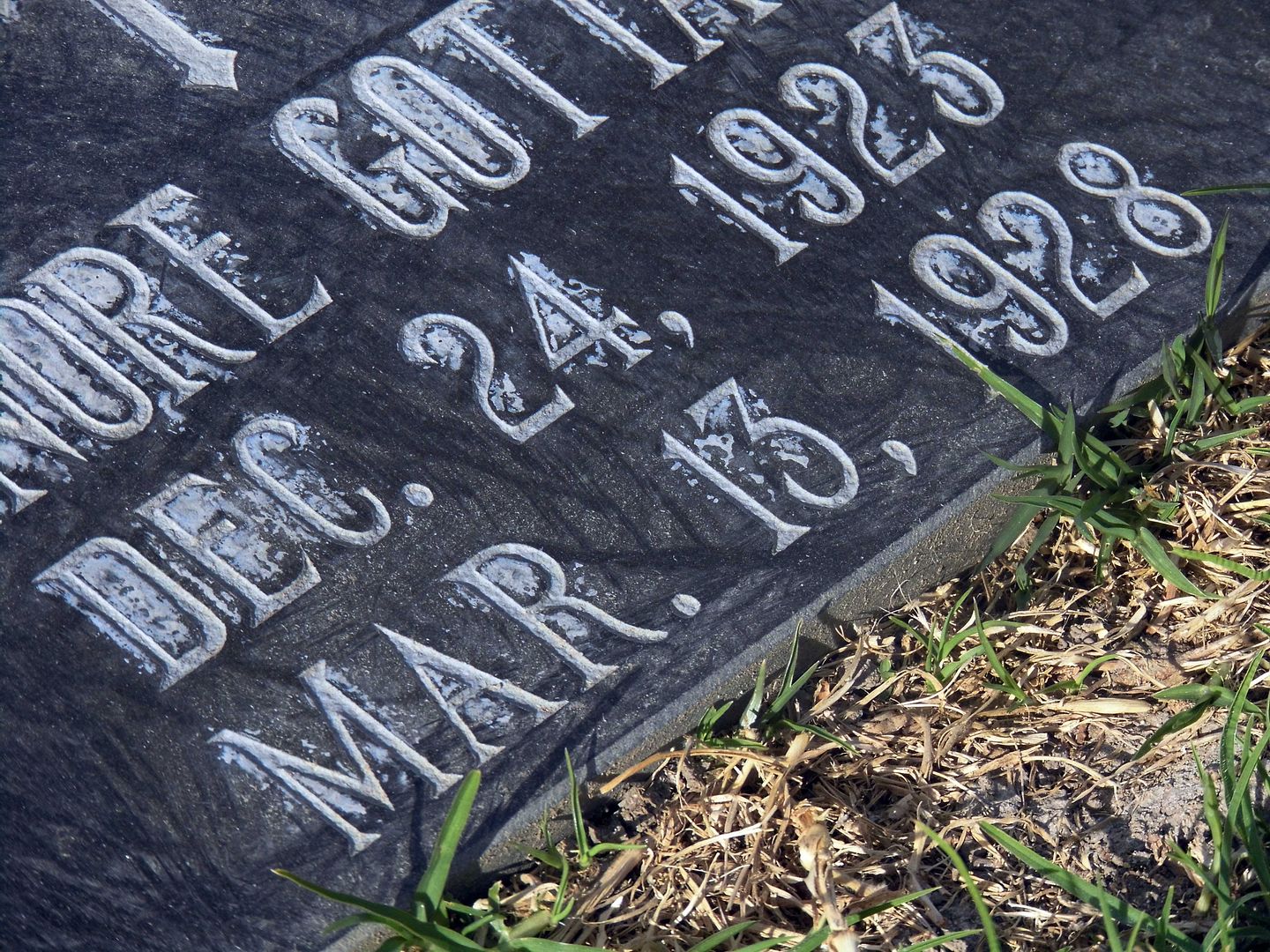
Piru, whose cemetery contains the tragic remains of many of the victims from this part of the flood plain.


There's the wife and 5 children of Italian immigrant Joe Gottardi, who leased a property just west of the Edison camp from Newhall Land and was in his home as it got carried away by the flood. Only he and one daughter, Vena, survived.


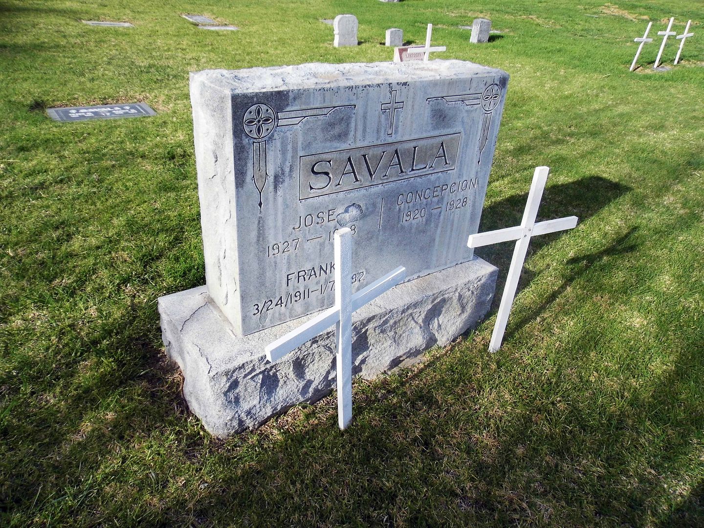
Esteban "Steve" Savala was also living with his family on Newhall Ranch land the night of the flood...


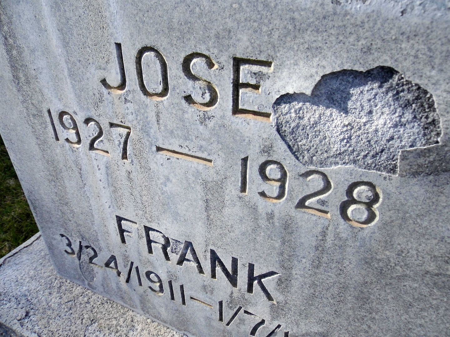
...and lost his wife Carlotta (Lopez) and children Juanita, Lucy, Rosa, Concepcion, Juanita, and Jose that night.


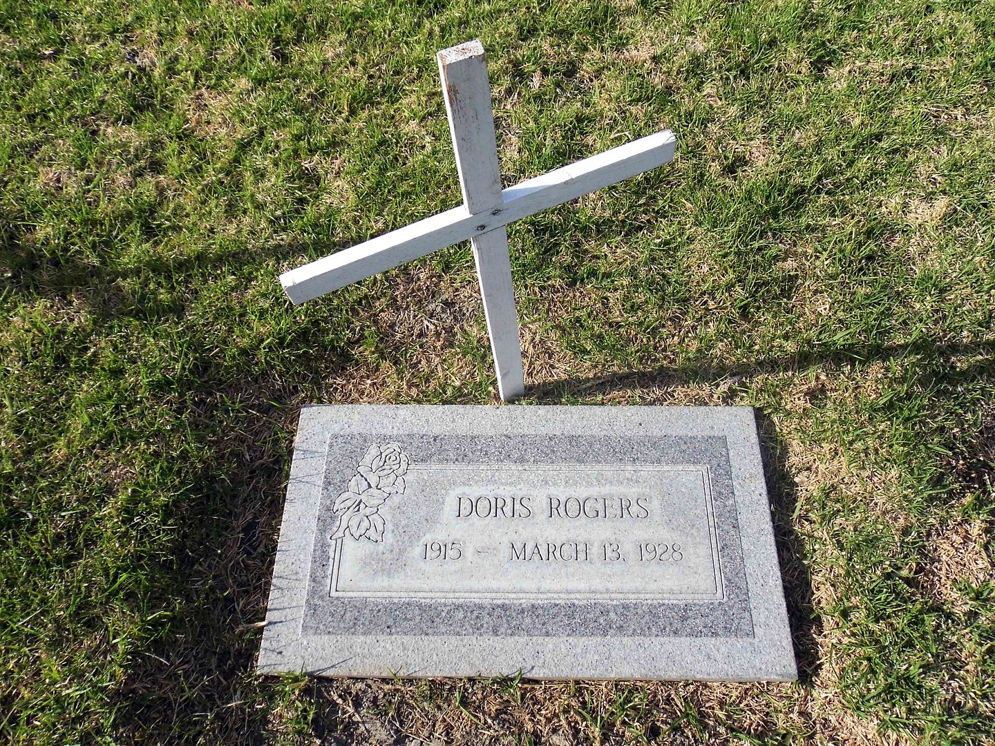
Chester R. Rogers and Velna E. Topley survived, but lost their four children to the flood—Doris, Chester, Margaret, and Richard—and Velna's mother, Rozetta.


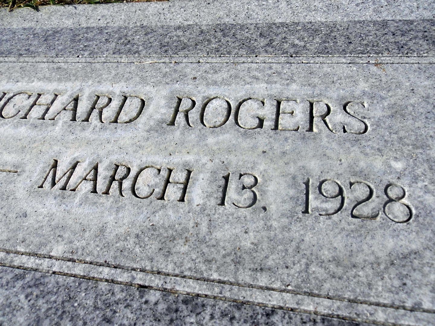
A monument to the victims of the St. Francis Dam Disaster was dedicated at Piru Cemetery upon its 90th anniversary in 2018. To find the gravestones of the victims, look for those marked with the exact date of March 13, 1928.

Even more victims are buried at Pierce Brothers Santa Paula Cemetery, Pioneer Cemetery in Sylmar [Ed 3/24/20: An expert tells me this has been disproven], Oakwood Cemetery in Chatsworth, and the Ruiz family cemetery (on private land).

People tend to go in March every year around the anniversary date, and the Santa Clarita Valley Historical Society usually hosts a lecture and bus tour or two this time of year. But this time of year this year, we're experiencing our own disaster-in-the-making.

So, let's remember the St. Francis Dam Disaster and honor its victims beyond just the month of March—even if we have to do so from afar.

Related Posts:
Photo Essay: The Path of Destruction of the St. Francis Dam Flood, 86 Years Later
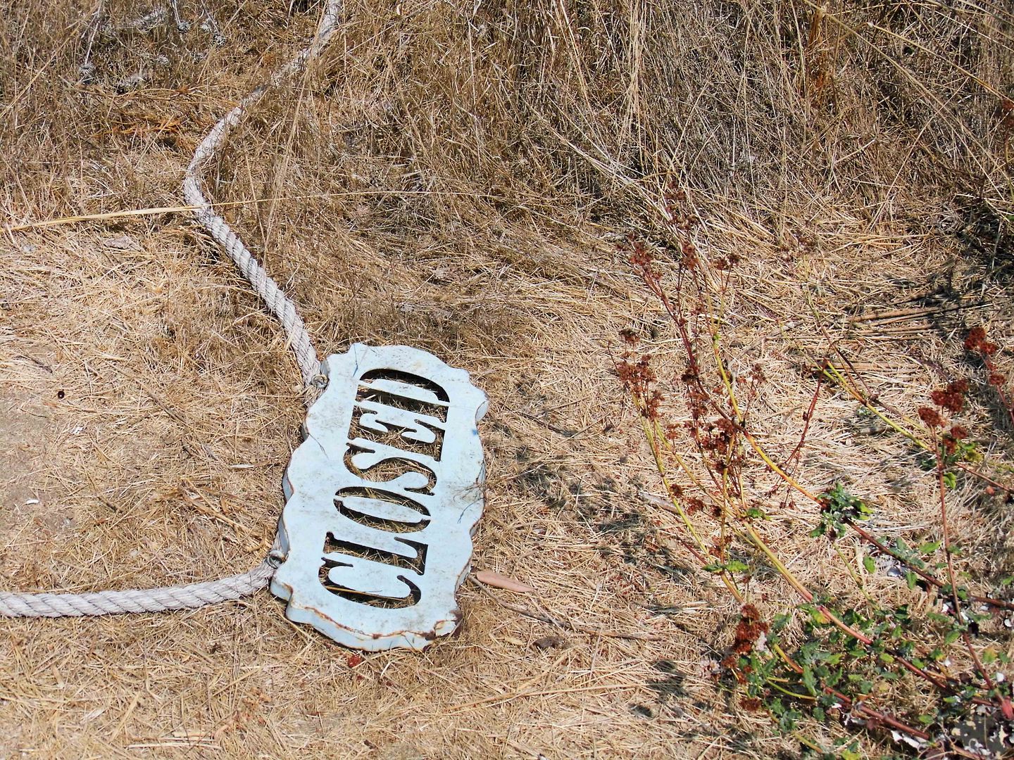
Photo Essay: A Pilgrimage to the St. Francis Dam Victims' Final Resting Place (Closed to Public)