Search

Showing posts sorted by relevance for query channelized. Sort by date Show all posts

March 15, 2020

Photo Essay: Taylor Yard's Prime Riverfront Property Becomes Parkland, One Parcel at a Time

A native of Ohio, J. Hartley Taylor arrived with his family to Los Angeles in the 1880s and set up shop along the east bank of the Los Angeles River.

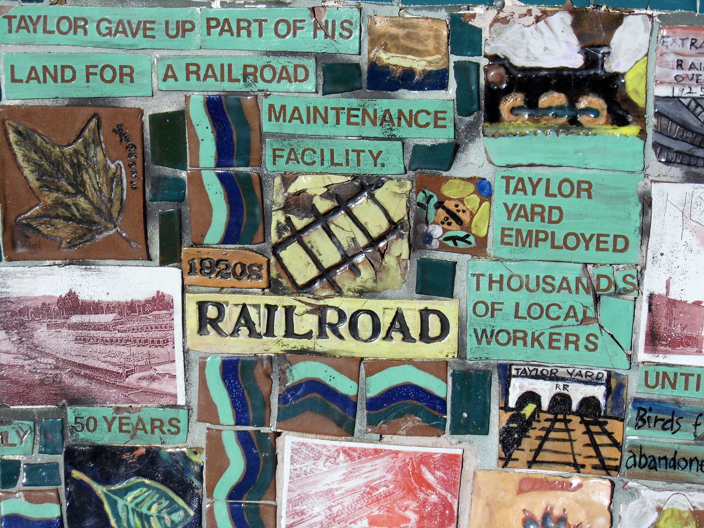
He eventually expanded his hog farm and little grocery into a full-on feed mill and grain storage facility—right where Southern Pacific (later Union Pacific Railroad) had laid down some spur tracks.

Despite becoming the largest commercial feed supplier on the West Coast at the time, Taylor Milling Corporation's site got taken over by the rail company in 1911—to be used for a railyard, freight-switching facility, storage space and maintenance and repair facility.

Southern Pacific named their new hub Taylor Yard in honor of the grain merchant and continued to build it out into the mid-1920s.

Although about 5,000 employees worked at Taylor Yard at its peak in the 1950s, industrial use of the site declined starting in the 1960s. It really took a hit from the 1973 opening of the computerized and automated West Colton switchyard outside the city of San Bernardino.

Switching operations ceased in 1985, and the remaining storage and maintenance activities ceased in 2006.


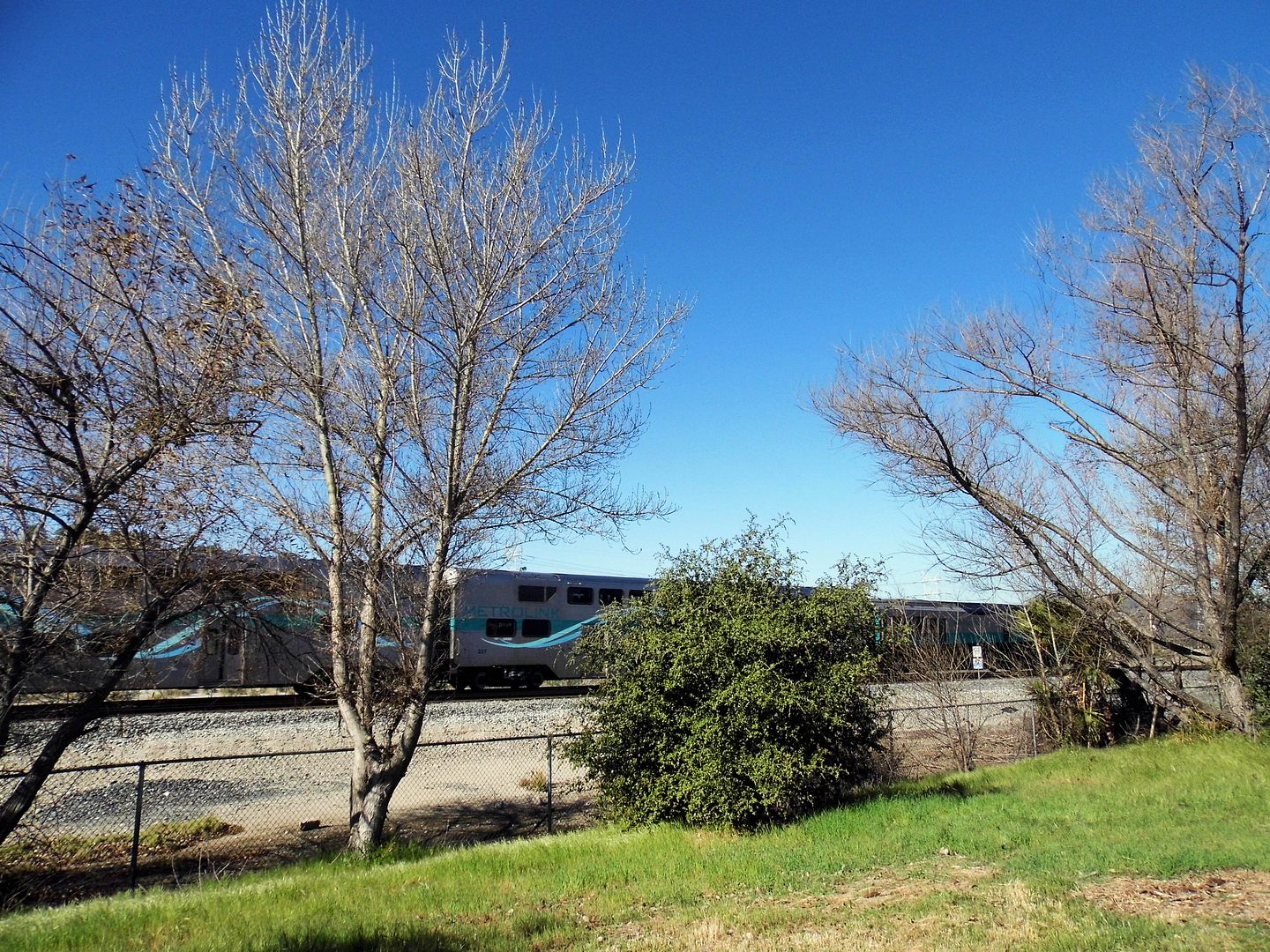
Today, alongside those same train tracks is the first parcel of the former 247-acre Taylor Yard (which once had over 2 miles of river frontage) to be subdivided into parkland—Rio de Los Angeles State Park.


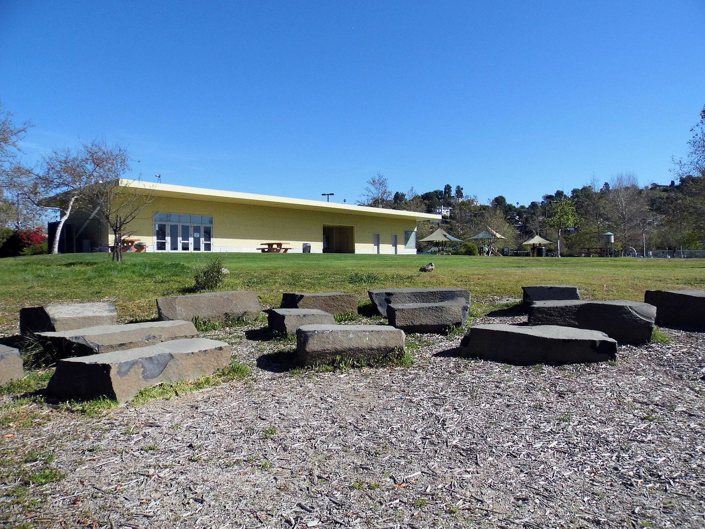
Established in 2007 and sandwiched between three densely populated communities adjacent to the river—Elysian Valley, Glassell Park, and Cypress Park, comprised of both industrial and residential areas—it reuses a couple of the old Taylor Yard buildings for park facilities.


A well maintained, unpaved loop winds through the park, past sports fields, playgrounds...


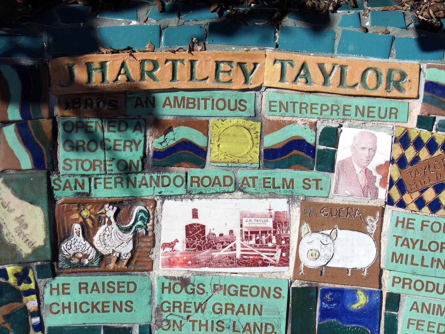
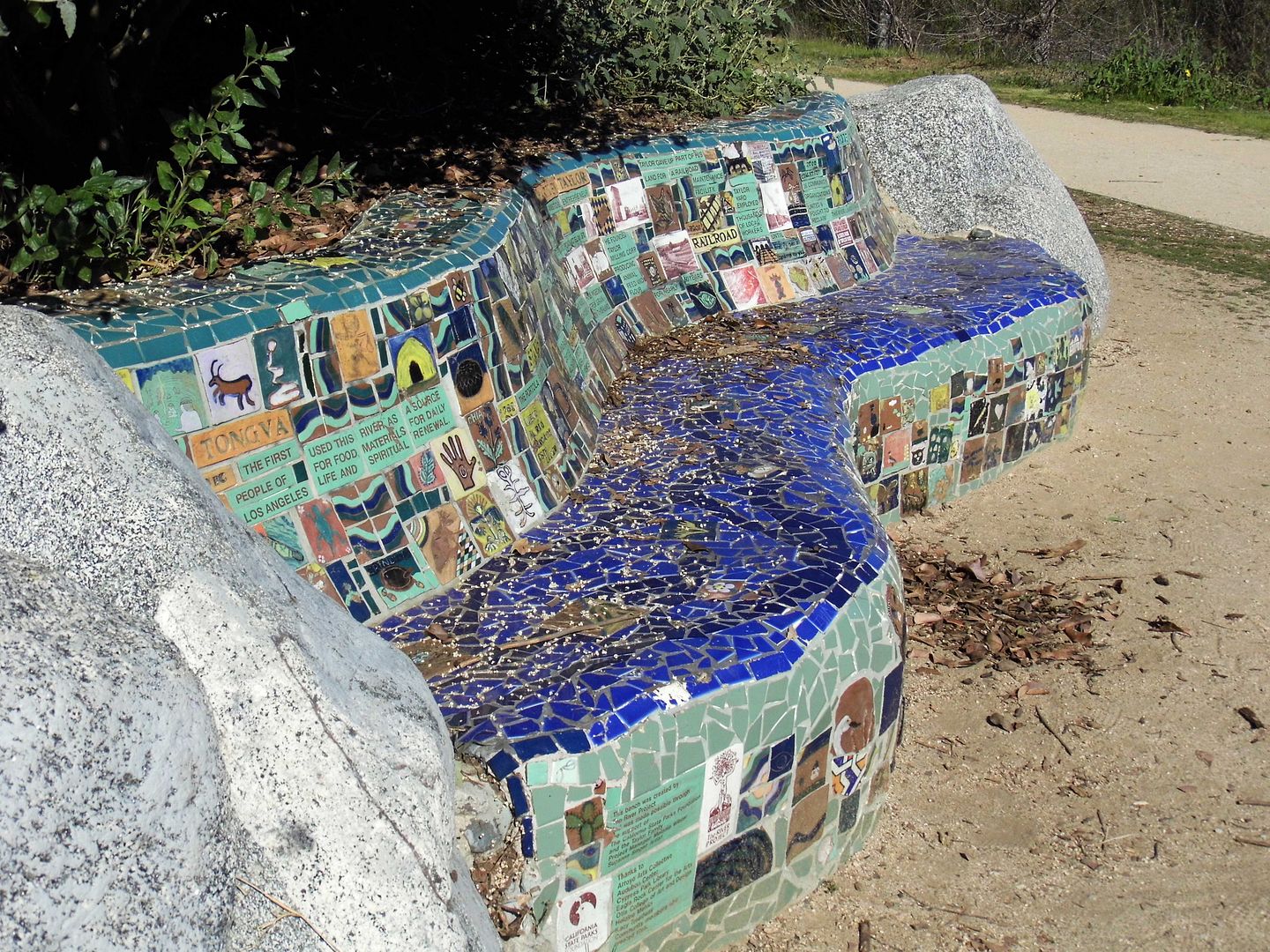
...and a community-created bench that tells the diverse history of the parkland in mosaic tile.


The hogs have been replaced by wildlife, like jackrabbits and plenty of birds...


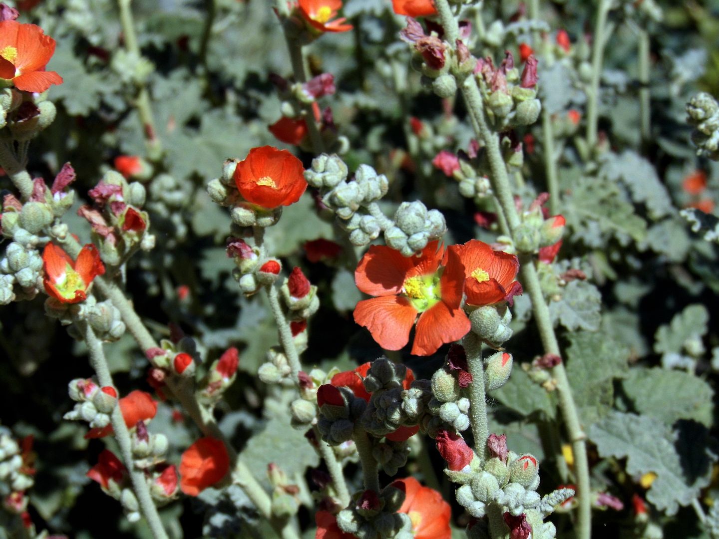
...and where grain was once stored and sold, native plants now grow.


It's become part of the Los Angeles River Revitalization plan to restore 11 miles of the L.A. River between Griffith Park and Downtown Los Angeles—a plan that also includes another (future) park, an 18-acre post-industrial lot that was also subdivided out of Taylor Yard.


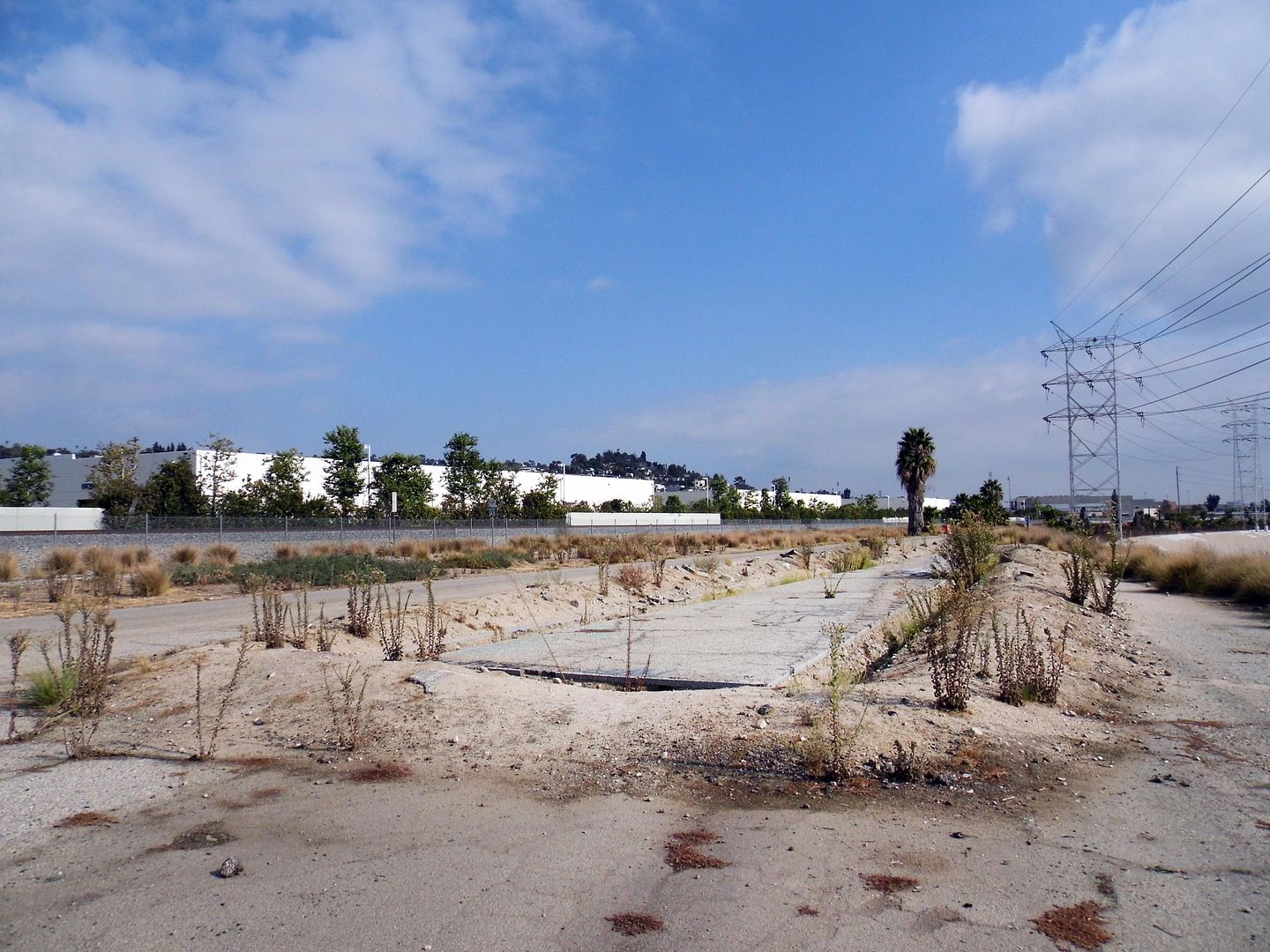
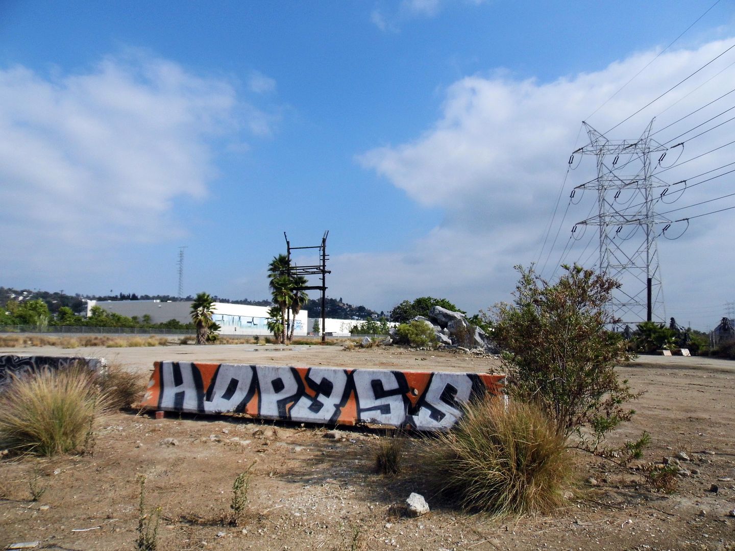
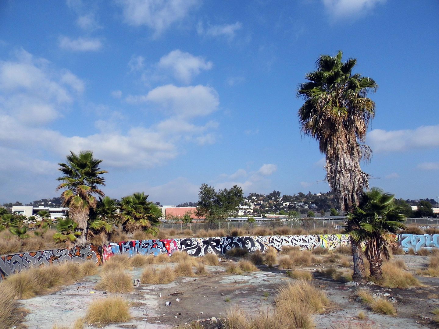
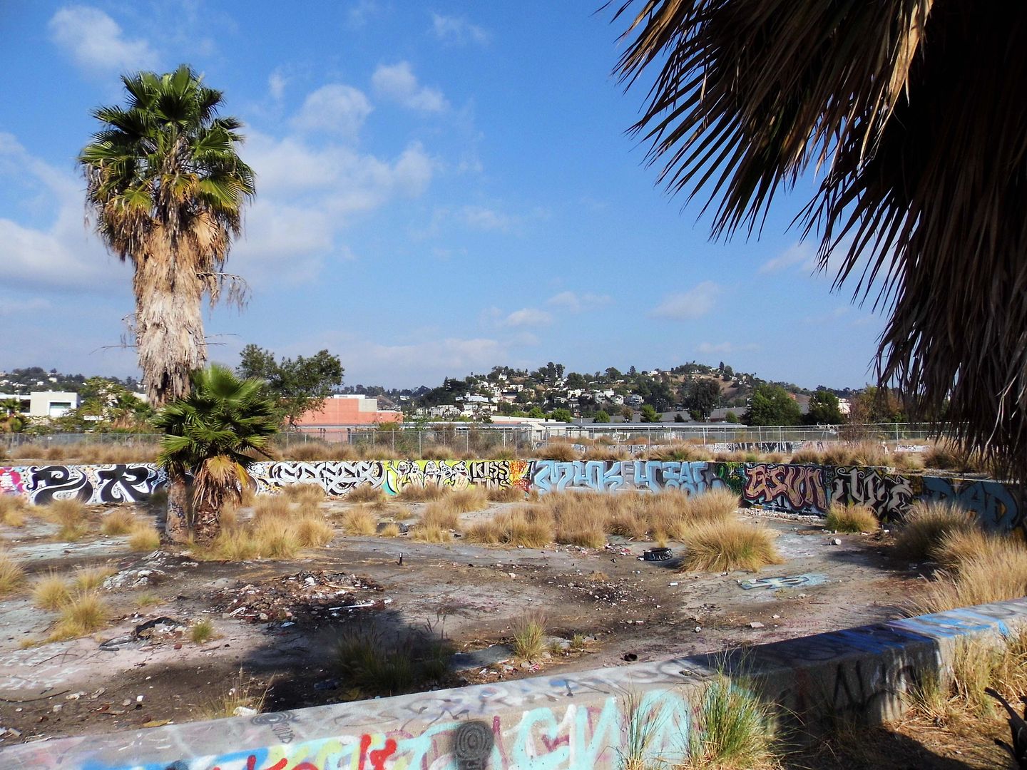
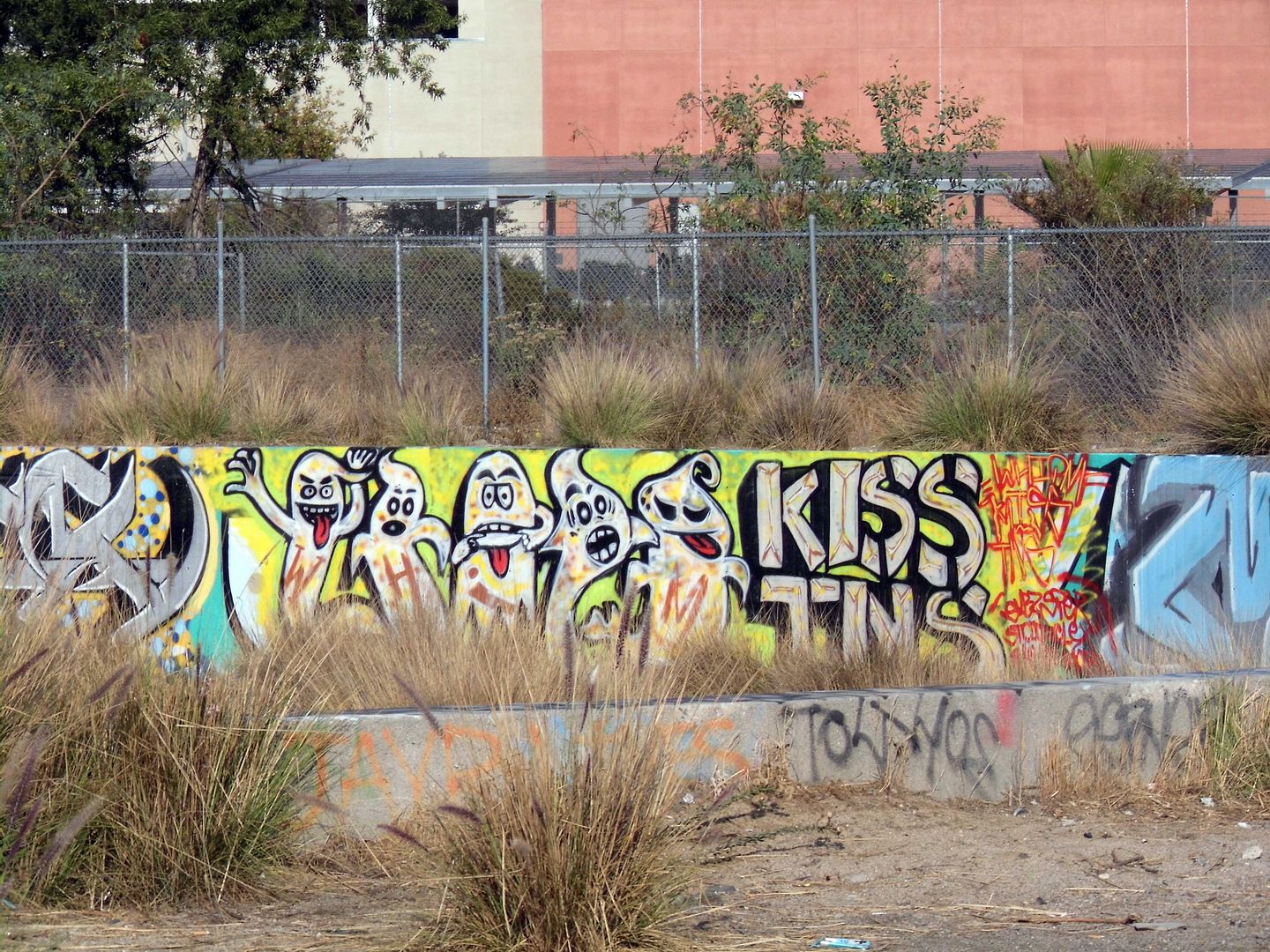
The Bowtie Project (La Parcela Pajarita) is, fitting to its name, shaped like a bowtie (that is, pinched in the middle) and is also along the east bank of the L.A. River—but unlike Rio de los Angeles, it hasn't undergone any infrastructural improvements (though although an asphalt access road leftover from the Taylor Yard days does run the 3/4-mile length of the site).


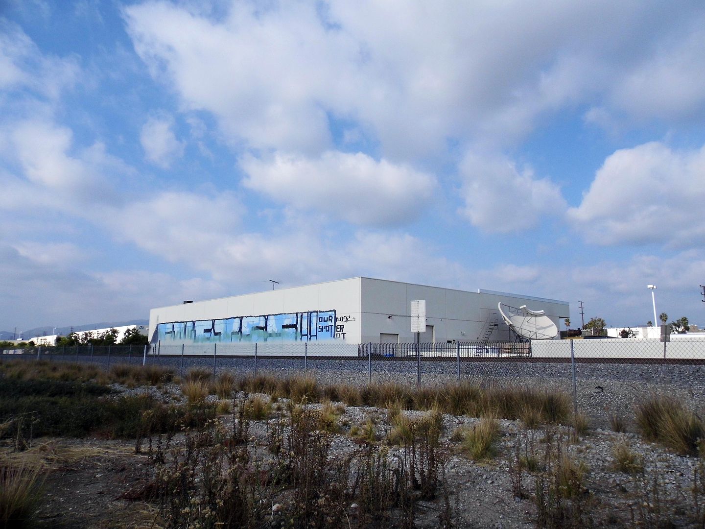
There may be no restroom, running water, lights, or electricity—but California State Parks, which owns the Bowtie, has partnered with the non-profit community arts organization Clockshop to activate artist projects, performances, and events at this little-known park.


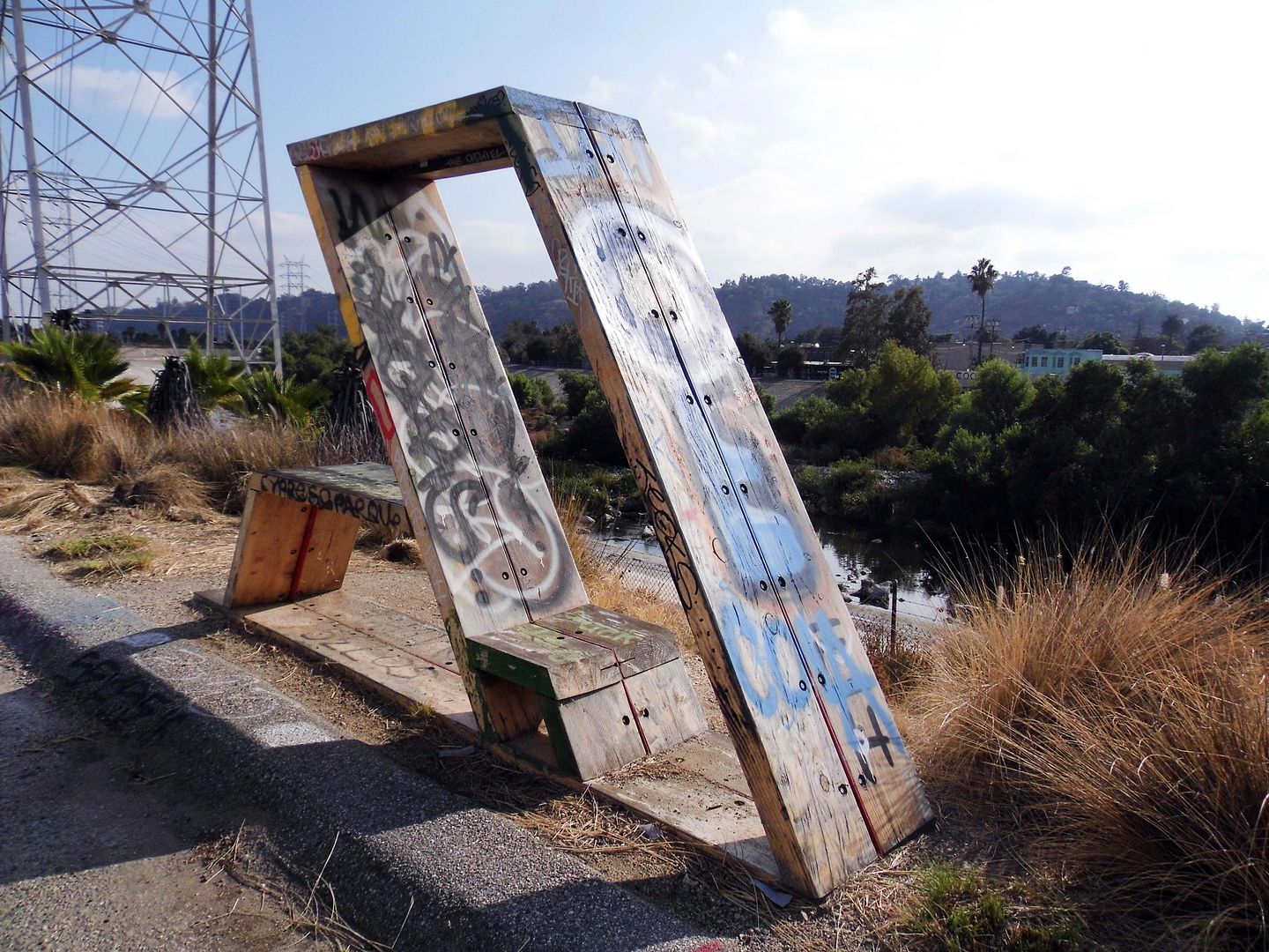
Since 2014, Clockshop has helped interpret the Bowtie Project as an urban space on the cusp of change—with sculptures being placed and events taking place right alongside the piles of rubble and rebar that remain scattered as reminders of the parcel's former use.


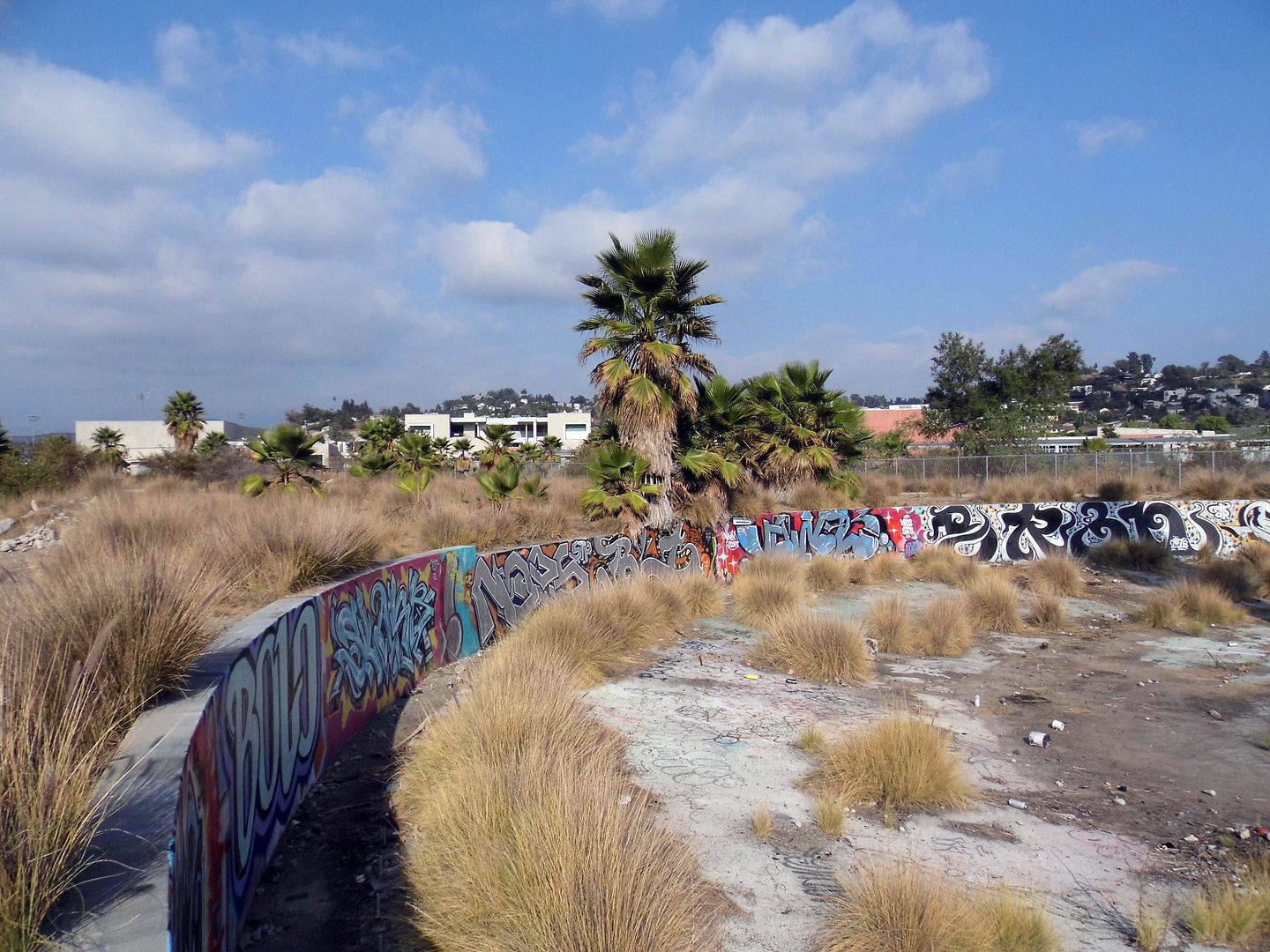
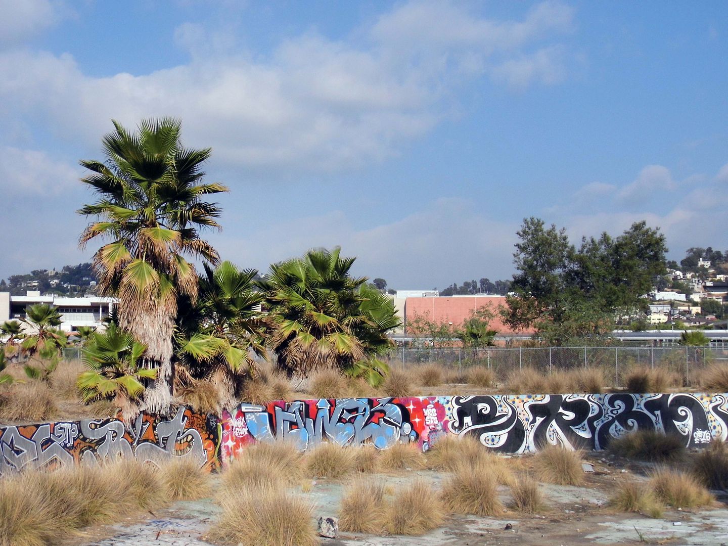
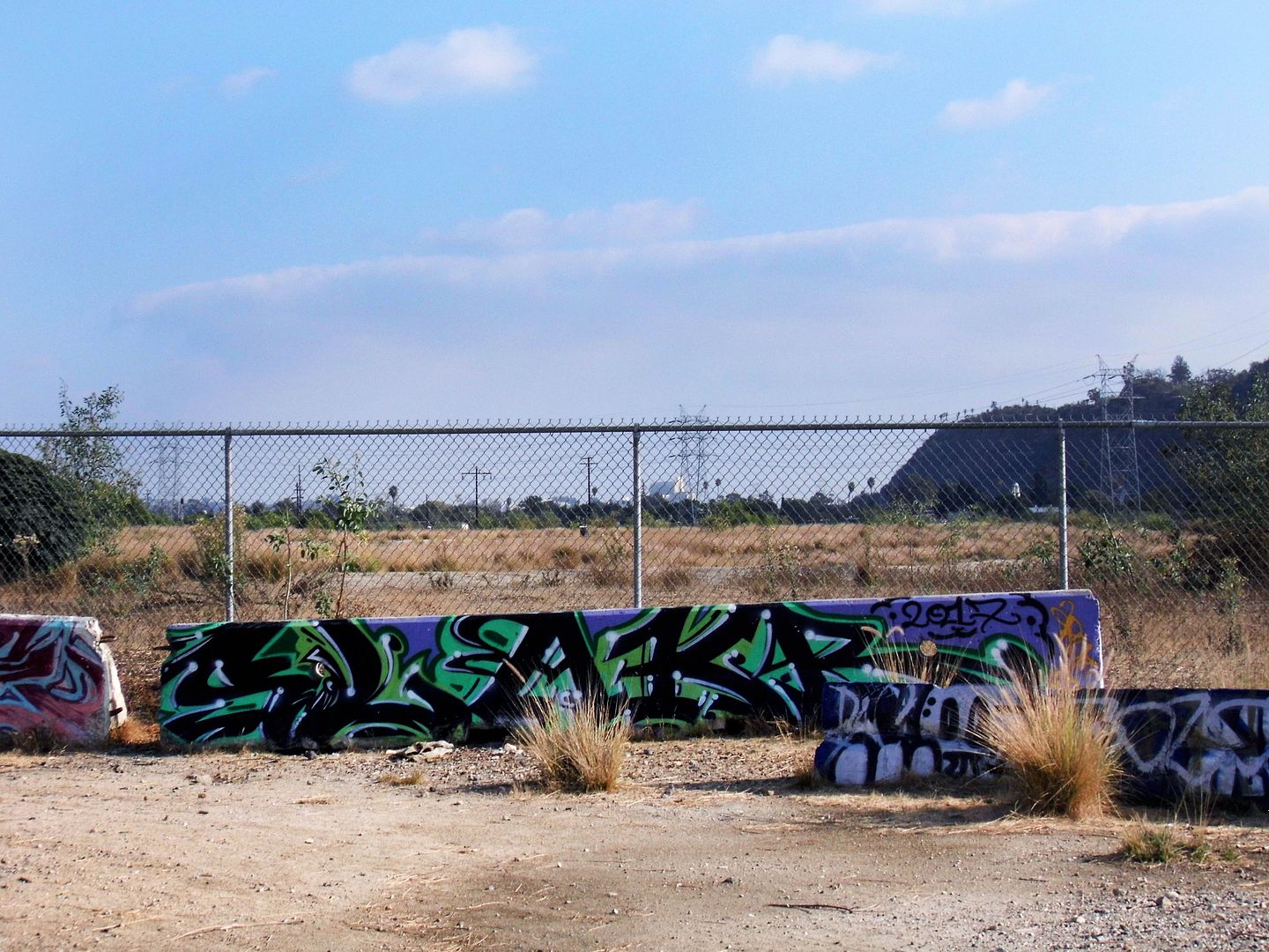
I'm glad I got to see it while I could in this state of limbo—with its LADWP power transmission towers, graffitied foundations, and other relics, still intact.


After all, they might not survive a future park overhaul.


Southern Pacific built the roundhouse/turntable, the remains of which are now located at the park's southern tip, in 1931 to service its freight trains.


Situated above the river's natural flood plain, and somewhat protected by Southern Pacific's levee at the river bank, the Taylor Yard operations were spared from the devastation of the 1938 flooding that wiped out a lot of other businesses and residences erected at riverside.


Now, besides the tagged concrete, invasive fountain grass intermingles with native California buckwheat, mulefat, and yerba santa. In the river channel, invasive giant reeds are trying to crowd out the native willows.


There may be some invisible traces of Taylor Yard at the Bowtie, too—maybe arsenic, lead, or anything else that might vaporize into visitors' lungs (e.g. tetrachloroethene/PCE and trichloroethene/TCE, both used at the roundhouse). If necessary, future soil remediation will be funded by the sewer lines that run way below the surface of the park.


The Bowtie Project—formerly known as the Bowtie Parcel—is one half of the Taylor Yard's subdivided Parcel G, designated Parcel G-1. The other half, G-2, lies inaccessible on the other side of some concrete barriers and a chainlink fence.


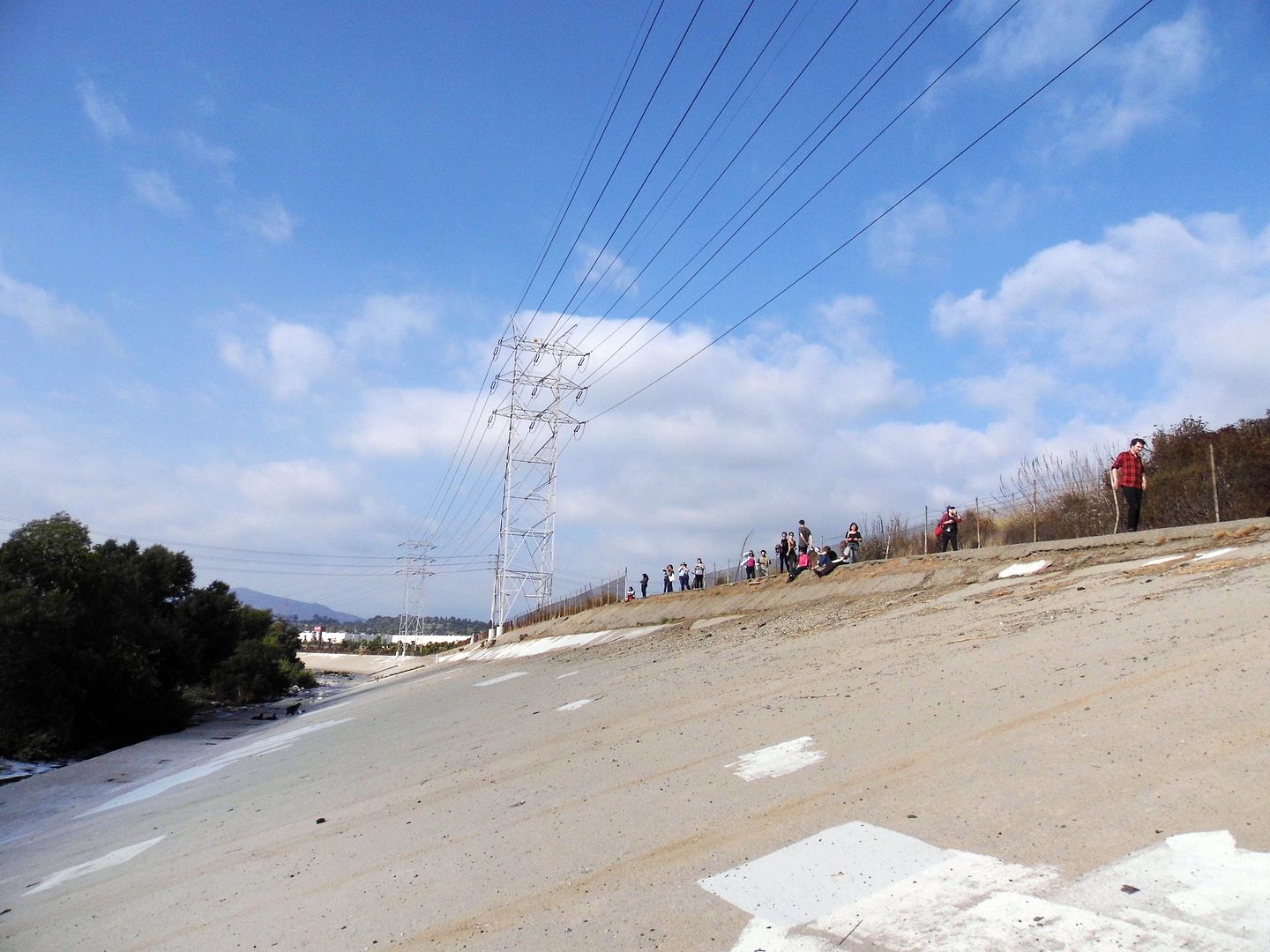
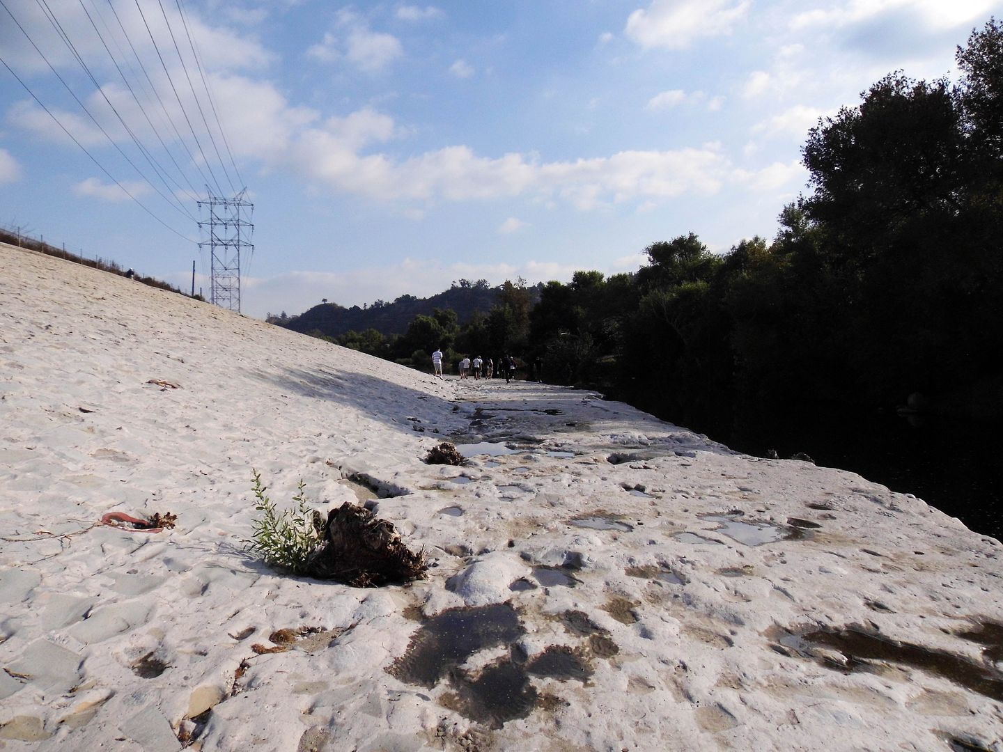
You can get a little close to the G-2 parcel by climbing down the steep concrete walls of the channelized river. G-2 is the last undeveloped remnant of Taylor Yard, purchased by the City of L.A. in early 2017 for $60 million.


It's slated to open as the 42-acre Taylor Yard River Park in the year 2028—envisioned to be the "crown jewel" of the revitalized river. A pedestrian bridge connecting Taylor Yard with the west bank has been in the works for a long time, so maybe that'll come around the same time?

Honestly, I can't complain. A lot has changed with the Los Angeles River since I moved here 9 years ago. A lot more people know we actually have a river.

Now we're just working more on getting access to it.

For more history on Taylor Yard, view the Historic Resources Survey Report here [opens in new window]. 

Related Posts:
Photo Essay: An Abandoned Streetcar Route Now Connects Both Sides of the LA River

June 11, 2012

Los Angeles River's Beautiful Ugly

Technically, it's still illegal to visit the Los Angeles River, a feature of Los Angeles' past and present which exists somewhere between watershed project, natural resource, real estate development, and public open space.

For years, the river's locked gates have been a beacon for homeless, gang members, and the other disenfranchised, disadvantaged, and ne'er do wells of the city.

There are stretches of it which have been turned into greenways with bike paths and river walks, but technically, it's still illegal to go there.

Thankfully, on Sunday, we had a key. And a permit.


The Los Angeles River isn't known so much as a river but as a concrete channel that cuts through the city. Because of the films and TV shows that have featured it over the years, most people know it more as a white-washed, dry ditch hidden in the nether regions of LA, home to body-dumping, skateboarding, and drag racing à la Thunder Road.


But thanks to a water reclamation project, for the first time since the river was covered in concrete as a flood control measure, there's a steady supply of water to the river, which was once fed by a number of creeks and tributaries in a time when LA was actually quite wet.


You can see the beginnings of the LA River at Owensmouth Avenue in Canoga Park (formerly called Owensmouth), where the Arroyo Calabasas meets the Bell Creek. Their concrete walls are conveniently labelled as such.


At the headwaters, the LA River lives up to almost all of its stereotypes: it's industrial, rusted, abandoned, green, and slimy. We didn't see any cadavers but there were a few healthy pigeons enjoying a bath.


A short distance away, near Balboa Park in Encino, the LA River becomes a real river at Sepulveda Basin, one of three soft bottom stretches of the waterway....


...near the Sepulveda Dam which was also built to control the floods that ravaged the Valley in the 1930s.


But whereas most of the Valley was left with a channelized, hot, dry, concrete-floored "river," Sepulveda Basin has managed to thrive as an open space with a nearby wildlife refuge.


We felt confident enough to actually get in the water with our bare feet...


...dodging mostly rocks and plants and birds...


...and the occasional gook.


The area is wild to visit because it looks quite similar to the stretches of the river that run through downtown, with the various bridge crossings and the high-banked sides...


...but this section, though not swimmable, would be fully navigable by water vessel.


And unlike Glendale Narrows, another soft-bottom section where nature has more or less taken over and the waters continue to break up the concrete floor, whose fragments simply float away, this section seems almost untouched. I wanted to spend all day there.


Instead we moved on to visit The Great Wall of Los Angeles, an extensive mural project that runs for a half mile along the concrete walls of the Tujunga Wash, a tributary of the Los Angeles River in the Valley Glen area...


...depicting the history of various ethnic minorities in California from prehistoric times to the 1950s, as well as other pop cultural and social milestone events like the Baby Boom and the birth of Rock and Roll.


The mural, like much of the LA River, lies behind a fence.


In fact, for the last 60+ years, it seems that all people have done is try to hide the LA River - limiting its access, obscuring the view of it with hedges...


...and turning their houses and buildings away from it.


At least now, when you're driving through downtown, or Studio City, or Burbank, you get to see those blue and white signs identifying the river, so you have some sense of its crossings...


But it's impossible to follow the river from beginning to end, or along any long stretches - by foot, bike, or car (or boat). It's a stop-and-start waterway that sometimes sends you walking in circles, the path dead-ending at, for example, CBS Studios, which is not letting in recreational visitors anytime soon.

For those of us obsessed with uncovering the hidden treasures of LA, exploring their beauty where others only find ugliness, the LA River has tremendous draw.

But those who have dreams for the river wish to remove the concrete and restore it back to its natural state.

Even upon my second day-long visit, I don't want to change it. I just want to get to it.

Related Reading:
Los Angeles River's Ugly Beauty

For more photos, click here.

To become a fan on Facebook, click here.

April 10, 2017

Damage Control

I found myself back in a kayak today for the first time in nearly four years.


I enjoy kayaking as a means to an end—a way to see things from sea level and keep a low profile as birds fly overhead and fish swim underneath.


But unless I've got somewhere interesting to go in it, I don't generally feel the need to be in a kayak...


...or row a boat just for the sake of rowing a boat.


It had been so long since I'd paddled (or had someplace interesting to paddle to) that I wasn't sure that I could finish the four-mile trip through the Los Cerritos Wetlands. The last time I'd been in these waters, I was being propelled in a gondola, navigated by a gondolier.


Fortunately, with me captaining my own ship, our sea voyage was taken at a leisurely pace, stopping to admire the Forster's terns (Sterna forsteri)...


...a school of silvery anchovies, and a sea lion who popped its head up out of the water in Alamitos Bay as we were gliding toward Marine Stadium.


Today I'd come back to paddle myself from the Los Cerritos Channel, past a row of snowy egrets and oil pumps, into an historic salt marsh that's currently awaiting restoration.


If natural wetlands are an endangered species in Southern California, then salt marshes are practically extinct. Long considered "swamps," most of them were filled in, or dredged and then filled in, or channelized, commercialized, and yachtified. Any remaining water has usually been forced into stagnation, cut off from the ocean tides.


circa 2015

In the case of the Los Cerritos Wetlands—situated more or less at the mouth of the San Gabriel River at the border between Long Beach and Seal Beach—there are the oil rigs, as well as two power plants (AES natural gas power plant, and on the east side is LADWP's Haynes Steam Plant), one on each side of the river.

When we got to the midpoint of our trip at Steamshovel Slough, we docked up on the vegetation to listen for the calls of rare Belding's Savannah Sparrows (which are entering their mating season) and to chat about our surroundings.

When our guides asked us what had brought us to this place today, other people in my group spoke about the importance of wetlands for animals and birds while others talked about how critical it is for humans to have access to open space where they can get hands-on education about nature.

And while all of that is true, both of these reasons felt a little too utilitarian to me. In fact, pretty much any reason I could come up with felt like an oversimplification.

But then it dawned on me that the thing I found so intriguing and compelling about this confluence between industry and nature was the opportunity to reverse the damage that humans have being doing to this area for a century or more.

I think that's the whole point of habitat restoration (like what I did on Santa Rosa Island)—to "roll back" the things that the human race has done that we thought were good things but turned out to be selfish and destructive in the long run.

Don't get me wrong—I'm a woman of action. As Lucille Ball is famously quoted as saying, I'd rather regret the things I've done rather than regret the things I haven't done.

But sometimes, the things you've done have got to be undone.

It's OK to make mistakes. What matters is how you fix them.

Related Posts:
Photo Essay: Naples, the Dreamland of Southern California
Basking in the Gloom at Bolsa Chica Wetlands

July 25, 2012

Plenty of Room to Paddle


"I'm kayaking the LA River tomorrow afternoon," I typed to my friend Michael, who's always asking me what I'm up to, living somewhat vicariously through me.

"U NEVER FAIL ME SANDI!" he replied.

For a second, I felt good. I always feel kind of admired when Michael marvels at how busy I keep myself.

But then, he wrote, "Honestly, you move so much, it's hard for a guy to find you. You're a moving target! .... U have to stay in one place long enough."

"A four-hour hike is not long enough?" I retorted. "Three hours in the library?" Those extended time blocks always feel like an eternity to me.

Michael then clarified: "Being on the move too much is not helpful for 'settling down.'"

Oh.


Even if that is the problem with my singlehood, I don't care.

Everyone says, "It'll happen when you least expect it," or, "when you're not looking."

So I live.


I kayak my way under bridges that people drive, walk, and bike across.


I am just trying to live a good life, be a good person, learn new things, and work on crafting whatever artistic talent I may have.


The desire to be a stable, suitable wife is not going to keep me off a notoriously toxic, polluted industrial river, whose raging rapids halted our kayak excursion...


...in order to explore the rusted relics that litter the lagoons and waterfalls.


Why should I not want to paddle everywhere I can? Why shouldn't I want to see the city from more than just the driver's seat of my car?


Wildflowers line the LA River.


Who else gets to see that?


Who else has witnessed a perched egret on a dead tree branch, or a huge heron flapping its wings overhead?


The LA River has been abused, rerouted, channelized, and polluted. But there is a stretch of it in the Valley, which feels pristine, whose depth reaches as much as eight feet, making it a real river, with a soft bottom, and plenty of room to paddle.

(There are, of course, other parts that are so shallow, you drag the bottom of your kayak along the bottom of the river, and use your paddle to merely push yourself off the lagoon you've found yourself landed upon.)

I know that I'm not going to meet Prince Charming on a kayak tour of the LA River. (I wish!) But that's not the point. I have to do what I want to do, and let the rest fall into place.

If it never does (which it looks like it's not going to), so be it. At least I've lived the life I've wanted to live.

Related Posts:
Los Angeles River's Ugly Beauty
Los Angeles River's Beautiful Ugly
Kayaking the Salton Sea
Photo Essay: Bronx River Estuary Paddle
Mono Lake: From Shore to Surface

To become a fan on Facebook, click here.