Search

Showing posts sorted by relevance for query butterfield. Sort by date Show all posts

November 25, 2022

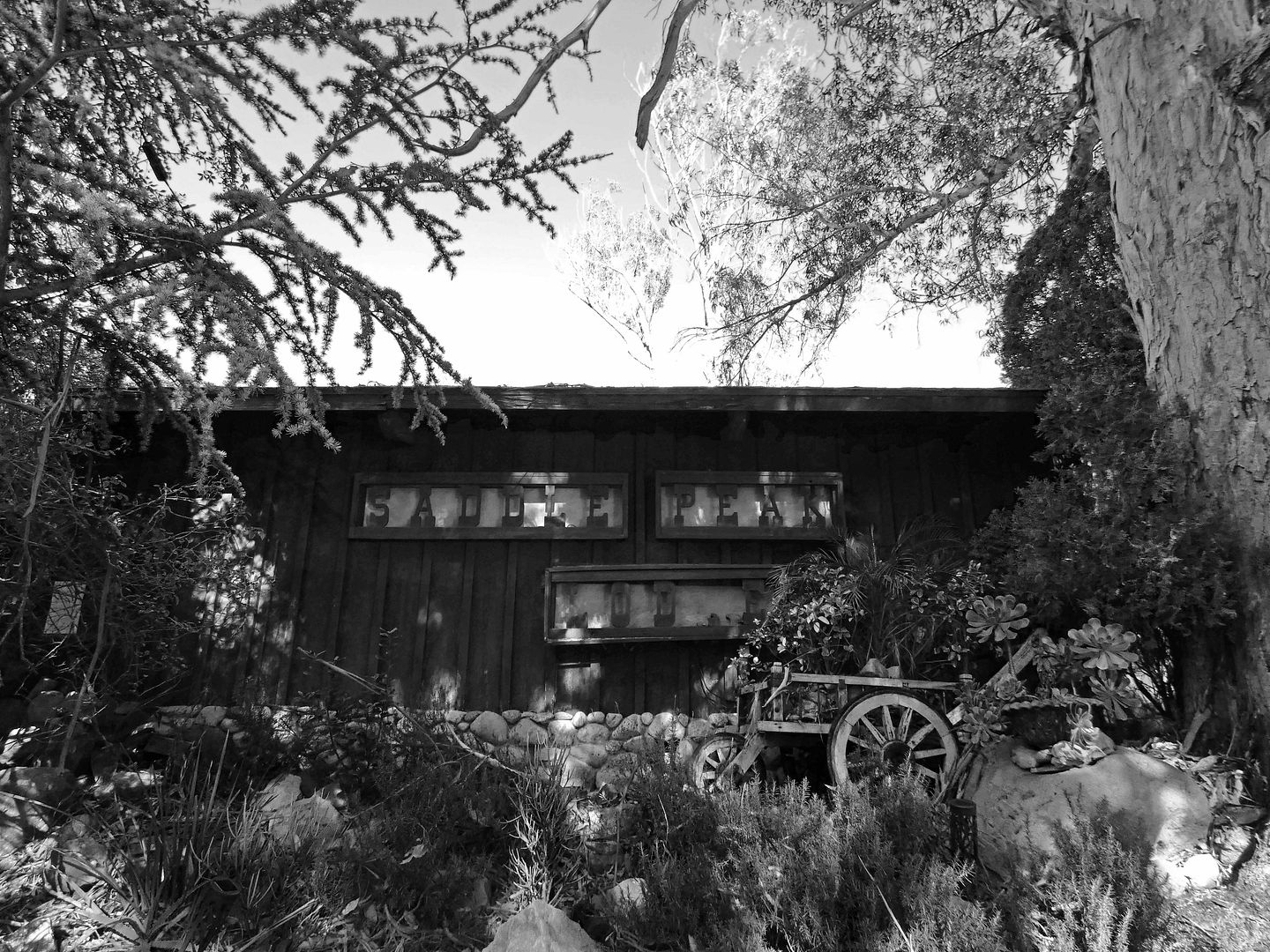
A Turkey-Free Thanksgiving at a Storied Mountain Lodge Outside of LA

When I was working as a field agent for Atlas Obscura a few years ago, I really wanted to host a dinner at Saddle Peak Lodge—specifically, a game meat dinner. 

I was fascinated with intimidating foods and thought that a communal experience would create a comfort level that I, and others, might not have alone. 

I couldn't get that event approved, so I finally went to Saddle Peak Lodge on my own a few years ago—but I wimped out both gastronomically and financially and just went to brunch. I don't remember the meal, but I'm pretty sure I had eggs (and not, like, ostrich eggs).

So, I've felt like I hadn't really experienced the restaurant—and when the 2018 Woolsey Fire swept through the area, fortunately sparing it, the urgency to return intensified.


I finally made it back yesterday, for Thanksgiving dinner—not because this colonial holiday is important to me (it's not), but because I felt like I needed the excuse of a special occasion to splurge on it. And since it's a Michelin star-receiving establishment, it also charges Michelin star-level prices.

January 16, 2014

Photo Essay: The Power Plants of the St. Francis Dam Disaster

[Last updated 4/7/19 7:31 PM PT—photo added]

I've been fascinated with the story of the St. Francis Dam Disaster for a while, partially because of my interest in both disaster sites and ruins, but also because of its place in LA's water history.

After all, you can't really understand the Dam without understanding the significance of the opening of the Los Angeles Aqueduct, and how that water supply (and resulting electrical power) helped make LA the thriving metropolis it is today.


Fifteen years before the St. Francis Dam broke in 1928, killing over 450 with a surging wall of water 180 feet high, the LA Aqueduct opened, and it became the crowning glory of the career of LA's chief engineer of water and power, William Mulholland (of Mulholland Drive fame).


Water pipe north of Power Plant #1, circa 2019

Once LA figured out how to actually get water from somewhere else (the Owens Valley), we had to figure out what to do with it: how to control its flow, how to convert it into usable power, and how to store a surplus, emergency supply.


Power Plant #1 was built and put into operation in 1917, primarily to control the flow of the water from the Owens Valley.


image courtesy of Water and Power Associates

Although the Aqueduct itself extends over 200 miles north of Power Plant #1 to its intake in Bishop, the pipes leading down to this plant mark the first real arrival of water to LA - over 20 miles north of the Cascades. If you venture into San Francisquito Canyon, down a road marked "PRIVATE" into a small company town called Pelton (built along the old Butterfield Stagecoach Road for the plant workers who have to be on call all day and all night, every day)...


...you find a number of relics of LA's former Bureau of Water and Power, including a rusty old DC current generator...


...dollies, a debris car, a section of the first Los Angeles Aqueduct "tube," a reaction turbine...


...and a wooden cable reel, only a few of which remain in use, as they've been cycled out in favor of metal reels for cable-pulling operations.


Power Plant #1's sprawling property in Pelton has become somewhat of a repository for decommissioned equipment and relics found deep under brush, from as far as Owens Valley to as nearby as the San Fernando Valley Generating Station in Sun Valley (like this tool trailer), Elizabeth Lake, and Power Plant #2, also in San Francisquito Canyon.


Although Power Plant #1 is currently in operation - much in the same way it was when it first opened - a visit to it feels like a step back in time. The name of the agency may have changed - the Bureau of Water and Power is now the LADWP - but the building has not.


Water still flows down the penstocks (intake tubes) built into the cliff behind the plant...


...bringing water to it, and the sound of waves.


Inside the power plant...


...it's loud. Really loud.


There's a lot of big, old equipment like Pelton wheels and Westinghouse alternating current generators...


...which are mostly original to the construction of the building, occasionally needing a repair or upgrade (mostly for efficiency purposes). When working properly, they run all of the time.


There are also gauges that measure the pressure of the water flowing through...


...and the three-cylinder, belt-driven pump that's not on all of the time, but sure made a racket when he turned it on.


For the most part, while standing in this facility, you experience working history that most people never visit, or even know about, but modern equipment has, in some cases, been added.


It hasn't necessarily improved the workings of the plant.


In many ways, the processes of this power plant have been mechanized and automated enough to be relatively self-sufficient. The technology of the Westinghouse temperature indicating device used here dates back to 1920, though it does require occasional manual spot checks on water temperature (which should be "warmish").


But this power plant is instrumental in the success of the functionality of the entire region, with a control room overlooking the generators below. From there, they can monitor and report on a total of six power stations in the area.


Workers know when a door is ajar.


Water levels, temperatures, pressure, and equipment functionality are all monitored for local reservoirs and pipelines.


Voltage is measured in megawatts, hertz, kilovolts, and megavars.


If disaster were to strike again at any of those local facilities...


...like it did in 1928 when the St. Francis Dam broke...


...Power Plant #1 would be ground zero.


(In fact, one of the first indications that something was wrong at the St. Francis Dam was the flickering of lights and odd power surges in the middle of the night.)


Located upstream from the dam site, Power Plant #1 was thankfully spared from the raging flood waters and suffered no damage from the break, but Power Plant #2 - located about a mile and a half downstream from the dam - was wiped away.


The water spilling through the dam from the reservoir took everything in its wake: trees, livestock, people, and buildings.


Miraculously, the inner workings of Power Plant #2 - generators bolted to a concrete floor - were spared and completely functional once the water receded.


Two of those turbines are still in use today, inside the rebuilt Power Plant, which was back up and running in November 1928, eight months after the dam broke.


The rebuilt Power Plant #2 was far more architecturally ornate than its 1920 predecessor, or its 1917 sister plant up the canyon, with colorful Art Deco stylings.


Power Plant #2 is visible from San Francisquito Canyon Road just south of the dam site, and is worth a visit to see the penstocks behind the building (two original, one replaced), and a historical marker for the dam disaster, located behind a chainlink fence by the front driveway. The public is not allowed inside the plant.

Stay tuned for more explorations of Old San Francisquito Canyon Road, and the remains of the St. Francis Dam at the disaster site.

Related Posts:
Celebrating the LA Aqueduct Centennial at The Cascades
Photo Essay: Burbank Water and Power Eco-Campus

March 22, 2013

Photo Essay: Over the Ridges and Through the Creeks of Tejon Ranch

I'd driven past Tejon Ranch on at least two sides of it, up the 5 freeway north through the Angeles National Forest and Los Padres, past the resort community of Castaic Lake and the off-highway vehicular recreation areas, as well as through the high desert on the other side. But although I'd seen the sign for it, I never really knew what it was, or what happened there.

Truth is, it's the largest contiguous parcel of privately owned property in the state, strategically positioned between mountains, valley, and desert, giving it incredible bio- and geodiversity, much of which has been conserved and remains relatively undeveloped.

It is, however, not a nature preserve. It is not open to the public. It is a private center of industry, primarily agricultural. So there are necessary modifications, like paved roads that run past where an old adobe once stood.


Then again, where the 5 runs now (also known as the Ridge Route) is through the old Grapevine settlement, named after the abundant grapevines that grew (and still grow, though bearing few to no grapes) over the hills and through the canyon. As many as five Native American tribes once dwelled there, until European settlers came, and Tejon Ranch was established through the aggregation of several Mexican land grants.

The wide highway stretch now known as the Grapevine pass - connecting Bakersfield to LA, Kern County to Los Angeles and Ventura Counties - is far less treacherous than the first narrow road that was built, and periodically expanded and straightened out over time.


Now, there are nearby barbed wire-topped, chainlink fences protecting stretches of the California Aqueduct (which is as big as a river)...


...and a gravel pit and pumping plant, which has been lifting water nearly 2000 feet over the Tehachapi Mountains, through tunnels and inverted siphons, and down to LA since 1965.


There is also oil.


But we, in our caravan, wanted to get away from industry and development, and drive into the heart of the ranch...


...whose cultural history is tied not only to gold but also to the Butterfield Overland Stagecoach, and to military history (with the neighboring Fort Tejon now across the highway, but once part of the original ranch).


When you drive into the interior - along roads which are often hard to discern amidst the overgrown, lush, green turf - you are reminded that Tejon is still very much a working ranch, with plenty of grazing cattle roaming the hills.


The "roads" - which are not really even Jeep trails, barely worn out tire tracks - can get pretty muddy and boggy, requiring 4WD and high clearance.


It was hard for me to sit in the front passenger seat, merely observing. I wanted to drive those hills.


There are some vestiges of old ranching days to be seen - old corrals, posts sticking up out of the ground -


...but some of the more intriguing relics are the bedrock mortars of the first Grapevine settlement.


Colorful lichen now grows upon the bedrock outcroppings that are now surrounded by untrampled wildflowers...


...but if you look closely, you can identify some of them as rain rocks...


...and others with holes bored into them to be used as mortars...


...to grind up acorns and other foods...


...but also perhaps for medicinal or ritualistic purposes as well.


Besides the aqueduct, there seems to be plenty of water at Tejon Ranch, with creeks flowing a-plenty, to be driven through carefully.


Occasionally, there is a bridge to ensure your safe passage.


Because of the water (and enough rain and snow this winter), Tejon Ranch is very much alive right now - and so green.


Fields of wildflowers blanket its hills, canyon floors, and alluvial fans, their perennial appearance a welcome ushering into spring.


Agriculture thrives there: the crops found at Tejon Ranch include orchards of pistachios, almonds, and walnuts, as well as vineyards of wine grapes.

However, we saw no sign of the citrus groves and fig trees that were once planted here.


In fact, there are plenty of reminders of what - and who - is no longer at Tejon Ranch...


...with few signs of 20th century buildings that were destroyed in an earthquake in the 1950s...


...and some plants that just didn't make it.


It's amazing that the wildflowers haven't been completely trampled or eaten by the cattle already...


...since they collect in large groups for grazing, like around the old schoolhouse ruins...


...on the hillsides...


...and by the cemetery...


...which is only weakly fenced in.


It's a wonder the cattle haven't barged in on it.


In the higher elevations you can see a dusting of color, like the orange Tejon poppy (which apparently is distinct from the California poppy)...


...and the purple lupin.


What's harder to see is what's immediately underfoot, and camouflaged in with the grass: stinging nettle, which lives up to its name by pricking, burning, and tingling your bare ankles if you walk through it. Which I did.


The higher you go, high up along the ridge, despite the overgrown grass and bountiful wildflowers, you are once again reminded of civilization...


...with a number of power line towers dotting the panorama.


The trees are sparser, the rock outcroppings more unique...


...the hills really really really steep...


...and the road all but disappeared.


It feels as though you're standing on the edge of the world...


...but there is no falling off...


...just a choice of secret, backcountry roads to follow the way down, past the poppies...


...and, of course, a cow (or a bull or a steer or an ox or whatever livestock of bovine origin) to watch your every move.

Tejon Ranch Conservancy provides limited, educational public access to Tejon Ranch annually. There are no marked trails, and locked gates protect each of the various areas we visited. The entire plot of land is bafflingly large (and oddly-shaped, kind of like a turkey), so their driving tour provides a good overview and introduction to the ranch - though, even after seven hours or so, we only saw a small portion of it.

And it's one of the best days I've had since moving to LA.

Related Post:
Photo Essay: The Wildflower Blanket at Tejon Ranch

To Like Avoiding Regret on Facebook, click here.