
[Last updated 1/18/25 9:21 AM PT—A couple of photos from the same visit added. Thankfully, Pacific Palisades Historical Society reports on Facebook that San Vicente Mountain Park was spared from the Palisades Fire (which got pretty close).]
But I knew that San Vicente Mountain Park—along the stretch of Mulholland Dirt Road somewhere between Bel Air and Encino—would have what I was looking for.

Last weekend, the gate was open, so I could've driven the 0.8 miles up the dirt road to the site, but I decided to hike it.

It's a scenic walk that's a natural extension of the Mulholland Scenic Parkway and Corridor, overlooking the Encino Reservoir to the north...

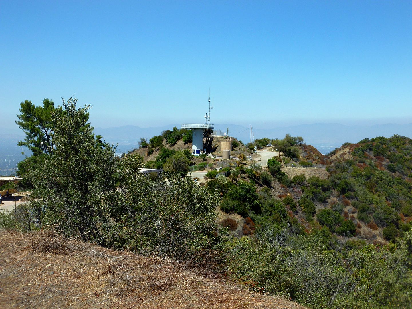
The observation tower is visible right from the entrance to the park, which is the old entrance to the site - replete with a restored security booth and gate.

There are tons of side trails that lead into the canyons and open spaces that surround the old missile site...


and most of the relics are actually gone, leaving a vast expanse of wilderness before you.

The trails stretch for miles along the ridges, some that appear unhiked for ages.

You can imagine why San Vicente Mountain was chosen as a key vantage point from which to identify and strike the enemy. You can see the full sky, and everything below.

Last weekend, the gate was open, so I could've driven the 0.8 miles up the dirt road to the site, but I decided to hike it.
It's a scenic walk that's a natural extension of the Mulholland Scenic Parkway and Corridor, overlooking the Encino Reservoir to the north...
The observation tower is visible right from the entrance to the park, which is the old entrance to the site - replete with a restored security booth and gate.
There are tons of side trails that lead into the canyons and open spaces that surround the old missile site...
and most of the relics are actually gone, leaving a vast expanse of wilderness before you.
The trails stretch for miles along the ridges, some that appear unhiked for ages.
You can imagine why San Vicente Mountain was chosen as a key vantage point from which to identify and strike the enemy. You can see the full sky, and everything below.
But there's no longer a sense of military presence in LA, unlike nearby major city San Diego.

If you drive just a few hours north or inland, though, you hit Edwards Air Force Base, Twentynine Palms, China Lake...hidden way in the desert, performing secret operations...
No comments:
Post a Comment